Great Carrying Place Portage Trail
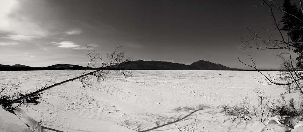 Photo: Julian Boed, CC BY 2.0 (via Flickr)
- 0.3 mi
- round trip
- 129 ft
- climb
- 1,202 ft
- high point
- Out and back
- route
- Aug–Sep
- best months
The Great Carrying Place Portage Trail is a short, easy out-and-back hike in Maine, about 0.34 miles long and roughly 0.68 miles round trip. It rises from about 1,190 feet to a high point of 1,202 feet, with a total elevation gain of 129 feet over the course of the trip. The steepest stretch comes early on, around 0.18 miles from the start, with a grade of about 3 percent. The nearest town is Spring Lake Landing, about 6 miles away. The trail is a quick stop, and the trip takes about half an hour. Summer is the most comfortable time to go. Typical July averages from the nearby Long Falls Dam weather station run to highs around 77°F and lows near 55°F, while winter highs there stay in the 20s. The Appalachian Trail passes about 1.3 miles away, and the Shore Trail is about 2 miles off. Flagstaff Lake, a fishing spot, is about 2 miles away, and the Safford Brook Trail is about 4.4 miles away.
Local outfitters
- Northeast Whitewater31 mi away
Not on Roamze yet. Their page has how to reach them.
- Appalachian TrailHiking1.3 mi
 Shore TrailHikingPhoto: Julian Boed, CC BY 2.0 (via Flickr)2 mi
- Flagstaff LakeLake fishing2.1 mi
- Off the Beaten Path WallsRock climbing3.6 mi
 Safford Brook TrailHikingPhoto: John Hayes (gravelboy), CC BY 2.0 (via Flickr)4.4 mi
- Carrabassett Valley BouldersRock climbing7 mi
- Tufulio's BouldersRock climbing7.2 mi
- Dead RiverCanoeing9 mi
Source: Roamze catalog (indexable pages within 10 miles, PostGIS distance)
- Shore TrailHiking · ~3 min drivePhoto: Julian Boed, CC BY 2.0 (via Flickr)
- Safford Brook TrailHiking · ~7 min drivePhoto: John Hayes (gravelboy), CC BY 2.0 (via Flickr)
 Fire Wardens TrailHiking · ~16 min drivePhoto: John Hayes (gravelboy), CC BY 2.0 (via Flickr)
- Maine Huts TrailHiking · ~16 min drive
 Appalachian TrailHiking · ~5 min drivePhoto: John Hayes (gravelboy), CC BY 2.0 (via Flickr)
 Appalachian TrailHiking · ~9 min drivePhoto: John Hayes (gravelboy), CC BY 2.0 (via Flickr)
- Appalachian TrailHiking · ~7 min drivePhoto: John Hayes (gravelboy), CC BY 2.0 (via Flickr)
 Horns Pond TrailHiking · ~15 min drivePhoto: John Hayes (gravelboy), CC BY 2.0 (via Flickr)
 Appalachian TrailHiking · ~8 min drivePhoto: John Hayes (gravelboy), CC BY 2.0 (via Flickr)
- Appalachian TrailHiking · ~2 min drive
Best time to visit Great Carrying Place Portage Trail
Best months: August–September. Best months have typical highs of 55–85 °F, lows of 30 °F or warmer (32 °F where the station doesn't record snow), at most one snowy day and no more than 12 wet days.
Jan
23° / 4°
12 wet
Feb
26° / 5°
10 wet
Mar
35° / 14°
12 wet
Apr
47° / 28°
12 wet
May
62° / 40°
14 wet
Jun
71° / 50°
14 wet
Jul
77° / 55°
14 wet
Aug
76° / 53°
12 wet
Sep
68° / 46°
11 wet
Oct
54° / 35°
13 wet
Nov
40° / 25°
13 wet
Dec
29° / 14°
14 wet
Typical high / low (°F) and days with rain or snow, 1991–2020. Measured at Long Falls Dam, ME, 3.9 mi away at 1,160 ft. This station doesn't record snowfall. Source: NOAA NCEI U.S. Climate Normals 1991–2020.
Map and trail data © OpenStreetMap contributors
