Carriage Trail
- 2.1 mi
- round trip
- 501 ft
- climb
- 1,078 ft
- high point
- Out and back
- route
- Sep
- best months
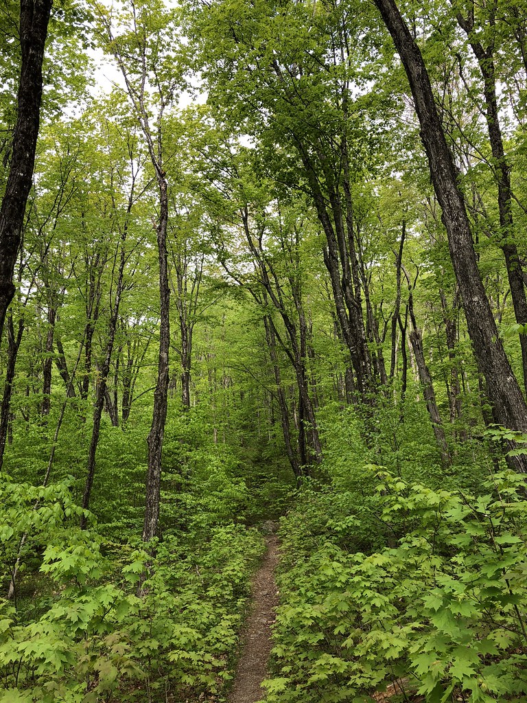
Carriage Trail is an easy out-and-back hike in Mount Kineo State Park in Maine, managed by State Park and Recreation. The trail is about 4 miles long, with a total elevation gain of about 38 feet, so it's a gentle walk that stays close to the same level for most of the way. The route starts at an elevation of about 1,041 feet and reaches a high point of about 1,078 feet. The steepest part comes at about 1.6 miles in, where the grade reaches about 21 percent. That short stretch is the only real climb on the trail, and the rest is mostly flat. Summer is the most comfortable time to go. Typical averages from the Brassua Dam weather station, about 4.6 miles away, show July highs around 76°F with lows near 55°F, while winter highs stay in the 20s. North Trail starts just 0.1 mile away, and Bridal Trail and Indian Trail are both within about a mile and a half. West Outlet, a canoeing spot, is about 4 miles off.
Local outfitters
- Northeast Whitewater25 mi away
Not on Roamze yet. Their page has how to reach them.
- North TrailHiking0.1 mi
- Bridal TrailHiking1.3 mi
- Indian TrailHiking1.4 mi
- Deer Head Farm TrailHiking3 mi
- Day Academy Grant Public Reserved LandHiking3.4 mi
- West OutletCanoeing4.2 mi
- Moosehead LakeLake fishing8.3 mi
- Jewett CoveCamping9.9 mi
Source: Roamze catalog (indexable pages within 10 miles, PostGIS distance)
 Dunn Point TrailHiking · ~23 min drivePhoto: cloud2013, CC BY 2.0 (via Wikimedia Commons)
 Big Moose Mountain TrailHiking · ~29 min drivePhoto: zappowbang, CC BY-SA 2.0 (via Flickr)
- Deer Head Farm TrailHiking · ~5 min drive
- Rowell Cove TrailHiking · ~23 min drivePhoto: cloud2013, CC BY 2.0 (via Wikimedia Commons)
- North TrailHiking · Next door
- Lobster Mountain TrailHiking · ~24 min drive
- Bridal TrailHiking · ~2 min drive
- Ram TrailHiking · ~18 min drive
- Little Moose Mountain TrailHiking · ~32 min drive
- Indian TrailHiking · ~2 min drive
Best time to visit Carriage Trail
Best months: September. Best months have typical highs of 55–85 °F, lows of 30 °F or warmer (32 °F where the station doesn't record snow), at most one snowy day and no more than 12 wet days.
Jan
22° / 1°
12 wet
Feb
25° / 0°
10 wet
Mar
35° / 11°
11 wet
Apr
47° / 26°
12 wet
May
62° / 38°
14 wet
Jun
71° / 49°
14 wet
Jul
76° / 55°
15 wet
Aug
75° / 53°
13 wet
Sep
67° / 45°
11 wet
Oct
53° / 35°
13 wet
Nov
40° / 25°
13 wet
Dec
29° / 12°
13 wet
Typical high / low (°F) and days with rain or snow, 1991–2020. Measured at Brassua Dam, ME, 4.6 mi away at 1,069 ft. This station doesn't record snowfall. Source: NOAA NCEI U.S. Climate Normals 1991–2020.

Map and trail data © OpenStreetMap contributors
