Boundary Trail
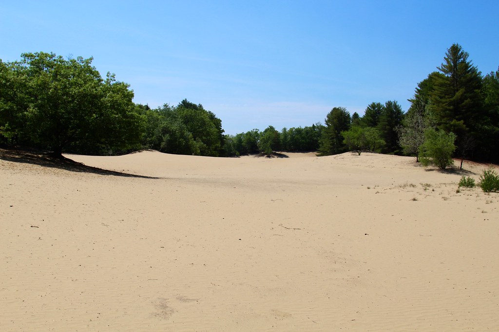
 Photo: Paul VanDerWerf from Brunswick, Maine, USA, CC BY 2.0 (via Wikimedia Commons)
- 0.9 mi
- round trip
- 358 ft
- climb
- 485 ft
- high point
- Out and back
- route
- Aug–Oct
- best months
Boundary Trail is a short, easy out-and-back hike in Maine, about a mile from Pownal Center. The trail is roughly 1.8 miles long, with a total elevation gain of 358 feet, and it reaches a high point of 485 feet. The climb is gentle, with the steepest stretch at about 0.47 miles in, where the grade reaches 10 percent. Summer is the most comfortable time to go. Typical averages from a nearby weather station in Gray show July highs around 79°F with lows near 60°F, while winter brings highs in the 30s and regular snow days from December through February. The hike takes about an hour. Krista's Trail and the Northern Loop both start within half a mile, and the Southern Boulder Patch climbing area is about 0.6 miles away. Chandler Brook, a canoeing spot, lies about 2.9 miles off.
- Krista's TrailHikingPhoto: Paul VanDerWerf from Brunswick, Maine, USA, CC BY 2.0 (via Wikimedia Commons)0.3 mi
 Northern LoopHikingPhoto: Paul VanDerWerf from Brunswick, Maine, USA, CC BY 2.0 (via Wikimedia Commons)0.4 mi
- Tote RoadHiking0.4 mi
- Bradbury Mountain State Park (CLOSED to Climbing Oct '17)Rock climbing0.6 mi
- Southern Boulder PatchRock climbing0.6 mi
- The CornerstoneRock climbing0.6 mi
- Chandler BrookCanoeing2.9 mi
- Royal River Water TrailCanoeing4 mi
Source: Roamze catalog (indexable pages within 10 miles, PostGIS distance)
- Krista's TrailHiking · Next doorPhoto: Paul VanDerWerf from Brunswick, Maine, USA, CC BY 2.0 (via Wikimedia Commons)
 Tributary TrailHiking · ~4 min drivePhoto: Paul VanDerWerf from Brunswick, Maine, USA, CC BY 2.0 (via Wikimedia Commons)
- Northern LoopHiking · Next doorPhoto: Paul VanDerWerf from Brunswick, Maine, USA, CC BY 2.0 (via Wikimedia Commons)
- Blue TrailHiking · ~10 min drive
- Switchback TrailHiking · Next doorPhoto: Paul VanDerWerf from Brunswick, Maine, USA, CC BY 2.0 (via Wikimedia Commons)
- Elmwood TrailHiking · ~2 min drivePhoto: Paul VanDerWerf from Brunswick, Maine, USA, CC BY 2.0 (via Wikimedia Commons)
- Field LoopHiking · ~6 min drivePhoto: Paul VanDerWerf from Brunswick, Maine, USA, CC BY 2.0 (via Wikimedia Commons)
- Oak Hill TrailHiking · ~6 min drivePhoto: Paul VanDerWerf from Brunswick, Maine, USA, CC BY 2.0 (via Wikimedia Commons)
 Access LoopHiking · ~6 min drivePhoto: Paul VanDerWerf from Brunswick, Maine, USA, CC BY 2.0 (via Wikimedia Commons)
 Keith LoopHiking · ~7 min drivePhoto: daveynin, CC BY 2.0 (via Flickr)
Best time to visit Boundary Trail
Best months: August–October. Best months have typical highs of 55–85 °F, lows of 30 °F or warmer (32 °F where the station doesn't record snow), at most one snowy day and no more than 12 wet days.
Jan
30° / 14°
11 wet · 9 snow
Feb
33° / 16°
10 wet · 8 snow
Mar
41° / 25°
11 wet · 6 snow
Apr
53° / 34°
12 wet · 2 snow
May
64° / 44°
13 wet
Jun
73° / 54°
13 wet
Jul
79° / 60°
13 wet
Aug
78° / 59°
11 wet
Sep
70° / 52°
10 wet
Oct
58° / 41°
11 wet
Nov
46° / 31°
11 wet · 3 snow
Dec
35° / 21°
12 wet · 7 snow
Typical high / low (°F) and days with rain or snow, 1991–2020. Measured at Gray, ME, 3.6 mi away at 378 ft. Source: NOAA NCEI U.S. Climate Normals 1991–2020.
Route details
- Distance
- 0.9 mi round trip
- Climbing
- About 358 ft
- Summit
- 487 ft
- Difficulty
- Easy
- Time
- About 0.5 hours
Other routes up Bradbury Mountain
Questions about this route
How long is the Boundary Trail on Bradbury Mountain?
About 0.9 mi round trip.
How much elevation gain is on the Boundary Trail?
About 358 ft of climbing round trip.
How hard is the Boundary Trail?
It is rated easy.
How long does the Boundary Trail take?
About 0.5 hours round trip.
How many routes go up Bradbury Mountain?
5: Tote Road, Switchback Trail, Boundary Trail, Northern Loop and Krista's Trail.
Conditions and forecast on Bradbury Mountain
Daily highs and lows, wind and the chance of precipitation at the summit and route start for the next 7 days, from the Open-Meteo model.
Map and trail data © OpenStreetMap contributors
