Blaine Creek
- 7.0 mi
- distance
- 673 ft
- high point
- Apr, Jun–Oct
- best months
Blaine Creek is a canoeing spot in Kentucky, about 1.9 miles from the town of Martha. It's a short drive from town, making it an easy put-in for paddlers who want to head out on the water close to home. For comfortable weather, aim for late spring or early fall. Typical averages from a nearby weather station run from highs around 76°F in May to about 79°F in September, with September also seeing the fewest wet days of the year, roughly eight. Other paddling lies within easy reach. Paintsville Lake, about 9.5 miles away, offers lake fishing, and the Little Fork Little Sandy River, a canoeing route, is about 9.6 miles off.
Local outfitters
- Hatfield and McCoy Airboat Tours48 mi away
Not on Roamze yet. Their page has how to reach them.
Source: Roamze catalog (indexable pages within 10 miles, PostGIS distance)
 Paint CreekCanoeing · ~21 min drivePhoto: Nyttend, Public domain (via Wikimedia Commons)
- Old Mill Park RampBoat launch · ~37 min drive
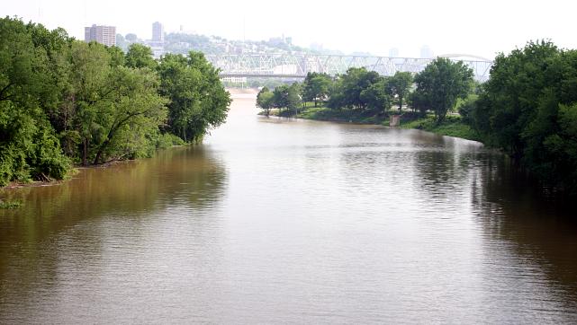 Licking RiverCanoeing · ~52 min drivePhoto: Rdikeman at English Wikipedia, CC BY-SA 3.0 (via Wikimedia Commons)
- Boat Ramp TwentysixBoat launch · ~44 min drive
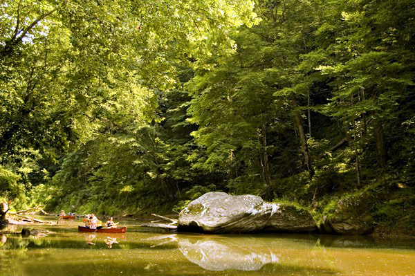 Red RiverCanoeing · ~53 min drivePhoto: Seicer at English Wikipedia, CC BY 2.5 (via Wikimedia Commons)
- Kentucky Division of Forestry RampBoat launch · ~45 min drive
- Little Fork Little Sandy RiverCanoeing · ~16 min drive
- Paragon Boat RampBoat launch · ~48 min drive
- Toms CreekCanoeing · ~20 min drive
- Blackwater Boat RampBoat launch · ~48 min drive
Best time to visit Blaine Creek
Best months: April and June–October. Best months have typical highs of 55–85 °F, lows of 30 °F or warmer (32 °F where the station doesn't record snow), at most one snowy day and no more than 12 wet days.
Jan
44° / 23°
12 wet
Feb
48° / 25°
11 wet
Mar
58° / 30°
12 wet
Apr
70° / 39°
12 wet
May
76° / 49°
13 wet
Jun
82° / 58°
12 wet
Jul
85° / 63°
12 wet
Aug
84° / 61°
10 wet
Sep
79° / 53°
8 wet
Oct
69° / 41°
9 wet
Nov
57° / 30°
10 wet
Dec
47° / 26°
12 wet
Typical high / low (°F) and days with rain or snow, 1991–2020. Measured at Charley 2 Sw, KY, 8.5 mi away at 740 ft. This station doesn't record snowfall. Source: NOAA NCEI U.S. Climate Normals 1991–2020.

