Jack Sutter Campsite
Campground
Campground · 1.8 mi from the trail
Closure in the area
There's a closure order in George Washington and Jefferson National Forest. It doesn't name Pine Mountain State Scenic Trail - Birch Knob Section, so check the source for the area it covers (2 listed).
Enchanted Creek Road (National Forest System Road 1881) will be closed for repairs until 12/31/27
Agency closure covering George Washington and Jefferson National Forest · USFS · George Washington and Jefferson National Forest
Bolar Mountain Recreation Area - Twin Ridge Road Closure
Agency closure covering George Washington and Jefferson National Forest · USFS · George Washington and Jefferson National Forest
Prescribed Fire Operations Mount Rogers National Recreation Area- Porter and Little Mountain
Agency alert covering George Washington and Jefferson National Forest · USFS · George Washington and Jefferson National Forest
Road Closures James River and Warm Springs Ranger District
Agency alert covering George Washington and Jefferson National Forest · USFS · George Washington and Jefferson National Forest
Virginia Creeper National Recreation Trail Closure Update
Agency alert covering George Washington and Jefferson National Forest · USFS · George Washington and Jefferson National Forest
As of · Source: USFS · George Washington and Jefferson National Forest. Agencies don't list every closure — check before you go.
The Birch Knob Section of the Pine Mountain State Scenic Trail is a long, steep out-and-back hike in Kentucky's Clinch Ranger District of the George Washington and Jefferson National Forest. The route is about 21 miles long, with a total elevation gain of 5,036 feet, and it is rated expert. The trail starts at an elevation of about 2,910 feet and reaches a high point of 2,982 feet, with the steepest stretch at about 2.4 miles in, where the grade reaches 20%. The most comfortable months for a visit are typically late spring and early fall. Typical averages from a nearby weather station in Wise, Virginia, run from highs around 72°F in May to about 76°F in September, with October highs near 66°F and lows around 44°F. The trip takes about 9.5 hours. The Pine Mountain State Scenic Trail - Highland Section lies about a mile away, and the Red Fox and Austin Gap hikes are within about 2 miles. Paddlers can reach the Pound River about 3 miles off.
Jack Sutter Campsite
Campground
Paco's Mexican Restaurant - Jenkins
Mexican restaurant
 If it rainsBrian Stansberry (photographer), CC BY 4.0 · Wikimedia Commons
Ralph Stanley Museum
Museum
Places © OpenStreetMap contributors, Places © Overture Maps Foundation · Photos: Brian Stansberry (photographer), CC BY 4.0 (commons)
More in Wise Pound RiverCanoeingPhoto: Mikebranham80, CC BY-SA 3.0 (via Wikimedia Commons)3 mi
Source: Roamze catalog (indexable pages within 10 miles, PostGIS distance)
 Pine Mountain State Scenic Trail - Birch Knob SectionHiking · ~30 min drivePhoto: Gamma Man, CC BY 2.0 (via Flickr)
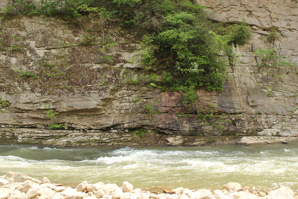 Pine Mountain State Scenic TrailHiking · ~31 min drivePhoto: Gamma Man, CC BY 2.0 (via Flickr)
 Pine Mountain State Scenic Trail - Birch Knob SectionHiking · ~32 min drivePhoto: Gamma Man, CC BY 2.0 (via Flickr)
Best months: September–November. Best months have typical highs of 55–85 °F, lows of 30 °F or warmer (32 °F where the station doesn't record snow), at most one snowy day and no more than 12 wet days.
Jan
43° / 25°
15 wet
Feb
47° / 27°
14 wet
Mar
55° / 34°
15 wet
Apr
65° / 43°
13 wet
May
72° / 51°
14 wet
Jun
78° / 58°
14 wet
Jul
81° / 61°
15 wet
Aug
80° / 60°
13 wet
Sep
76° / 54°
11 wet
Oct
66° / 44°
11 wet
Nov
55° / 34°
12 wet
Dec
46° / 29°
14 wet
Typical high / low (°F) and days with rain or snow, 1991–2020. Measured at Wise 1se, VA, 13.8 mi away at 2,564 ft. This station doesn't record snowfall. Source: NOAA NCEI U.S. Climate Normals 1991–2020.
Map and trail data © OpenStreetMap contributors
