Bear Creek Horse Camp Access Road
- 0.3 mi
- round trip
- 13 ft
- climb
- 1,310 ft
- high point
- Out and back
- route
- Mar–Nov
- best months
Is Bear Creek Horse Camp Access Road open right now?
Closure in the area
There's a closure order in Daniel Boone National Forest. It doesn't name Bear Creek Horse Camp Access Road, so check the source for the area it covers (2 listed).
National Visitor Use Monitoring, Oct 2026-Sept 2027
Agency closure covering Daniel Boone National Forest · USFS · Daniel Boone National Forest
Scott Creek Boat ramp briefly inaccessible, July 30
Agency closure covering Daniel Boone National Forest · USFS · Daniel Boone National Forest
Low water levels at Laurel River Lake
Agency alert covering Daniel Boone National Forest · USFS · Daniel Boone National Forest
Active logging operations near Redbird Crest Trail Sections 17-19
Agency alert covering Daniel Boone National Forest · USFS · Daniel Boone National Forest
Cliffside Trail #519 Closure
Agency alert covering Daniel Boone National Forest · USFS · Daniel Boone National Forest
As of · Source: USFS · Daniel Boone National Forest. Agencies don't list every closure — check before you go.
Bear Creek Horse Camp Access Road is a short, easy out-and-back route in Kentucky's Big South Fork National River and Recreation Area, managed by the National Park Service. It sits within the Stearns Ranger District of Daniel Boone National Forest, about 0.3 miles from Bear Creek Campground - KY and the Bear Creek Horse Camp Connector. The road is a 0.6-mile round trip with a low point of 1,284 feet and a high of 1,310 feet, so the climb is minimal. Spring and fall are the most comfortable times to go. Typical averages from a nearby weather station show October highs around 69°F with lows near 41°F, and May highs around 77°F. Nearby, Bear Creek Road and the Split Bow Arch Trail are both within a mile. Climbers can find Upstream Routes about 2.6 miles away, and Blue Heron Campground is about 2.8 miles off.
- Bear Creek Horse Camp ConnectorHiking0.3 mi
- Bear Creek Campground - KYCamping0.3 mi
- Bear Creek RoadHiking0.5 mi
- Split Bow Arch TrailHiking0.8 mi
- Upstream RoutesRock climbing2.6 mi
- Downstream AreaRock climbing2.6 mi
- Blue HeronRock climbing2.6 mi
- Blue Heron CampgroundCamping2.8 mi
Source: Roamze catalog (indexable pages within 10 miles, PostGIS distance)
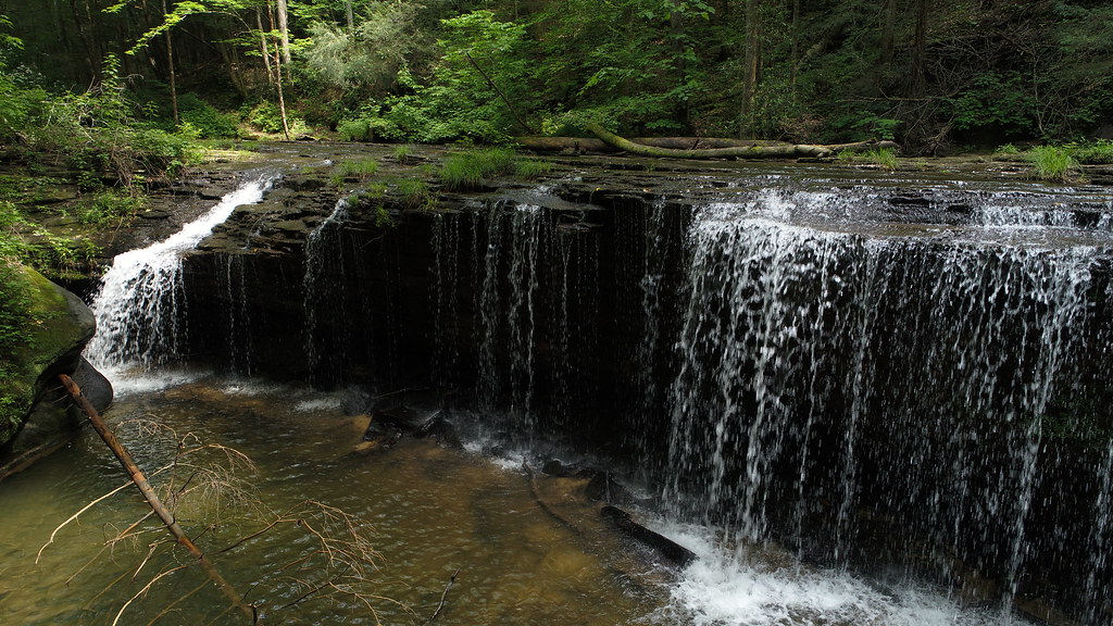 Lick Creek Falls Trail 631AHiking · ~10 min drivePhoto: US Forest Service - Southern Region, Public Domain Mark (via Flickr)
- Cotton Patch LoopHiking · ~2 min drive
- Pilot-Wines LoopHiking · ~11 min drive
- LICK CREEKHiking · ~10 min drivePhoto: US Forest Service - Southern Region, Public Domain Mark (via Flickr)
- Blue Heron Loop TrailHiking · ~3 min drive
 Laurel Hill Multi Use TrailHiking · ~12 min drivePhoto: George Green, U.S. Army Corps of Engineers, Public domain (via Wikimedia Commons)
- Kentucky Trail (Segment E)Hiking · ~4 min drive
- Kentucky Trail (Segment I)Hiking · ~12 min drivePhoto: George Green, U.S. Army Corps of Engineers, Public domain (via Wikimedia Commons)
- Kentucky Trail (Segment C)Hiking · ~5 min drive
- Bear Creek Horse Camp ConnectorHiking · Next door
Best time to visit Bear Creek Horse Camp Access Road
Best months: March–November. Best months have typical highs of 55–85 °F, lows of 30 °F or warmer (32 °F where the station doesn't record snow), at most one snowy day and no more than 12 wet days.
Jan
45° / 24°
11 wet
Feb
49° / 26°
10 wet
Mar
59° / 33°
10 wet
Apr
69° / 41°
10 wet
May
77° / 51°
11 wet
Jun
82° / 59°
10 wet
Jul
85° / 63°
10 wet
Aug
85° / 62°
8 wet
Sep
79° / 54°
7 wet
Oct
69° / 41°
8 wet
Nov
57° / 32°
8 wet
Dec
48° / 27°
11 wet
Typical high / low (°F) and days with rain or snow, 1991–2020. Measured at Stearns 2s, KY, 3.4 mi away at 1,220 ft. This station doesn't record snowfall. Source: NOAA NCEI U.S. Climate Normals 1991–2020.
