South Fork Solomon River
- 263 mi
- distance
- 3,357 ft
- high point
- Apr–May, Sep–Oct
- best months
South Fork Solomon River is a 263-mile paddling stretch near Morland, Kansas. It is intermittent and may run dry in some seasons. USGS models an average flow of about 99 cfs and a gradient of about 7.0 feet per mile.
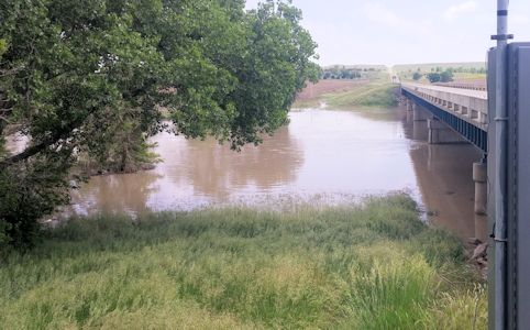 Saline RiverCanoeing · ~29 min drivePhoto: Nathan Sullivan @ United States Geological Survey, Public domain (via Wikimedia Commons)
 Prairie Dog CreekCanoeing · ~47 min drivePhoto: Ammodramus, Public domain (via Wikimedia Commons)
 Smoky Hill RiverCanoeing · ~1h 9m drivePhoto: National Weather Service, Public domain (via Wikimedia Commons)
- North Fork Solomon RiverCanoeing · ~25 min drive
- Big CreekCanoeing · ~56 min drive
- Hackberry CreekCanoeing · ~58 min drive
- Sappa CreekCanoeing · ~1h 17m drive
Also worth it near here
Best time to visit South Fork Solomon River
Best months: April–May and September–October. Best months have typical highs of 55–85 °F, lows of 30 °F or warmer (32 °F where the station doesn't record snow), at most one snowy day and no more than 12 wet days.
Jan
43° / 17°
3 wet
Feb
46° / 20°
4 wet
Mar
57° / 29°
5 wet
Apr
66° / 38°
8 wet
May
76° / 49°
10 wet
Jun
88° / 60°
10 wet
Jul
93° / 66°
9 wet
Aug
90° / 64°
9 wet
Sep
83° / 54°
7 wet
Oct
69° / 40°
6 wet
Nov
55° / 27°
4 wet
Dec
44° / 19°
3 wet
Typical high / low (°F) and days with rain or snow, 1991–2020. Measured at Hill City Muni Ap, KS, 10 mi away at 2,188 ft. The station sits about 1,200 ft lower than this place, so expect it a little cooler here. This station doesn't record snowfall. Source: NOAA NCEI U.S. Climate Normals 1991–2020.
