Riverpond Campground
Kayaking business nearby (~10 mi away) — hasn't claimed their Roamze page yet
Idaho
Payette River: Chief Parrish
Free — you'll pick up right here.
No agency boundary, access route or field report is mapped to it — so there is no verdict, and we won't guess. We'll tell you the moment this water has something to say.
Covered nearby
Waters within 25 miles where we do have a current picture.
Nobody's filed a report here yet — be the first.
Payette River: Chief Parrish
Suggested plan · check conditions before you go
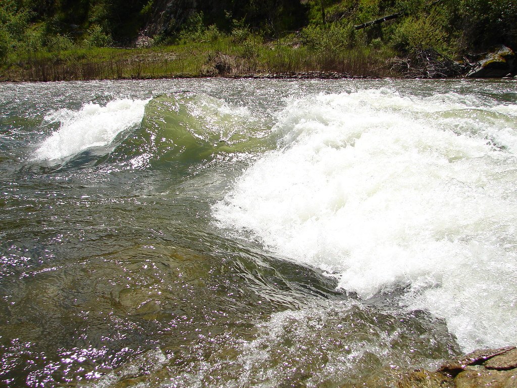
The Main Payette River is a classic Class III, pool-drop river cooperatively managed by the BLM and Boise National Forest. Chief Parrish is located about half way along the Main Payette River between Banks and Beehive Bend. This site is used as a launch or take-out spot primarily used by kayakers. The site is also a popular picnicking site. The facilities include a small, gravel parking area, vault toilet, and three picnic tables. This is a fee parking area - $5.00/day or $30.00 season pass for the Boise National Forest Annual Day Use Pass. Day passes are available on-site.Purchase online Boise National Forest Annual Day Use PassPayette River Maps (Boater's Guide)
 Photo: Rickmouser45, CC BY-SA 4.0 (via Wikimedia Commons)
Grimes Creek
~27 min drive
Grimes Creek is a 40-mile paddling stretch near Idaho City, Idaho. It is intermittent and may run dry in some seasons. USGS models an average flow of about 179 cfs and a gradient of about 86.8 feet per mile.
Beehive Bend River Access
~4 min drive
Beehive Bend River Access is a boat launch in Idaho. It gives access to Payette River: Beehive Bend.
Payette River: Beehive Bend
~4 min drive
A worthwhile stop near Idaho.
 Photo: U.S. Forest Service, Public domain (via Wikimedia Commons)
Mores Creek
~36 min drive
Mores Creek is a 24-mile paddling stretch near Idaho City, Idaho. It flows year-round. USGS models an average flow of about 352 cfs and a gradient of about 79.3 feet per mile.
Banks River Access
~7 min drive
Banks River Access is a boat launch in Idaho.
Swinging Bridge
~17 min drive
A worthwhile stop near Idaho.
Sohoagaiteka’a Naokwaide
~20 min drive
Sohoagaiteka’a Naokwaide is a 15-mile paddling stretch near Ola, Idaho. It is intermittent and may run dry in some seasons. USGS models an average flow of about 55 cfs and a gradient of about 130.1 feet per mile. Land along it is managed by the U.S. Forest Service.
Deer Creek Boat Launch
~11 min drive
Deer Creek Boat Launch is a boat launch in Idaho.
Pine Flats
~39 min drive
A worthwhile stop near Idaho.
Shafer Creek
~23 min drive
Shafer Creek is a 13-mile paddling stretch near Horseshoe Bend, Idaho. It flows year-round. USGS models an average flow of about 55 cfs and a gradient of about 150.8 feet per mile.
Local operatorsoffering guided trips. You book directly with them — Roamze doesn’t take a cut.
Riverpond Campground
Kayaking business nearby (~10 mi away) — hasn't claimed their Roamze page yet
Garden Valley RV Park
Kayaking business nearby (~10 mi away) — hasn't claimed their Roamze page yet
Middle Fork Campground
Kayaking business nearby (~10 mi away) — hasn't claimed their Roamze page yet
