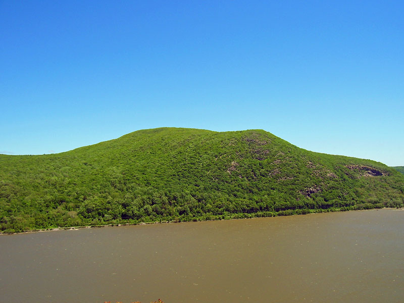
Boardman Mountain
- 638 ft
- summit
- Jul–Oct
- best months
Boardman Mountain is a summit in Connecticut, rising to 638 feet about 2 miles from the town of Gaylordsville. It sits right beside the Housatonic Range Trail, which passes within a tenth of a mile, making it an easy addition to a longer outing on that route. Summer is the most comfortable time to visit. Typical averages from a nearby weather station show July highs around 78°F with lows near 61°F, while winter highs stay in the low 30s. The Housatonic Range Trail starts almost at the mountain's base. The Nclc and Silo Trail are both within about 3 miles. Across the state line in New York, the Swamp River offers canoeing about 6.6 miles away.
Conditions and forecast
Daily highs and lows, wind and the chance of precipitation at the summit for the next 7 days, from the Open-Meteo model.
- Summit elevation
- 638 ft
Elevation from USGS 3D Elevation Program terrain data (about 10 m resolution).
We don't know of a mapped trail or route to the summit of Boardman Mountain. Plan the approach with local maps, a guidebook or a local guide, and check conditions before you go.
Questions about Boardman Mountain
How tall is Boardman Mountain?
638 ft (194 m).
Is there a trail to the top of Boardman Mountain?
We don't know of a mapped trail or route to the summit. Plan the approach with local maps, a guidebook or a local guide.
- Straits Rock748 ft · Connecticut1 route1.2 mi away
- Pine Knob705 ft · Connecticut1 route1.9 mi away
- Candlewood Mountain999 ft · Connecticut1 route2.4 mi away
- Steep Rock774 ft · Connecticut2 routes6.5 mi away
- Fuller Mountain1,337 ft · Connecticut1 route9.7 mi away
- Calebs Peak1,144 ft · Connecticut1 route9.7 mi away
 Housatonic Range TrailHikingPhoto: H. Morrow Long, CC BY-SA 3.0 (via Wikimedia Commons)0.1 mi
 NclcHikingPhoto: H. Morrow Long, CC BY-SA 3.0 (via Wikimedia Commons)1.9 mi
 Silo TrailHikingPhoto: H. Morrow Long, CC BY-SA 3.0 (via Wikimedia Commons)2.6 mi
- Swamp RiverCanoeing6.6 mi
- Murrow Park PawlingRock climbing8.5 mi
- East Branch Croton RiverCanoeing9.4 mi
- EMC WallRock climbing9.7 mi
- St. John's LedgesRock climbing9.8 mi
Source: Roamze catalog (indexable pages within 10 miles, PostGIS distance)
 Bull HillSummit · ~49 min drivePhoto: Daniel Case, CC BY-SA 3.0 (via Wikimedia Commons)
- Straits RockSummit · ~2 min drive
- Pine KnobSummit · ~3 min drive
- Candlewood MountainSummit · ~4 min drive
- Steep RockSummit · ~11 min drive
- Fuller MountainSummit · ~17 min drive
- Calebs PeakSummit · ~17 min drive
- Mount TomSummit · ~19 min drive
- Cobble MountainSummit · ~19 min drive
- Cornwall HillSummit · ~20 min drive
Best time to visit Boardman Mountain
Best months: July–October. Best months have typical highs of 55–85 °F, lows of 30 °F or warmer (32 °F where the station doesn't record snow), at most one snowy day and no more than 12 wet days.
Jan
33° / 16°
13 wet
Feb
36° / 19°
11 wet
Mar
44° / 26°
12 wet
Apr
57° / 37°
13 wet
May
66° / 47°
15 wet
Jun
73° / 56°
13 wet
Jul
78° / 61°
12 wet
Aug
76° / 60°
11 wet
Sep
70° / 53°
10 wet
Oct
60° / 41°
12 wet
Nov
49° / 32°
11 wet
Dec
39° / 23°
13 wet
Typical high / low (°F) and days with rain or snow, 1991–2020. Measured at Carmel 4n, NY, 14 mi away at 680 ft. This station doesn't record snowfall. Source: NOAA NCEI U.S. Climate Normals 1991–2020.
