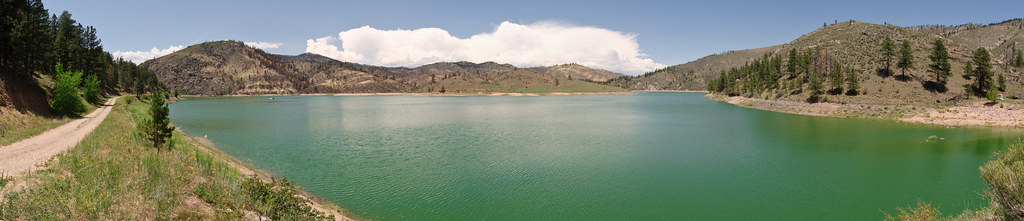
Happy Hour Crag
Happy Hour Crag in Colorado has 10 routes across 6 grades, offering sport and trad climbing.
- 10 routes
- 5.7 – 5.11b
- Sport · Trad
Is Happy Hour Crag open right now?
Alert in the area
The Forest Service lists 4 alerts for Canyon Lakes Ranger District.
Salt Cabin Prescribed (RX) Fire Closure
Agency alert covering Canyon Lakes Ranger District · Order 02-10-05-26-10 · USFS · Canyon Lakes Ranger District
Fire Restrictions
Agency alert covering Arapaho and Roosevelt National Forests · USFS · Arapaho and Roosevelt National Forests
West Crystal A - Mechanical Fuelbreak Area and Road Closure
Agency alert covering Canyon Lakes Ranger District · Order 02-10-05-26-04 · USFS · Canyon Lakes Ranger District
Cameron Peak Fire Road Closures
Agency alert covering Canyon Lakes Ranger District · Order 02-10-05-26-01 · USFS · Canyon Lakes Ranger District
As of · Source: USFS · Canyon Lakes Ranger District. Agencies don't list every closure — check before you go.
Best time to visit Happy Hour Crag
Best months: April–June and August–October. Best months have typical highs of 55–85 °F, lows of 30 °F or warmer (32 °F where the station doesn't record snow), at most one snowy day and no more than 12 wet days.
Jan
45° / 18°
4 wet
Feb
47° / 21°
5 wet
Mar
56° / 29°
6 wet
Apr
63° / 35°
9 wet
May
71° / 44°
12 wet
Jun
82° / 53°
10 wet
Jul
87° / 59°
9 wet
Aug
85° / 57°
9 wet
Sep
77° / 48°
7 wet
Oct
64° / 36°
6 wet
Nov
53° / 26°
5 wet
Dec
44° / 18°
4 wet
Typical high / low (°F) and days with rain or snow, 1991–2020. Measured at Ft Collins, CO, 12.2 mi away at 5,004 ft. The station sits about 700 ft lower than this place, so expect it a little cooler here. This station doesn't record snowfall. Source: NOAA NCEI U.S. Climate Normals 1991–2020.
Happy Hour Crag is a climbing area in Colorado on city-managed land within the boundaries of the Canyon Lakes Ranger District of the Arapaho and Roosevelt National Forests. Fort Collins is the nearest town, and its own climbing area sits about 1.9 miles away. For the most comfortable climbing weather, look to spring and fall. Typical averages from the Ft Collins weather station, about 700 feet lower and 12 miles off, run to highs near 77°F in September and 63°F in April, and temperatures at the crag run slightly cooler. Poudre Practice Rock is about 0.8 miles away. Overlook Trail (0.5 miles) and Black Powder Trail (0.6 miles) are the closest hikes, and Ansel Watrous Campground lies about 4.9 miles off.
Routes (10)
Keep exploring — more climbs worth the drive
 Photo: kalestews, CC BY 2.0 (via Flickr)
Greyrock
~4 min drive
Greyrock is a climbing area in Colorado with 4 routes.
 Photo: kalestews, CC BY 2.0 (via Flickr)
Granite Sea
~4 min drive
7 granite climbing routes in Colorado ranging across 5 difficulty grades.
Photo: kalestews, CC BY 2.0 (via Flickr)Breakers
~4 min drive
Breakers in Colorado has 5 trad climbing routes on 5 difficulty grades.
Photo: kalestews, CC BY 2.0 (via Flickr)Northwest Slabs
~4 min drive
11 routes at Northwest Slabs in Colorado span 8 difficulty grades with mixed, sport, and trad options.
 Photo: Jeffrey Beall, CC BY 4.0 (via Wikimedia Commons)
Poudre Canyon
~4 min drive
Poudre Canyon in Colorado has 7 climbing routes with 7 difficulty grades, offering bouldering pads, sport, and trad.
Photo: kalestews, CC BY 2.0 (via Flickr)The South Slabs
~4 min drive
South Slabs, The is a climbing crag in Colorado with 22 routes.
Fort Collins
~3 min drive
Fort Collins, Colorado climbing crag with 5 routes ranging from 5 distinct difficulty grades.
Unwilling Boulder
~4 min drive
12-pad bouldering routes at Unwilling Boulder, Colorado.
Pine Vu Blocs
~4 min drive
Pine Vu Blocs is a bouldering crag in Colorado with 9 routes.
Picnic Rock
~4 min drive
Picnic Rock in Colorado has 8 climbing routes with 7 difficulty grades.