Amphitheatre Campground
Campground
Campground · 1.3 mi from the trail
Closure in the area
There's a closure order in Grand Mesa, Uncompahgre and Gunnison National Forests. It doesn't name Sutton - Neosho, so check the source for the area it covers (2 listed).
Gold Mountain Wildfire Roads and Trails Closure Order v 4.0
Agency closure covering Grand Mesa, Uncompahgre and Gunnison National Forests · USFS · Grand Mesa, Uncompahgre and Gunnison National Forests
Ophir Pass Road Closure
Agency closure covering Grand Mesa, Uncompahgre and Gunnison National Forests · USFS · Grand Mesa, Uncompahgre and Gunnison National Forests
Potter Basin Road Closure Order
Agency alert covering Grand Mesa, Uncompahgre and Gunnison National Forests · USFS · Grand Mesa, Uncompahgre and Gunnison National Forests
Beaver Park Road Closure Order
Agency alert covering Grand Mesa, Uncompahgre and Gunnison National Forests · USFS · Grand Mesa, Uncompahgre and Gunnison National Forests
TERMINATION OF ORDER - FIRE RESTRICTIONS
Agency alert covering Grand Mesa, Uncompahgre and Gunnison National Forests · USFS · Grand Mesa, Uncompahgre and Gunnison National Forests
As of · Source: USFS · Grand Mesa, Uncompahgre and Gunnison National Forests. Agencies don't list every closure — check before you go.
Sutton - Neosho is a mountain biking route in Colorado's Ouray Ranger District, part of the Grand Mesa, Uncompahgre and Gunnison National Forests. The Forest Service manages the land, and the route is roughly 2 miles long, with a one-way climb of 918 feet from a low point of about 8,114 feet to a high of about 9,008 feet. Summer is the most comfortable time to ride. Typical averages from the Ouray weather station, about a mile away and roughly 1,200 feet lower, show July highs near 79°F and lows around 53°F. Winter brings highs in the mid-30s and snow on seven days a month in January and February. Snow days drop to zero in June and July. Wildhorse Peak is about 0.4 miles away, and the Jimmy Cliff climbing area is about half a mile off. Amphitheatre Campground is about 1.3 miles away, and Canyon Creek offers canoeing about 1.9 miles from the route.
Amphitheatre Campground
Campground
Smuggler Union Tramhouse
Attraction
Places © OpenStreetMap contributors, Places © Overture Maps Foundation
More in TellurideNot on Roamze yet. Their page has how to reach them.
 Wildhorse PeakHikingPhoto: Jacob Montgomery, CC BY-SA 3.0 (via Wikimedia Commons)0.4 miJimmy CliffRock climbingPhoto: Jacob Montgomery, CC BY-SA 3.0 (via Wikimedia Commons)0.5 mi
 Camp Bird Mine Rd/Mountain Rescue Cache CragRock climbingPhoto: ranok, CC BY 2.0 (via Flickr)0.8 mi
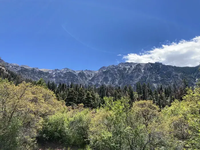 Amphitheater (co)CampingPhoto: Recreation.gov (RIDB) / public domain1.3 mi
 East Fork Dallas CreekCanoeingPhoto: Boyd Norton, Public domain (via Wikimedia Commons)9.2 mi
Source: Roamze catalog (indexable pages within 10 miles, PostGIS distance)
 Alpine MineMountain biking · ~4 min drivePhoto: Greg Willis from Denver, CO, usa, CC BY-SA 2.0 (via Wikimedia Commons)
 Bear Creek-South ForkMountain biking · ~6 min drivePhoto: robert thigpen from diboll, texas, CC BY-SA 2.0 (via Wikimedia Commons)
 Virginius MineMountain biking · ~12 min drivePhoto: QKC, CC BY-SA 3.0 (via Wikimedia Commons)
 HaydenMountain biking · ~3 min drivePhoto: Sandy Horvath-Dori from Grand Junction, CO, USA, CC BY 2.0 (via Wikimedia Commons)
Best months: June–July and September. Best months have typical highs of 55–85 °F, lows of 30 °F or warmer (32 °F where the station doesn't record snow), at most one snowy day and no more than 12 wet days.
Jan
34° / 15°
8 wet · 7 snow
Feb
36° / 19°
8 wet · 7 snow
Mar
44° / 25°
9 wet · 8 snow
Apr
52° / 31°
9 wet · 6 snow
May
63° / 39°
7 wet · 2 snow
Jun
74° / 47°
6 wet
Jul
79° / 53°
10 wet
Aug
75° / 51°
14 wet
Sep
69° / 45°
11 wet
Oct
57° / 34°
8 wet · 3 snow
Nov
44° / 24°
8 wet · 6 snow
Dec
35° / 16°
8 wet · 7 snow
Typical high / low (°F) and days with rain or snow, 1991–2020. Measured at Ouray, CO, 1.1 mi away at 7,840 ft. The station sits about 1,200 ft lower than this place, so expect it a little cooler here. Source: NOAA NCEI U.S. Climate Normals 1991–2020.
Map and trail data © OpenStreetMap contributors
