Entrada Trail
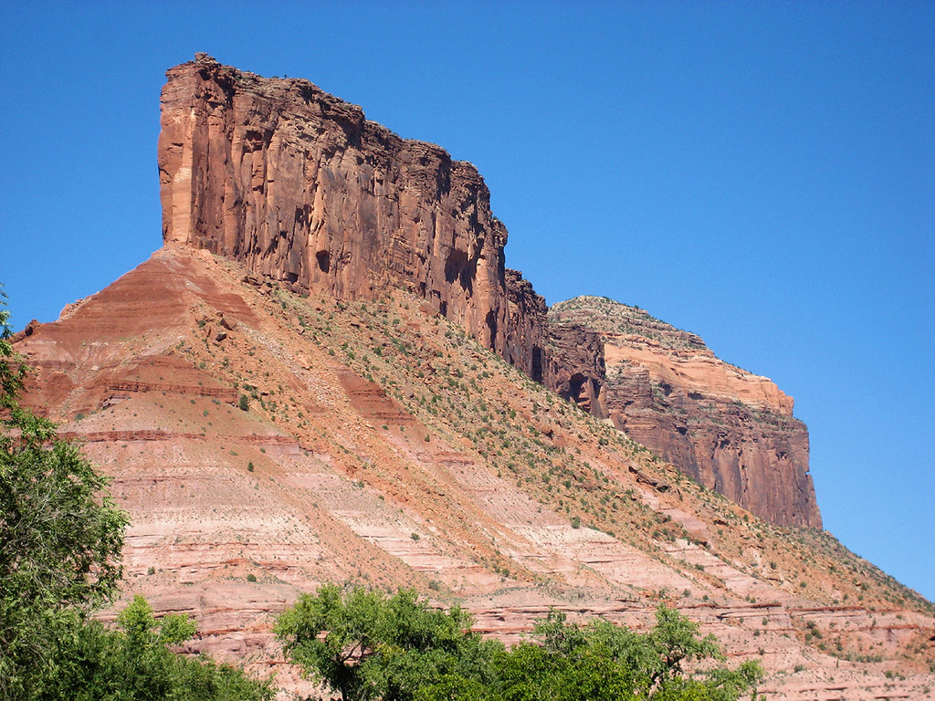
 Photo: Jeffrey Beall, CC BY 4.0 (via Wikimedia Commons)
- 0.6 mi
- distance
- 98 ft
- climb
- Mar–May, Sep–Nov
- best months
Entrada Trail is a short mountain biking route on Bureau of Land Management land in Colorado's Grand Junction Field Office, about 0.6 miles long and rising from roughly 4,670 feet to about 4,705 feet. The climb is gentle, with a total gain of 98 feet, and the steepest stretch comes at about 0.34 miles in, where the grade reaches 10 percent. Spring and fall are the most comfortable times to ride. Typical averages from a nearby weather station show May highs around 80°F and October highs around 71°F, while July averages about 95°F and winter brings highs in the mid-40s and a few snowy days a month. The trail sits among several other routes. Dynamite Trail is about 0.2 miles away, and Vista Grande Loop and Runway Trail are each about 0.3 miles off. Wildflower Trail, a hike, is also about 0.3 miles away.
Local outfitters
- Red Desert RV Park29 mi away
- Moab Rim Campark30 mi away
Not on Roamze yet. Their page has how to reach them.
- Dynamite TrailMountain bikingPhoto: Jeffrey Beall, CC BY 4.0 (via Wikimedia Commons)0.2 mi
- Vista Grande LoopMountain bikingPhoto: Jeffrey Beall, CC BY 4.0 (via Wikimedia Commons)0.3 mi
 Wildflower TrailHikingPhoto: Argyleist, CC BY 2.0 (via Flickr)0.3 mi
 Runway TrailMountain bikingPhoto: Jeffrey Beall, CC BY 4.0 (via Wikimedia Commons)0.3 mi
- Olive GardenRock climbing0.9 mi
- GatewayRock climbing1.8 mi
 Sewemup MesaRock climbingPhoto: SymphonicPoet, CC BY 2.0 (via Flickr)5.2 mi
- 4.1 Road BoulderingRock climbing6.4 mi
Source: Roamze catalog (indexable pages within 10 miles, PostGIS distance)
- Dynamite TrailMountain biking · Next doorPhoto: Jeffrey Beall, CC BY 4.0 (via Wikimedia Commons)
- Vista Grande LoopMountain biking · Next doorPhoto: Jeffrey Beall, CC BY 4.0 (via Wikimedia Commons)
- Runway TrailMountain biking · Next doorPhoto: Jeffrey Beall, CC BY 4.0 (via Wikimedia Commons)
- Cutler Rim TrailMountain biking · Next doorPhoto: Jeffrey Beall, CC BY 4.0 (via Wikimedia Commons)
- Lumsden LoopMountain biking · ~1 min drivePhoto: Jeffrey Beall, CC BY 4.0 (via Wikimedia Commons)
 Bachelor BasinMountain biking · ~30 min drivePhoto: Matt Lavin, CC BY-SA 2.0 (via Wikimedia Commons)
- Dry Fork Mill CreekMountain biking · ~30 min drivePhoto: Matt Lavin, CC BY-SA 2.0 (via Wikimedia Commons)
 Geyser to BurroMountain biking · ~31 min drivePhoto: The Greater Southwestern Exploration Company, CC BY 2.0 (via Wikimedia Commons)
- Clark LakeMountain biking · ~33 min drivePhoto: Matt Lavin, CC BY-SA 2.0 (via Wikimedia Commons)
 Boren MesaMountain biking · ~35 min drivePhoto: Greg Gebhardt, CC BY-SA 3.0 (via Wikimedia Commons)
Best time to visit Entrada Trail
Best months: March–May and September–November. Best months have typical highs of 55–85 °F, lows of 30 °F or warmer (32 °F where the station doesn't record snow), at most one snowy day and no more than 12 wet days.
Jan
45° / 21°
6 wet · 2 snow
Feb
52° / 27°
5 wet · 1 snow
Mar
63° / 34°
6 wet · 1 snow
Apr
70° / 40°
6 wet
May
80° / 48°
6 wet
Jun
91° / 57°
4 wet
Jul
95° / 64°
6 wet
Aug
92° / 62°
7 wet
Sep
85° / 53°
6 wet
Oct
71° / 41°
5 wet
Nov
57° / 30°
4 wet · 1 snow
Dec
45° / 22°
5 wet · 3 snow
Typical high / low (°F) and days with rain or snow, 1991–2020. Measured at Gateway 1ene, CO, 1.6 mi away at 4,671 ft. Source: NOAA NCEI U.S. Climate Normals 1991–2020.
Map and trail data © OpenStreetMap contributors
