Junction Creek Campground
Campground
Campground · 0.8 mi from the trail
Closure in the area
There's a closure order in Columbine Ranger District. It doesn't name Pine Chute, so check the source for the area it covers (5 listed).
Pagosa Ranger District Road Closure
Agency closure covering Columbine Ranger District · Order 02-13-08-26-17 · USFS · Columbine Ranger District
COLUMBINE RANGER DISTRICT Road Closure
Agency closure covering Columbine Ranger District · Order 02-13-08-26-18 · USFS · Columbine Ranger District
Travel is not advised to the San Juan NF
Agency closure covering San Juan National Forest · USFS · San Juan National Forest
Closures and dangerous conditions on roads, bridges, and trails from flooding
Agency closure covering San Juan National Forest · USFS · San Juan National Forest
Multiple roads and trails damaged by flooding on SJNF
Agency closure covering San Juan National Forest · USFS · San Juan National Forest
As of · Source: USFS · Columbine Ranger District. Agencies don't list every closure — check before you go.
Pine Chute is a mountain biking route in the Columbine Ranger District of the San Juan National Forest in Colorado, managed by the Forest Service. The trail is about 2.3 miles long, with a one-way climb of 405 feet from a starting elevation of 7,952 feet to a high point of 8,082 feet. The steepest stretch comes at about 1.2 miles in, where the grade reaches 14%. Summer is the most comfortable time to ride. Typical averages from the nearby Lemon Dam weather station, at a similar elevation, show July highs around 79°F with lows near 49°F, while September cools to highs near 70°F. Winter is cold, with January highs around 37°F and lows near 9°F. Logchutes 2 lies just 0.2 miles away, and Log Chute West and Log Chutes Trail 3 Ext are each about 0.4 miles off. For an overnight stay, Junction Creek Campground is roughly 0.8 miles away.
Junction Creek Campground
Campground
 If it rainsJeffrey Beall, CC BY 4.0 · Wikimedia Commons
Places © OpenStreetMap contributors, Places © Overture Maps Foundation · Photos: Jeffrey Beall, CC BY 4.0 (commons)
More in DurangoNot on Roamze yet. Their page has how to reach them.
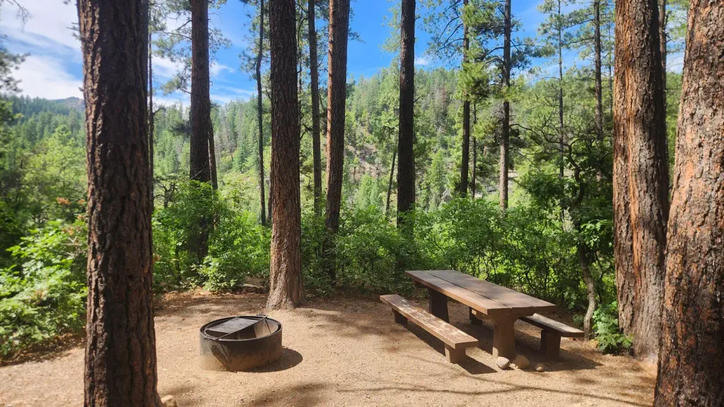 Junction Creek CampgroundCampingPhoto: Recreation.gov (RIDB) / public domain0.8 mi
Source: Roamze catalog (indexable pages within 10 miles, PostGIS distance)
Best months: May–June and September–October. Best months have typical highs of 55–85 °F, lows of 30 °F or warmer (32 °F where the station doesn't record snow), at most one snowy day and no more than 12 wet days.
Jan
37° / 9°
9 wet
Feb
40° / 11°
8 wet
Mar
47° / 19°
8 wet
Apr
54° / 26°
7 wet
May
63° / 35°
8 wet
Jun
75° / 43°
7 wet
Jul
79° / 49°
14 wet
Aug
76° / 48°
16 wet
Sep
70° / 41°
11 wet
Oct
59° / 32°
8 wet
Nov
46° / 22°
7 wet
Dec
37° / 13°
8 wet
Typical high / low (°F) and days with rain or snow, 1991–2020. Measured at Lemon Dam, CO, 14 mi away at 8,110 ft. This station doesn't record snowfall. Source: NOAA NCEI U.S. Climate Normals 1991–2020.
Map and trail data © OpenStreetMap contributors
