Wilcox Trail
- 1.2 mi
- loop
- 62 ft
- climb
- 4,895 ft
- high point
- Loop
- route
- Apr–Jun, Aug–Oct
- best months
Wilcox Trail is a short loop at the Environmental Learning Center in Colorado, about a mile long with a low of about 4,870 feet and a high of about 4,895 feet. The trail is rated easy, and the climb is flat, with a total gain of about 62 feet. The route starts near 4,876 feet, the steepest grade is about 2% at about 0.21 miles in, and the elevation drops back to about 4,870 feet by the end. Spring and fall are the most comfortable times to go. Typical averages from a nearby weather station run from highs around 70°F and lows around 43°F in May to highs around 77°F and lows around 47°F in September. July is the warmest month, with typical highs near 88°F. The trip takes about half an hour. Homestead Trail is about 2.8 miles away, and the climbing areas at Biglandia and the CSU campus are both within about 4 miles. Sandpiper Trail is about 4.9 miles away.
Local outfitters
- Wildcat Mountaineering26 mi away
- Alpine Lodge at Red Feather Lakes34 mi away
Not on Roamze yet. Their page has how to reach them.
- Homestead TrailHiking2.8 mi
- BiglandiaRock climbing3.1 mi
- CSU campusRock climbing3.8 mi
 Sandpiper TrailHikingPhoto: KimonBerlin, CC BY-SA 2.0 (via Wikimedia Commons)4.9 mi
- Heron Loop TrailHikingPhoto: KimonBerlin, CC BY-SA 2.0 (via Wikimedia Commons)5 mi
 Cattail Flats TrailHikingPhoto: Mountain Roamer, CC BY-SA 2.0 (via Flickr)5.1 mi
- Torture ChamberRock climbing6.5 mi
- Piano RidgeRock climbing6.6 mi
Source: Roamze catalog (indexable pages within 10 miles, PostGIS distance)
- Sandpiper TrailHiking · ~8 min drivePhoto: KimonBerlin, CC BY-SA 2.0 (via Wikimedia Commons)
- Foothills TrailHiking · ~13 min drive
- Heron Loop TrailHiking · ~9 min drivePhoto: KimonBerlin, CC BY-SA 2.0 (via Wikimedia Commons)
- Quarry Ridge LoopHiking · ~14 min drive
- Cattail Flats TrailHiking · ~9 min drivePhoto: Mountain Roamer, CC BY-SA 2.0 (via Flickr)
- Sawmill TrailHiking · ~14 min drive
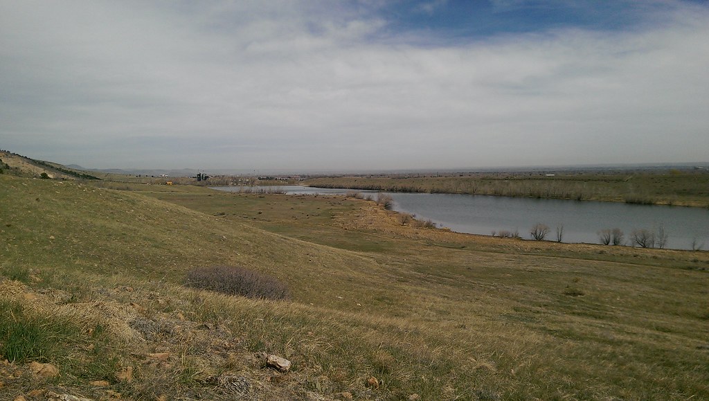 Ridge TrailHiking · ~10 min drivePhoto: Vic Dillahay, CC BY 2.0 (via Flickr)
 Foothills TrailHiking · ~11 min drivePhoto: Greg Younger from Fort Collins, USA, CC BY-SA 2.0 (via Wikimedia Commons)
 Valley TrailHiking · ~11 min drivePhoto: Vic Dillahay, CC BY 2.0 (via Flickr)
 Reservoir Loop TrailHiking · ~11 min drivePhoto: Mountain Roamer, CC BY-SA 2.0 (via Flickr)
Best time to visit Wilcox Trail
Best months: April–June and August–October. Best months have typical highs of 55–85 °F, lows of 30 °F or warmer (32 °F where the station doesn't record snow), at most one snowy day and no more than 12 wet days.
Jan
43° / 15°
4 wet
Feb
45° / 18°
5 wet
Mar
55° / 26°
6 wet
Apr
61° / 34°
9 wet
May
70° / 43°
11 wet
Jun
81° / 52°
9 wet
Jul
88° / 58°
8 wet
Aug
85° / 55°
8 wet
Sep
77° / 47°
7 wet
Oct
63° / 34°
6 wet
Nov
51° / 24°
5 wet
Dec
42° / 16°
4 wet
Typical high / low (°F) and days with rain or snow, 1991–2020. Measured at Ft Collins 4 E, CO, 1.3 mi away at 4,920 ft. This station doesn't record snowfall. Source: NOAA NCEI U.S. Climate Normals 1991–2020.
Map and trail data © OpenStreetMap contributors
