Newlin's Gold Trail
- 0.4 mi
- round trip
- 131 ft
- climb
- 6,349 ft
- high point
- Out and back
- route
- Apr–Jun, Aug–Oct
- best months
Newlin's Gold Trail is an easy out-and-back hike in Colorado, about 1.8 miles from the community of Surrey Ridge. It is a short walk, roughly 0.86 miles round trip, with an elevation gain of about 130 feet, so it makes a quick addition to a day of exploring the surrounding trails and paths. The trail starts and ends at a high point of about 6,349 feet, with a brief steep stretch at the beginning of the route. The climb is gentle, and the trail is rated easy, so it works well as a warm-up or a short break between other outings. Late spring and early fall are the most comfortable times to visit. Typical averages from the Castle Rock weather station, about 6 miles away, show May highs around 68°F and September highs around 77°F, while July peaks near 86°F. The Coyote Run Loop mountain biking trail lies just 0.2 miles away. The Rosie Rueter Trail and Canal Trail are both within about a mile and a half, and Cherry Creek, a canoeing spot, is about 2.5 miles off.
Local outfitters
- Lostfork Basecamp44 mi away
- Camp Always Choose Adventures44 mi away
Not on Roamze yet. Their page has how to reach them.
- coyote run loopMountain biking0.2 mi
 Rosie Rueter TrailHikingPhoto: gregor_y, CC BY-SA 2.0 (via Flickr)0.9 mi
- Canal TrailHikingPhoto: gregor_y, CC BY-SA 2.0 (via Flickr)1.3 mi
 Cherry CreekCanoeingPhoto: Tim Kiser (w:User:Malepheasant), CC BY-SA 2.5 (via Wikimedia Commons)2.5 mi
- Denver SouthRock climbing4.5 mi
- The Pinery Rv LotCamping5.1 mi
 Legacy Trail BoulderingRock climbingPhoto: gregor_y, CC BY-SA 2.0 (via Flickr)7.5 mi
 Plum CreekCanoeingPhoto: Jeffrey Beall, CC BY 4.0 (via Wikimedia Commons)8.4 mi
Source: Roamze catalog (indexable pages within 10 miles, PostGIS distance)
- Rosie Rueter TrailHiking · ~2 min drivePhoto: gregor_y, CC BY-SA 2.0 (via Flickr)
- Canal TrailHiking · ~2 min drivePhoto: gregor_y, CC BY-SA 2.0 (via Flickr)
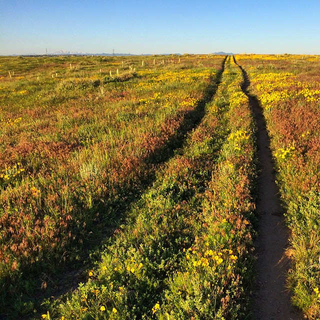 Ridgegate TrailHiking · ~4 min drivePhoto: gregor_y, CC BY-SA 2.0 (via Flickr)
 The Pinery TrailHiking · ~10 min drivePhoto: jefbrr, CC BY 2.0 (via Flickr)
 Pinery Loop TrailHiking · ~11 min drivePhoto: jefbrr, CC BY 2.0 (via Flickr)
 Hidden Mesa - Mesa Rim LoopHiking · ~12 min drivePhoto: jaygannett, CC BY-SA 2.0 (via Flickr)
- Pleasant Pass TrailHiking · ~12 min drivePhoto: jaygannett, CC BY-SA 2.0 (via Flickr)
- Coyote Run LoopHiking · Next door
- Newlin's Gold TrailHiking · Next door
- Gold Hill PathHiking · ~4 min drive
Best time to visit Newlin's Gold Trail
Best months: April–June and August–October. Best months have typical highs of 55–85 °F, lows of 30 °F or warmer (32 °F where the station doesn't record snow), at most one snowy day and no more than 12 wet days.
Jan
46° / 18°
4 wet
Feb
47° / 20°
5 wet
Mar
54° / 27°
5 wet
Apr
59° / 33°
6 wet
May
68° / 42°
8 wet
Jun
80° / 50°
8 wet
Jul
86° / 56°
9 wet
Aug
84° / 55°
9 wet
Sep
77° / 47°
6 wet
Oct
65° / 35°
4 wet
Nov
54° / 26°
4 wet
Dec
46° / 18°
5 wet
Typical high / low (°F) and days with rain or snow, 1991–2020. Measured at Castle Rock, CO, 6.4 mi away at 6,185 ft. This station doesn't record snowfall. Source: NOAA NCEI U.S. Climate Normals 1991–2020.
Map and trail data © OpenStreetMap contributors
