First Notch 3 Trail
- 1.3 mi
- round trip
- 116 ft
- climb
- 8,602 ft
- high point
- Out and back
- route
- May–Jun, Sep–Oct
- best months
Is First Notch 3 Trail open right now?
Closure in the area
There's a closure order in Columbine Ranger District. It doesn't name First Notch 3 Trail, so check the source for the area it covers (5 listed).
Pagosa Ranger District Road Closure
Agency closure covering Columbine Ranger District · Order 02-13-08-26-17 · USFS · Columbine Ranger District
COLUMBINE RANGER DISTRICT Road Closure
Agency closure covering Columbine Ranger District · Order 02-13-08-26-18 · USFS · Columbine Ranger District
Travel is not advised to the San Juan NF
Agency closure covering San Juan National Forest · USFS · San Juan National Forest
Closures and dangerous conditions on roads, bridges, and trails from flooding
Agency closure covering San Juan National Forest · USFS · San Juan National Forest
Multiple roads and trails damaged by flooding on SJNF
Agency closure covering San Juan National Forest · USFS · San Juan National Forest
As of · Source: USFS · Columbine Ranger District. Agencies don't list every closure — check before you go.
First Notch 3 Trail is a short, easy out-and-back hike in the Columbine Ranger District of Colorado's San Juan National Forest, managed by the Forest Service. The route is about 2.7 miles long, with a total climb of 116 feet, and the trail stays mostly flat with the steepest stretch around 0.38 miles in. The most comfortable months for a visit are typically June through September, when typical averages from a nearby weather station at Lemon Dam run from highs around 75°F in June to about 79°F in July, with September easing to around 70°F. That station sits roughly 500 feet below the trail, so temperatures on the trail run a little cooler. Winters there are cold, with typical January highs near 37°F and lows around 9°F. The First Notch Winter Trail lies about half a mile away, and Devils Hole Trail is about 1.4 miles off. First Notch 2 Trail is roughly 1.9 miles away. Lower Piedra Campground is about 3 miles from the trail.
Local outfitters
- Crazy Horse Outfitters16 mi away
- Wilderness Journeys Pagosa18 mi away
Not on Roamze yet. Their page has how to reach them.
- First Notch Winter TrailHiking0.5 mi
- Devils Hole TrailHiking1.4 mi
- First Notch 2 TrailHiking1.9 mi
 Lower Piedra CampgroundCampingPhoto: Dicklyon, CC BY-SA 4.0 (via Wikimedia Commons)3 mi
- Piedra Camp 3Camping3.5 mi
- Piedra Camp 2Camping3.5 mi
- First Fork Piedra RiverCanoeing6.3 mi
- Devil CreekCanoeing8.2 mi
Source: Roamze catalog (indexable pages within 10 miles, PostGIS distance)
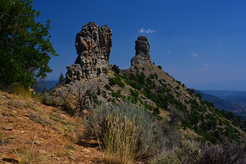 Great HouseHiking · ~13 min drivePhoto: stevehfung, CC BY-SA 2.0 (via Flickr)
- First Notch Winter TrailHiking · Next door
- Pine-PiedraHiking · ~4 min drive
- Devils HoleHiking · ~5 min drive
- First Notch 3 TrailHiking · Next door
- Devils Hole TrailHiking · ~2 min drive
- Sheep CreekHiking · ~5 min drive
- Poison IvyHiking · ~5 min drive
- First Notch 2 TrailHiking · ~3 min drive
- HORSE CREEKHiking · ~7 min drive
Best time to visit First Notch 3 Trail
Best months: May–June and September–October. Best months have typical highs of 55–85 °F, lows of 30 °F or warmer (32 °F where the station doesn't record snow), at most one snowy day and no more than 12 wet days.
Jan
37° / 9°
9 wet
Feb
40° / 11°
8 wet
Mar
47° / 19°
8 wet
Apr
54° / 26°
7 wet
May
63° / 35°
8 wet
Jun
75° / 43°
7 wet
Jul
79° / 49°
14 wet
Aug
76° / 48°
16 wet
Sep
70° / 41°
11 wet
Oct
59° / 32°
8 wet
Nov
46° / 22°
7 wet
Dec
37° / 13°
8 wet
Typical high / low (°F) and days with rain or snow, 1991–2020. Measured at Lemon Dam, CO, 16.2 mi away at 8,110 ft. This station doesn't record snowfall. Source: NOAA NCEI U.S. Climate Normals 1991–2020.
Map and trail data © OpenStreetMap contributors
