Forgotten Valley Campground
Campground
Campground · 0.7 mi from the trail
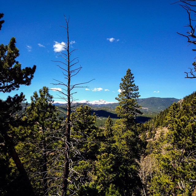
Burro Trail is a 0.72-mile moderate hike in Golden Gate Canyon State Park in Colorado, managed by State Fish and Wildlife. It is an out-and-back route, and the full round trip covers about 1.4 miles with a total elevation gain of 432 feet. The trail starts at roughly 7,869 feet and reaches a high point of 8,123 feet, and the climb is front-loaded, with the steepest stretch at 14% grade about 0.28 miles in. Summer is the most comfortable time to go. Typical averages from a nearby weather station run to highs around 79°F in July and 77°F in August, with July lows near 50°F. Winter is cold, with January highs around 39°F and lows near 17°F. Several other trails sit close by. Burro To City Lights Ridge Trail is about 0.4 miles away, and Mountain Lion Trail and Burro Spur To Windy Peak Trail are each within about a mile. Sourdough Springs Campground is roughly 4.8 miles away for an overnight stay.
Forgotten Valley Campground
Campground
Chop house Steak House
Steakhouse
 If it rainsClyde Charles Brown, CC BY-SA 4.0 · Wikimedia Commons
University museum, geology in CO, United States
Places © OpenStreetMap contributors, Places © Overture Maps Foundation · Photos: Clyde Charles Brown, CC BY-SA 4.0 (commons)
More in Idaho SpringsNot on Roamze yet. Their page has how to reach them.
 Mountain Lion TrailHikingPhoto: Tony Webster — CC BY 2.0 (via Flickr)1 mi
 South Boulder CreekCanoeingPhoto: Jeffrey Beall, CC BY 3.0 (via Wikimedia Commons)6.3 mi
Source: Roamze catalog (indexable pages within 10 miles, PostGIS distance)
 Burro TrailHiking · ~1 min drivePhoto: Jesse James — CC BY 2.0 (via Flickr)
 Horseshoe TrailHiking · ~3 min drivePhoto: jackieflynt, CC BY-SA 2.0 (via Flickr)
 Beaver TrailHiking · ~4 min drivePhoto: Brian from California Desert, United States, CC BY 2.0 (via Wikimedia Commons)Mountain Lion TrailHiking · ~2 min drivePhoto: Tony Webster — CC BY 2.0 (via Flickr)
 Snowshoe Hare Connector To Mule Deer TrailHiking · ~4 min drivePhoto: jackieflynt, CC BY-SA 2.0 (via Flickr)Black Bear TrailHiking · ~4 min drivePhoto: Brian from California Desert, United States, CC BY 2.0 (via Wikimedia Commons)
 Snowshoe Hare TrailHiking · ~4 min drivePhoto: Josh Gross — CC BY 2.0 (via Flickr)Coyote/Mule Deer TrailHiking · ~5 min drivePhoto: Brian from California Desert, United States, CC BY 2.0 (via Wikimedia Commons)Coyote TrailHiking · ~5 min drivePhoto: Tony Webster — CC BY 2.0 (via Flickr)Blue Grouse TrailHiking · ~5 min drivePhoto: jackieflynt, CC BY-SA 2.0 (via Flickr)
Best months: May–September. Best months have typical highs of 55–85 °F, lows of 30 °F or warmer (32 °F where the station doesn't record snow), at most one snowy day and no more than 12 wet days.
Jan
39° / 17°
5 wet
Feb
40° / 17°
5 wet
Mar
47° / 22°
6 wet
Apr
52° / 27°
8 wet
May
61° / 35°
10 wet
Jun
73° / 44°
9 wet
Jul
79° / 50°
10 wet
Aug
77° / 48°
11 wet
Sep
70° / 41°
8 wet
Oct
57° / 31°
6 wet
Nov
47° / 24°
5 wet
Dec
40° / 17°
5 wet
Typical high / low (°F) and days with rain or snow, 1991–2020. Measured at Gross Rsvr, CO, 6.4 mi away at 7,970 ft. This station doesn't record snowfall. Source: NOAA NCEI U.S. Climate Normals 1991–2020.
Map and trail data © OpenStreetMap contributors


