

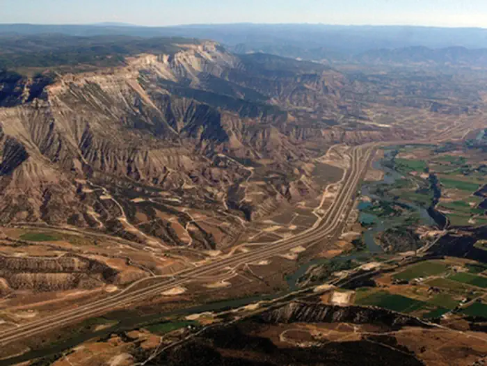
RV Ranch at Grand Junction
Hiking business nearby (~33 mi away) — hasn't claimed their Roamze page yet
Free — you'll pick up right here.
Watch this trail
Sign up to watch it — saving subscribes you to gate, closure and report changes.
Colorado
1.8 mi
Distance
271 ft
Gain
We won't guess. Here is exactly what we do and don't know.
What we do know
Inside Grand Mesa, Uncompahgre and Gunnison National Forests
2 managing-area boundaries mapped — agency alerts for them feed this page automatically.
Boundary data
What's missing
No access route mapped
We don't yet know which road reaches this trailhead, so we can't tell you if it's gated.
Nobody's filed a report here yet — be the first.
Why you'll love it
Battlement
AI-suggested draft · review before you go
The Battlement Trail is a 1.8-mile out-and-back hike located in Colorado near the Colorado area. Managed by the Medicine Bow-Routt National Forest Parks Ranger District, this trail offers an accessible option for hikers seeking a shorter woodland experience. The trail follows an out-and-back route, allowing hikers to turn around at any point and return via the same path. This format makes it ideal for those wanting flexibility in their hiking distance or for families with varying fitness levels. The Medicine Bow-Routt National Forest encompasses diverse terrain across northern Colorado and southeastern Wyoming, known for mixed conifer forests, mountain meadows, and scenic vistas. The Battlement Trail provides access to the natural features characteristic of this region. For current conditions, trail maintenance updates, and any seasonal closures, contact the Parks Ranger District directly. Visitors should come prepared with adequate water and weather-appropriate gear, as mountain conditions can change rapidly. This straightforward out-and-back route serves as a solid choice for a moderate outing in the Medicine Bow-Routt National Forest.

Battlement Trail A
~3 min drive
43 mi · Hard
Battlement Trail B
~5 min drive
2.2 mi · Easy

Cottonwood
~35 min drive
3.4 mi · Moderate
Adt - Colorado C - Q - Seg 6
~29 min drive
A 0.37-mile out-and-back trail in Colorado with 11 ft elevation gain.
Crag Crest National Recreation Trail
~35 min drive
10 mi · Hard
Crag to Cobbett
~37 min drive
1.9 mi · Easy
Island Lake
~37 min drive
3.0 mi · Moderate
High Trail
~29 min drive
2.26-mile out-and-back trail in Colorado gaining 909 feet of elevation.

Sunlight to Powderhorn Sno
~35 min drive
33 mi · Hard
Cobbett Lake
~37 min drive
0.8 mi · Easy
Local operatorsoffering guided trips. You book directly with them — Roamze doesn’t take a cut.
RV Ranch at Grand Junction
Hiking business nearby (~33 mi away) — hasn't claimed their Roamze page yet
Hanging Lake Adventure Co-op
Hiking business nearby (~35 mi away) — hasn't claimed their Roamze page yet
Glenwood Canyon Resort
Hiking business nearby (~37 mi away) — hasn't claimed their Roamze page yet