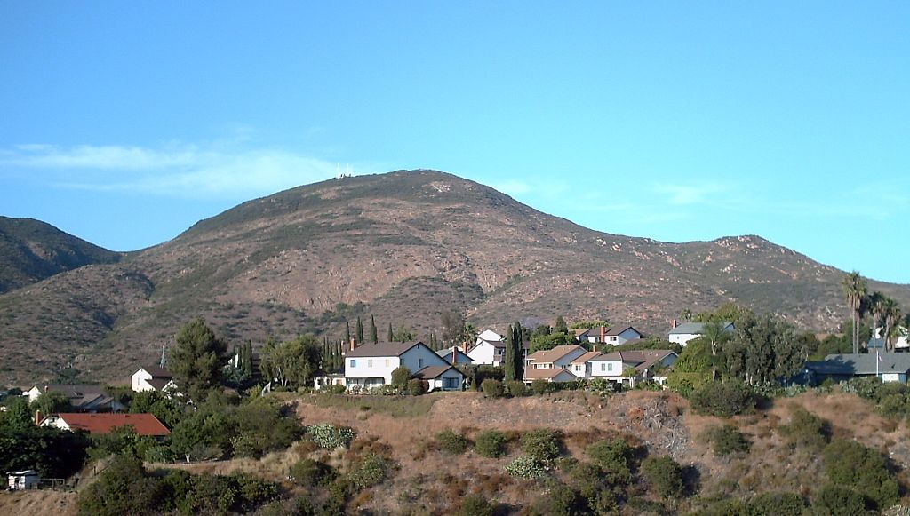
McGinty Mountain
 Photo: Wasquewhat, CC BY-SA 4.0 (via Wikimedia Commons)
- 2,298 ft
- summit
- Oct–Jun
- best months
McGinty Mountain is a summit in San Diego County, California, rising to about 2,298 feet. The nearest town is Jamul, about 2.4 miles away. Spring and fall are the most comfortable times to visit. Typical averages from the nearby Alpine weather station show April highs around 71°F and November highs around 71°F, while July and August average in the upper 80s. The South San Diego County climbing area sits just 0.2 miles away. Within about 5 miles you'll also find the Daley Ranch Truck Trail, the California Riding and Hiking Trail, and the Honey Springs Trailhead.
Conditions and forecast
Daily highs and lows, wind and the chance of precipitation at the summit for the next 7 days, from the Open-Meteo model.
- Summit elevation
- 2,298 ft
Elevation from USGS 3D Elevation Program terrain data (about 10 m resolution).
We don't know of a mapped trail or route to the summit of McGinty Mountain. Plan the approach with local maps, a guidebook or a local guide, and check conditions before you go.
Questions about McGinty Mountain
How tall is McGinty Mountain?
2,298 ft (700 m).
Is there a trail to the top of McGinty Mountain?
We don't know of a mapped trail or route to the summit. Plan the approach with local maps, a guidebook or a local guide.
 San Miguel Mountain2,565 ft · California1 route6.5 mi awayPhoto: Wasquewhat, CC BY-SA 4.0 (via Wikimedia Commons)
- Gaskill Peak3,833 ft · California1 route7.1 mi away
- Mother Miguel Mountain1,526 ft · California1 route8.3 mi away
 Otay Mountain3,566 ft · California1 route10 mi awayPhoto: RightCowLeftCoast, CC BY-SA 4.0 (via Wikimedia Commons)
 Viejas Mountain4,188 ft · California1 route11 mi awayPhoto: Ken Lund from Reno, Nevada, USA, CC BY-SA 2.0 (via Wikimedia Commons)
- El Cajon Mountain3,666 ft · California1 route12 mi away
- South San Diego CountyRock climbing0.2 mi
- Daley Ranch Truck TrailHiking3.5 mi
- California Riding and Hiking TrailHiking3.6 mi
- Honey Springs TrailheadHiking4.9 mi
- Suncrest Truck TrailHiking5 mi
- HollenbeckRock climbing5.5 mi
 Sweetwater RiverCanoeingPhoto: Wasquewhat, CC BY-SA 4.0 (via Wikimedia Commons)5.9 mi
- Harbison CanyonRock climbing6 mi
Source: Roamze catalog (indexable pages within 10 miles, PostGIS distance)
 Lyons PeakSummit · ~9 min drivePhoto: Wasquewhat, CC BY-SA 4.0 (via Wikimedia Commons)
- San Miguel MountainSummit · ~11 min drivePhoto: Wasquewhat, CC BY-SA 4.0 (via Wikimedia Commons)
 Mount HelixSummit · ~15 min drivePhoto: Redideo, CC BY-SA 4.0 (via Wikimedia Commons)
- Otay MountainSummit · ~17 min drivePhoto: RightCowLeftCoast, CC BY-SA 4.0 (via Wikimedia Commons)
- Viejas MountainSummit · ~18 min drivePhoto: Ken Lund from Reno, Nevada, USA, CC BY-SA 2.0 (via Wikimedia Commons)
 Cowles MountainSummit · ~21 min drivePhoto: The original uploader was Rsduhamel at English Wikipedia., CC BY-SA 3.0 (via Wikimedia Commons)
 Tecate PeakSummit · ~24 min drivePhoto: UncleMunkle, CC BY-SA 3.0 (via Wikimedia Commons)
 Iron MountainSummit · ~30 min drivePhoto: Robert DuHamel, CC BY-SA 3.0 (via Wikimedia Commons)
 Cuyamaca PeakSummit · ~34 min drivePhoto: Tylerfinvold at en.wikipedia, Public domain (via Wikimedia Commons)
 Twin PeaksSummit · ~36 min drivePhoto: Perdelsky at English Wikipedia, Public domain (via Wikimedia Commons)
Also worth it near here
- South San Diego CountyRock climbing · Next door
- Diamond Jack RV ParkCamping · ~3 min drive
 Cross Timbers TrailHiking · ~9 min drivePhoto: Phelan Riessen from San Diego, USA, CC BY-SA 2.0 (via Wikimedia Commons)
- Sweetwater RiverCanoeing · ~10 min drivePhoto: Wasquewhat, CC BY-SA 4.0 (via Wikimedia Commons)
Best time to visit McGinty Mountain
Best months: October–June. Best months have typical highs of 55–85 °F, lows of 30 °F or warmer (32 °F where the station doesn't record snow), at most one snowy day and no more than 12 wet days.
Jan
64° / 42°
6 wet
Feb
64° / 42°
7 wet
Mar
67° / 44°
6 wet
Apr
71° / 47°
4 wet
May
74° / 51°
3 wet
Jun
81° / 54°
1 wet
Jul
87° / 60°
1 wet
Aug
89° / 62°
1 wet
Sep
86° / 60°
1 wet
Oct
78° / 54°
2 wet
Nov
71° / 48°
4 wet
Dec
63° / 42°
6 wet
Typical high / low (°F) and days with rain or snow, 1991–2020. Measured at Alpine, CA, 7.4 mi away at 1,695 ft. The station sits about 600 ft lower than this place, so expect it a little cooler here. This station doesn't record snowfall. Source: NOAA NCEI U.S. Climate Normals 1991–2020.
