Jesse Morrow Mountain
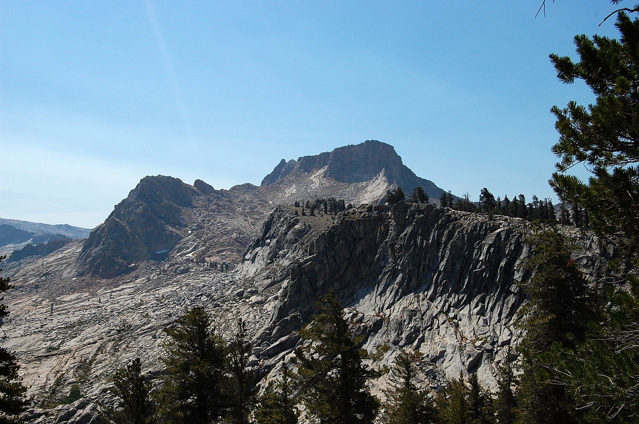
 Photo: David Prasad, CC BY-SA 2.0 (via Wikimedia Commons)
- 2,107 ft
- summit
- Feb–Jun, Oct–Nov
- best months
Jesse Morrow Mountain is a summit in California, rising to 2,107 feet about 3 miles from the small community of Minkler. It is a straightforward objective for anyone exploring this corner of the state, with the nearest town close enough to make it an easy addition to a day spent in the area. Spring and fall are the most comfortable times to visit. Typical averages from a nearby weather station show May highs around 77°F and October highs around 77°F, while July and August average highs near 93°F. That station sits about 370 feet lower than the summit, so temperatures on top run a little cooler. For more time on foot, The Long Trail lies about 5 miles away, and the Raptor Walk Trail is roughly 7 miles off.
Conditions and forecast
Daily highs and lows, wind and the chance of precipitation at the summit for the next 7 days, from the Open-Meteo model.
- Summit elevation
- 2,107 ft
Elevation from USGS 3D Elevation Program terrain data (about 10 m resolution).
We don't know of a mapped trail or route to the summit of Jesse Morrow Mountain. Plan the approach with local maps, a guidebook or a local guide, and check conditions before you go.
Questions about Jesse Morrow Mountain
How tall is Jesse Morrow Mountain?
2,107 ft (642 m).
Is there a trail to the top of Jesse Morrow Mountain?
We don't know of a mapped trail or route to the summit. Plan the approach with local maps, a guidebook or a local guide.
- Buena Vista Peak7,613 ft · California1 route28 mi away
- Big Baldy8,208 ft · California1 route30 mi away
- Little Baldy8,043 ft · California1 route35 mi away
- Dogtooth Peak10,294 ft · California1 route35 mi away
- Sunset Rock6,401 ft · California1 route37 mi away
- Bear Hill6,728 ft · California2 routes37 mi away
Source: Roamze catalog (indexable pages within 10 miles, PostGIS distance)
 Bear MountainSummit · ~12 min drivePhoto: sdold, CC BY-SA 3.0 (via Wikimedia Commons)
 Twin PeaksSummit · ~1h 7m drivePhoto: Erik Fitzpatrick, CC BY 2.0 (via Wikimedia Commons)
 Goat MountainSummit · ~1h 8m drivePhoto: Guywelch2000, CC BY-SA 4.0 (via Wikimedia Commons)
 Mount SillimanSummit · ~1h 9m drivePhoto: Erik Fitzpatrick, CC BY 2.0 (via Wikimedia Commons)
 Alta PeakSummit · ~1h 13m drivePhoto: Bryan Siders, CC BY 2.0 (via Wikimedia Commons)
 Mount GoddardSummit · ~1h 18m drivePhoto: Gilbert, G.K., Public domain (via Wikimedia Commons)
 Mount SolomonsSummit · ~1h 22m drivePhoto: Claisam (talk · contribs), CC BY-SA 3.0 (via Wikimedia Commons)
 Devils CragsSummit · ~1h 24m drivePhoto: Eggbones, CC BY-SA 4.0 (via Wikimedia Commons)
 Eagle Scout PeakSummit · ~1h 24m drivePhoto: Mitch Barrie, CC BY-SA 2.0 (via Wikimedia Commons)
 Black GiantSummit · ~1h 24m drivePhoto: Sebastian Werner, CC BY 2.0 (via Wikimedia Commons)
Best time to visit Jesse Morrow Mountain
Best months: February–June and October–November. Best months have typical highs of 55–85 °F, lows of 30 °F or warmer (32 °F where the station doesn't record snow), at most one snowy day and no more than 12 wet days.
Jan
52° / 39°
Feb
56° / 40°
Mar
63° / 43°
Apr
68° / 47°
May
77° / 53°
Jun
85° / 61°
Jul
93° / 69°
Aug
93° / 69°
Sep
88° / 64°
Oct
77° / 54°
Nov
60° / 45°
Dec
51° / 38°
Typical high / low (°F) and days with rain or snow, 1991–2020. Measured at Balch Pwr House, CA, 21.4 mi away at 1,735 ft. This station doesn't record snowfall. Source: NOAA NCEI U.S. Climate Normals 1991–2020.
