Group Campsites Road
Near Twentynine Palms
 Photo: Michael R Perry, CC BY 2.0 (via Flickr)
- 4 routes
- 5.5 – 5.6
- Trad · Bouldering
Is Group Campsites Road open right now?
Alert in the area
The National Park Service lists 3 alerts for Joshua Tree National Park.
Partial Trail Closure of West Side Loop
Park alert covering Joshua Tree National Park · NPS · Joshua Tree National Park
Inaccurate Third-Party Apps
Park alert covering Joshua Tree National Park · NPS · Joshua Tree National Park
Oasis of Mara Trail Partial Closure
Park alert covering Joshua Tree National Park · NPS · Joshua Tree National Park
As of · Source: NPS · Joshua Tree National Park. Agencies don't list every closure — check before you go.
Best time to visit Group Campsites Road
Best months: October–April. Best months have typical highs of 55–85 °F, lows of 30 °F or warmer (32 °F where the station doesn't record snow), at most one snowy day and no more than 12 wet days.
Jan
60° / 38°
3 wet
Feb
63° / 39°
3 wet
Mar
70° / 43°
2 wet
Apr
77° / 47°
1 wet
May
86° / 54°
0 wet
Jun
95° / 61°
0 wet
Jul
101° / 70°
2 wet
Aug
100° / 70°
2 wet
Sep
93° / 64°
2 wet
Oct
82° / 52°
1 wet
Nov
69° / 43°
2 wet
Dec
60° / 36°
3 wet
Typical high / low (°F) and days with rain or snow, 1991–2020. Measured at Joshua Tree, CA, 7.1 mi away at 2,563 ft. The station sits about 600 ft lower than this place, so expect it a little cooler here. This station doesn't record snowfall. Source: NOAA NCEI U.S. Climate Normals 1991–2020.
Group Campsites Road is a climbing area in Joshua Tree National Park, within the Joshua Tree Wilderness in California, managed by the National Park Service. It sits among a cluster of climbing spots, with Grain Central Station just 0.1 mile away and Big Top and Group Camp 1 Boulders each about 0.3 mile off. Spring and fall are the most comfortable times to visit. Typical averages from a nearby weather station in Joshua Tree show April highs around 77°F and October highs around 82°F, while July and August average about 100°F. The area has four routes, three of which are trad climbs graded 5.5 to 5.6 and one boulder problem at V0. Al's Route and Left Sideshow Crack are both 5.5, and Right Sideshow Crack is 5.6. For a walk, Big Pine Trail is about 1.9 miles away, and Fortynine Palms Trail is about 3.2 miles away. Sheep Pass Group campground lies roughly 7.5 miles off.
Routes (4)
Group site 1 apron(1)
Little Top, The(3)
Facts about this crag
Keep exploring — more climbs worth the drive
 Photo: daveynin, CC BY 2.0 (via Flickr)
Grain Central Station
~0 min drive
13-route climbing area in California with sport and trad options.
 Photo: daveynin, CC BY 2.0 (via Flickr)
Group Campsites Road
~0 min drive
Group Campsites Road is a bouldering area in California with 1 route.
Photo: daveynin, CC BY 2.0 (via Flickr)Big Top
~0 min drive
Big Top is a California climbing crag with 8 routes, sport and trad.
 Photo: daveynin, CC BY 2.0 (via Flickr)
Group Camp 1 Boulders
~1 min drive
6 bouldering routes at Group Camp 1 Boulders in California.
Photo: daveynin, CC BY 2.0 (via Flickr)Group Campsite 8
~1 min drive
Group Campsite 8 in California has 7 climbing routes in mixed, sport, and trad styles.
 Photo: Jarek Tuszyński, CC BY-SA 3.0 (via Wikimedia Commons)
Group Campsite 11
~1 min drive
Group Campsite 11 in California has 11 climbing routes across 6 grades, offering sport and trad options.
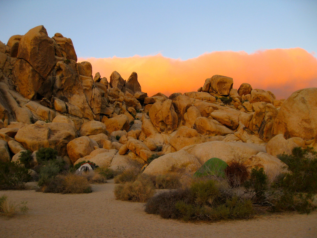 Photo: daveynin, CC BY 2.0 (via Flickr)
Hodgepodge Rock - North Face
~1 min drive
Hodgepodge Rock - North Face in California offers 5 mixed and trad routes across 5 difficulty grades.
 Photo: daveynin, CC BY 2.0 (via Flickr)
Hodgepodge Rock
~1 min drive
Hodgepodge Rock in California has 2 climbing routes featuring sport and trad styles.
Photo: daveynin, CC BY 2.0 (via Flickr)Hodgepodge Rock - West Face
~1 min drive
13-route climbing crag in California with sport and trad options.
Photo: daveynin, CC BY 2.0 (via Flickr)Moosedog Tower
~1 min drive
Moosedog Tower in California has 16 routes across 8 grades, offering sport and trad climbing.

