Average Joe's
One of 13 routes at Buckthorn Boulder.
- V-easy
- grade
- Bouldering Pads
- style
Is Average Joe's open right now?
Closure in the area
There's a closure order in Mountaintop Ranger District. It doesn't name Average Joe's, so check the source for the area it covers.
Radford Fire Closure Area
Agency closure covering Mountaintop Ranger District · Order 05-12-52-24-06 · USFS · Mountaintop Ranger District
Safety Alert - Falling Rocks at Bonita Falls
Agency alert covering San Bernardino National Forest · USFS · San Bernardino National Forest
Fire Restrictions
Agency alert covering San Bernardino National Forest · Order 05-12-00-26-05 · USFS · San Bernardino National Forest
As of · Source: USFS · Mountaintop Ranger District. Agencies don't list every closure — check before you go.
Best time to visit Average Joe's
Best months: May–October. Best months have typical highs of 55–85 °F, lows of 30 °F or warmer (32 °F where the station doesn't record snow), at most one snowy day and no more than 12 wet days.
Jan
46° / 24°
6 wet
Feb
46° / 24°
6 wet
Mar
51° / 27°
6 wet
Apr
57° / 31°
4 wet
May
66° / 37°
2 wet
Jun
75° / 43°
1 wet
Jul
80° / 50°
2 wet
Aug
79° / 49°
3 wet
Sep
73° / 44°
2 wet
Oct
63° / 35°
2 wet
Nov
53° / 28°
3 wet
Dec
46° / 24°
6 wet
Typical high / low (°F) and days with rain or snow, 1991–2020. Measured at Big Bear Lake, CA, 2 mi away at 6,753 ft. The station sits about 1,300 ft lower than this place, so expect it a little cooler here. This station doesn't record snowfall. Source: NOAA NCEI U.S. Climate Normals 1991–2020.
One of 13 routes catalogued at Buckthorn Boulder.
Keep exploring — more climbs worth the drive
 Photo: sergei.gussev, CC BY 2.0 (via Flickr)
(e) Castle Rock - East Face
~7 min drive
Castle Rock - East Face in California has 7 climbing routes across 6 grades.
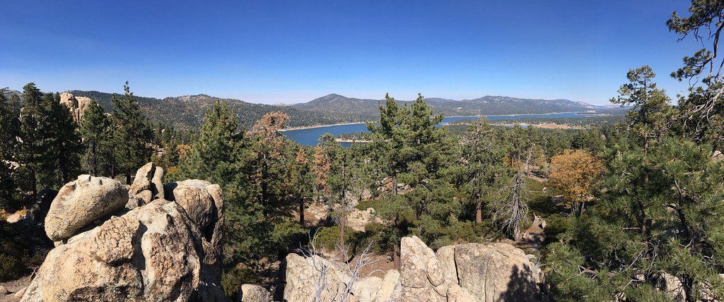 Photo: sergei.gussev, CC BY 2.0 (via Flickr)
(c) Castle Rock - Southeast Face
~7 min drive
Castle Rock - Southeast Face in California has 10 routes (moderate to hard) in sport and trad styles.
 Photo: sergei.gussev, CC BY 2.0 (via Flickr)
(b) Castle Rock - South Face
~7 min drive
(b) Castle Rock - South Face in California has 7 climbing routes on the south face.
Photo: sergei.gussev, CC BY 2.0 (via Flickr)(a) Castle Rock - Southwest Face
~7 min drive
Castle Rock - Southwest Face in California has 6 routes across 5 grades, offering mixed, sport, and trad climbing.
 Photo: sergei.gussev, CC BY 2.0 (via Flickr)
Castle Rock Area
~7 min drive
Castle Rock Area in California has 11 climbing routes across 6 grades, offering bouldering pads, sport, and trad.
Photo: sergei.gussev, CC BY 2.0 (via Flickr)Castle Rock Slab
~7 min drive
Castle Rock Slab in California has 3 climbing routes ranging from easy to hard, offering sport and trad options.
 Photo: sergei.gussev, CC BY 2.0 (via Flickr)
Castle Rock Slab (West Face)
~7 min drive
5 routes at Castle Rock Slab (West Face) in California range from 5 difficulty grades and offer sport and trad climbing.
 Photo: inkknife_2000 (7.5 million views +), CC BY-SA 2.0 (via Wikimedia Commons)
Fisherman’s Boulders
~7 min drive
Fisherman’s Boulders in California has 19 routes across 12 difficulty grades, offering bouldering pads, sport, and trad.
 Photo: inkknife_2000 (7.5 million views +), CC BY-SA 2.0 (via Wikimedia Commons)
Fisherman's Buttress - East Face
~8 min drive
Fisherman's Buttress - East Face in California has 12 routes across 8 grades, offering sport and trad climbing.
 Photo: Clinton Steeds, CC BY 2.0 (via Flickr)
Forest Road 2N86
~8 min drive
Forest Road 2N86 in California has 2 climbing routes with alpine no fixed protection.


