College
Campground
Campground · 0.2 mi from the trail
Caution today
Agency alerts are in effect for this area; weather is marginal · USFS, OpenWeather · checked 9 h ago
Closure in the area
There's a closure order in Sierra National Forest. It doesn't name Huntington Launching Ramp, so check the source for the area it covers (3 listed).
Safety Tips for Burned Areas: Garnet Fire Area
Agency closure covering Sierra National Forest · USFS · Sierra National Forest
Wilderness Food and Refuse Storage
Agency closure covering Sierra National Forest · Order 05-15-00-26-03 · USFS · Sierra National Forest
Food and Refuse Storage
Agency closure covering Sierra National Forest · Order 05-15-00-26-02 · USFS · Sierra National Forest
Forest Order removes Fish Camp, Soda Springs, and Little Jackass from closure list
Agency alert covering Sierra National Forest · Order 05-15-00-26-11 · USFS · Sierra National Forest
Ansel Adams and John Muir Wilderness Campfire Restrictions
Agency alert covering Sierra National Forest · Order 05-15-00-26-09 · USFS · Sierra National Forest
As of · Source: USFS · Sierra National Forest. Agencies don't list every closure — check before you go.
Huntington Launching Ramp is a boat launch in the High Sierra Ranger District of Sierra National Forest in California, about 5 miles from the town of Big Creek. It is a day-use site with a fee of $10 per vehicle per day and flush toilets. Summer is the most comfortable time to visit. Typical averages from the nearby Huntington Lake weather station, at about 7,000 feet, show July and August highs around 74°F with lows near 49°F and only one or two wet days a month. Winter is much colder, with January highs in the low 40s and lows in the mid-20s. The College and Deer Creek campgrounds sit just a few tenths of a mile away, and the Huntington Shore and Lake Trail hikes are about 0.4 miles off. Paddlers can also look to Pitman Creek, roughly 4 miles away.
College
Campground
Places © OpenStreetMap contributors, Places © Overture Maps Foundation
More in Shaver Lake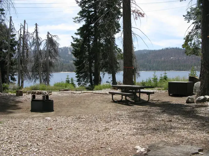 Deer CreekCampingPhoto: Recreation.gov (RIDB) / public domain0.3 mi
 Huntington ShoreHikingPhoto: Tom Hilton, CC BY 2.0 (via Flickr)0.4 mi
Source: Roamze catalog (indexable pages within 10 miles, PostGIS distance)
 Dinkey CreekCanoeing · ~24 min drivePhoto: USFS Region 5, Public domain (via Wikimedia Commons)
 North Fork Kings RiverCanoeing · ~37 min drivePhoto: Gene Daniels, Public domain (via Wikimedia Commons)
 South Fork San Joaquin RiverCanoeing · ~17 min drivePhoto: The Greater Southwestern Exploration Company from Long Beach, California, United States, CC BY 2.0 (via Wikimedia Commons)
Best months: May–October. Best months have typical highs of 55–85 °F, lows of 30 °F or warmer (32 °F where the station doesn't record snow), at most one snowy day and no more than 12 wet days.
Jan
43° / 24°
11 wet
Feb
44° / 23°
11 wet
Mar
46° / 26°
10 wet
Apr
50° / 29°
8 wet
May
56° / 36°
6 wet
Jun
66° / 42°
3 wet
Jul
74° / 49°
2 wet
Aug
74° / 49°
1 wet
Sep
68° / 44°
2 wet
Oct
58° / 37°
4 wet
Nov
49° / 31°
8 wet
Dec
44° / 25°
10 wet
Typical high / low (°F) and days with rain or snow, 1991–2020. Measured at Huntington Lake, CA, 3.1 mi away at 7,020 ft. We don't have this place's elevation, so higher spots nearby can run cooler. This station doesn't record snowfall. Source: NOAA NCEI U.S. Climate Normals 1991–2020.

