Luther Pass Campground
Campground
Campground · 1.5 mi from the trail
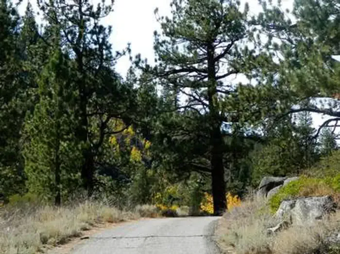
 Photo: AT2663, CC BY-SA 3.0 (via Wikimedia Commons)
Caution at last check
Agency alerts are in effect for this area; weather is good · USFS, OpenWeather · checked 16 h ago
Closure in the area
There's a closure order in Lake Tahoe Basin Management Unit. It doesn't name Tahoe Rim Trail, so check the source for the area it covers.
Harmful Algal Blooms
Agency closure covering Lake Tahoe Basin Management Unit · USFS · Lake Tahoe Basin Management Unit
Desolation Wilderness Food and Refuse Storage (Bear Canister) Restriction
Agency alert covering Lake Tahoe Basin Management Unit · Order 19-25-06 · USFS · Lake Tahoe Basin Management Unit
Meyers Landfill Area Closure
Agency alert covering Lake Tahoe Basin Management Unit · Order 19-25-01 · USFS · Lake Tahoe Basin Management Unit
Campfire Restrictions
Agency alert covering Lake Tahoe Basin Management Unit · Order 19-24-04 · USFS · Lake Tahoe Basin Management Unit
Camping/Overnight Stay Restriction
Agency alert covering Lake Tahoe Basin Management Unit · Order 19-24-05 · USFS · Lake Tahoe Basin Management Unit
As of · Source: USFS · Lake Tahoe Basin Management Unit. Agencies don't list every closure — check before you go.
The Tahoe Rim Trail is a mountain biking route in California's Lake Tahoe Basin Management Unit, managed by the Forest Service. The trail is about 2.35 miles from the starting point, and the out-and-back route totals about 4.7 miles with a total climb of about 1,299 feet. The one-way elevation gain is about 918 feet, and the steepest stretch comes at about 0.82 miles in, with a grade of about 19%. The trail is rated hard, and the climb is rolling, with the high point at about 8,977 feet and the low point at about 8,036 feet. The Grass Lake Spur lies about 0.1 mile away, and the TRT Segment 1 Grass Lake Spur is also about 0.1 mile away. Nearby, the Luther Spires and Shire Spire climbing areas are about 1.2 miles away, and the Upper Truckee River offers canoeing about 2.3 miles away. For an overnight stay, Kit Carson Campground is about 4.8 miles away.
Luther Pass Campground
Campground
Places © OpenStreetMap contributors, Places © Overture Maps Foundation
More in Bear ValleyNot on Roamze yet. Their page has how to reach them.
 Kit Carson CampgroundCampingPhoto: Recreation.gov (RIDB) / public domain4.8 mi
Source: Roamze catalog (indexable pages within 10 miles, PostGIS distance)
Tahoe Rim TrailMountain biking · ~2 min drivePhoto: AT2663, CC BY-SA 3.0 (via Wikimedia Commons)Tahoe Rim TrailMountain biking · ~2 min drivePhoto: AT2663, CC BY-SA 3.0 (via Wikimedia Commons) Pacific Crest TrailMountain biking · ~6 min drivePhoto: Webwords, CC BY-SA 4.0 (via Wikimedia Commons)
Map and trail data © OpenStreetMap contributors


