Sycamore Group Multi-Use Area
Campground
Campground · 2.3 mi from the trail
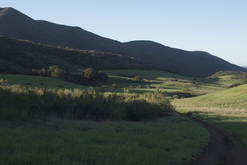 Photo: KnaPix, CC BY 2.0 (via Flickr)
No closures listed
The National Park Service lists no closures for Santa Monica Mountains National Recreation Area.
As of · Source: NPS · Santa Monica Mountains National Recreation Area. Agencies don't list every closure — check before you go.
The Wendy Trail Equestrian Bypass is a short, easy hike in the Santa Monica Mountains National Recreation Area, managed by the National Park Service. The route is about 0.6 miles long and has a total gain of 109 feet, so it works well as a quick add-on to a longer outing in the area. Spring and fall are the most comfortable times to visit. Typical averages from a nearby weather station in Camarillo show May highs around 72°F and October highs around 76°F, while summer runs a bit warmer, with August highs near 79°F. That station sits well below the trail, so temperatures on the bypass tend to run cooler. The Wendy Trail lies about 0.2 miles away, and the Satwiwa Loop Trail and Hidden Valley Overlook Trail are both within half a mile. For an overnight stay, Circle X Ranch Group Campground is about 3 miles off.
Sycamore Group Multi-Use Area
Campground
 If it rainsLos Angeles, CC BY-SA 3.0 · Wikimedia Commons
Places © OpenStreetMap contributors, Places © Overture Maps Foundation · Photos: Los Angeles, CC BY-SA 3.0 (commons)
More in Moorpark Wendy TrailHikingPhoto: KnaPix, CC BY 2.0 (via Flickr)0.2 mi
 Satwiwa Loop TrailHikingPhoto: Santa Monica Mountains National Recreation Area, Public domain (via Wikimedia Commons)0.4 mi
 Hidden Valley Overlook TrailHikingPhoto: Randy from Newbury Park, California, USA, CC BY 2.0 (via Wikimedia Commons)0.5 mi
 Old Cabin TrailHikingPhoto: Santa Monica Mountains National Recreation Area, Public domain (via Wikimedia Commons)0.7 mi
 Hueco WallRock climbingPhoto: Daniel Guo, CC BY-SA 3.0 (via Wikimedia Commons)2.4 mi
 The GrottoRock climbingPhoto: Churnice, CC BY-SA 3.0 (via Wikimedia Commons)2.4 mi
Source: Roamze catalog (indexable pages within 10 miles, PostGIS distance)
Wendy TrailHiking · Next doorPhoto: KnaPix, CC BY 2.0 (via Flickr)Old Cabin TrailHiking · ~2 min drivePhoto: Randy from Newbury Park, California, USA, CC BY 2.0 (via Wikimedia Commons)Old Boney TrailHiking · ~2 min drivePhoto: Randy from Newbury Park, California, USA, CC BY 2.0 (via Wikimedia Commons)Satwiwa Loop TrailHiking · Next doorPhoto: Santa Monica Mountains National Recreation Area, Public domain (via Wikimedia Commons)Fossil TrailHiking · ~2 min drivePhoto: Santa Monica Mountains National Recreation Area, Public domain (via Wikimedia Commons)Hidden Valley Overlook TrailHiking · Next doorPhoto: Randy from Newbury Park, California, USA, CC BY 2.0 (via Wikimedia Commons) Potrero Ridge TrailHiking · ~2 min drivePhoto: Randy from Newbury Park, California, USA, CC BY 2.0 (via Wikimedia Commons)Old Cabin TrailHiking · ~1 min drivePhoto: Santa Monica Mountains National Recreation Area, Public domain (via Wikimedia Commons)Los Robles Trail WestHiking · ~2 min drivePhoto: Randy from Newbury Park, California, USA, CC BY 2.0 (via Wikimedia Commons)Pinehill TrailHiking · ~1 min drivePhoto: KnaPix, CC BY 2.0 (via Flickr)
Best months: Year-round. Best months have typical highs of 55–85 °F, lows of 30 °F or warmer (32 °F where the station doesn't record snow), at most one snowy day and no more than 12 wet days.
Jan
68° / 45°
6 wet
Feb
68° / 46°
6 wet
Mar
69° / 47°
5 wet
Apr
71° / 49°
3 wet
May
72° / 53°
2 wet
Jun
75° / 57°
0 wet
Jul
78° / 60°
0 wet
Aug
79° / 61°
0 wet
Sep
80° / 59°
1 wet
Oct
76° / 54°
3 wet
Nov
73° / 49°
4 wet
Dec
68° / 44°
5 wet
Typical high / low (°F) and days with rain or snow, 1991–2020. Measured at Camarillo Ap, CA, 8.6 mi away at 77 ft. The station sits about 800 ft lower than this place, so expect it a little cooler here. This station doesn't record snowfall. Source: NOAA NCEI U.S. Climate Normals 1991–2020.
Map and trail data © OpenStreetMap contributors

