Weaver Basin Wetlands Trail
- 0.4 mi
- loop
- 11 ft
- climb
- 1,892 ft
- high point
- Loop
- route
- Apr–May, Oct
- best months
Caution at last check
Weather is marginal · OpenWeather · checked 18 h ago
Weaver Basin Wetlands Trail is a short loop in northern California, about 1.5 miles from the town of Weaverville. The route is easy, covering roughly 0.37 miles with a total elevation gain of 11 feet. It's a flat, low-effort outing, and the trail's loop shape makes it a simple start or stop before exploring the surrounding area. The trail's elevation stays close to 1,880 feet, with a high point of 1,892 feet and a low of 1,881 feet. The climb is nearly flat, and the steepest section comes at about 0.24 miles into the route, with a grade of about 2 percent. For comfortable weather, late spring and early fall stand out. Typical averages from a nearby weather station in Weaverville show May highs around 77°F and October highs around 75°F, while July and August average in the mid-90s. Lee Fong Trail is just 0.2 miles away, and Upper West Weaver Creek Trail is about 1.2 miles off. Weaver Creek, a paddling spot, lies roughly 1.7 miles away, and Steiner Flat Primitive Campground is about 4.1 miles away for overnight stays.
- Lee Fong TrailHiking0.2 mi
- Upper West Weaver Creek TrailHiking1.2 mi
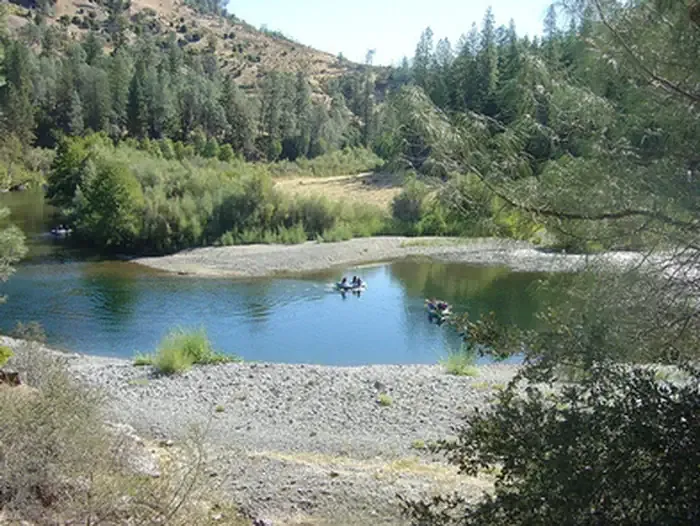
- Weaver CreekCanoeing1.7 mi
- Lower Jackass RidgeHiking2 mi
 Steiner Flat Primitive CampgroundCampingPhoto: Recreation.gov (RIDB) / public domain4.1 mi
- East Weaver Cg-FCamping4.3 mi
- Rush CreekCanoeing6 mi
- Cortizone CornerRock climbing9.5 mi
Source: Roamze catalog (indexable pages within 10 miles, PostGIS distance)
 Soldier Creek Claim Access TrailHiking · ~9 min drivePhoto: Shopstone, CC0 (via Wikimedia Commons)
- Weaver BasinHiking · ~5 min drive
- Mckenzie GulchHiking · ~5 min drive
- Dolly Ditch TrailHiking · ~9 min drive
- Lee Fong TrailHiking · Next door
- East Weaver CreekHiking · ~8 min drive
- Shasta Spring TrailHiking · ~5 min drive
- Upper West Weaver Creek TrailHiking · ~2 min drive
- La Grange Ditch TrailHiking · ~9 min drive
- Junkans Ditch TrailHiking · ~6 min drive
Best time to visit Weaver Basin Wetlands Trail
Best months: April–May and October. Best months have typical highs of 55–85 °F, lows of 30 °F or warmer (32 °F where the station doesn't record snow), at most one snowy day and no more than 12 wet days.
Jan
50° / 31°
16 wet
Feb
55° / 31°
14 wet
Mar
61° / 33°
14 wet
Apr
68° / 36°
10 wet
May
77° / 42°
7 wet
Jun
86° / 46°
4 wet
Jul
95° / 52°
1 wet
Aug
94° / 50°
1 wet
Sep
88° / 44°
2 wet
Oct
75° / 36°
6 wet
Nov
57° / 33°
13 wet
Dec
47° / 31°
17 wet
Typical high / low (°F) and days with rain or snow, 1991–2020. Measured at Weaverville, CA, 1.8 mi away at 2,058 ft. This station doesn't record snowfall. Source: NOAA NCEI U.S. Climate Normals 1991–2020.
Map and trail data © OpenStreetMap contributors
