Trinity Lakeshore
- 6.8 mi
- round trip
- 513 ft
- climb
- 2,544 ft
- high point
- Out and back
- route
- Apr–May, Oct
- best months
Caution today
Agency alerts are in effect for this area; weather is good · USFS, OpenWeather · checked 7 h ago
Is Trinity Lakeshore open right now?
Closure in the area
There's a closure order in Shasta-Trinity National Forest. It doesn't name Trinity Lakeshore, so check the source for the area it covers (2 listed).
Road Closure on Wild Mad Road
Agency closure covering Shasta-Trinity National Forest · Order 14-25-09 · USFS · Shasta-Trinity National Forest
Mud and Ash Creek Area and Road Closure
Agency closure covering Shasta-Trinity National Forest · Order 14-25-07 · USFS · Shasta-Trinity National Forest
Bailey Cove Road Closure Order
Agency alert covering Shasta-Trinity National Forest · Order 14-25-11 · USFS · Shasta-Trinity National Forest
Trout Creek Bridge Closure Order
Agency alert covering Shasta-Trinity National Forest · Order 14-26-02 · USFS · Shasta-Trinity National Forest
South Fork Suspension Bridge Closure
Agency alert covering Shasta-Trinity National Forest · Order 14-25-30 · USFS · Shasta-Trinity National Forest
As of · Source: USFS · Shasta-Trinity National Forest. Agencies don't list every closure — check before you go.
Trinity Lakeshore is a 6.8-mile out-and-back hike in the Weaverville Ranger District of Shasta-Trinity National Forest in northern California, managed by the Forest Service. The trail starts about 0.2 miles from the community of Pinewood Cove. The route is rated hard, with a total elevation gain of 513 feet. It is a natural-surface trail, and both horses and bikes are allowed. Late spring and early fall are the most comfortable times to go. Typical averages from a nearby weather station in Weaverville show May highs around 77°F and October highs around 75°F, while July and August average in the mid-90s. Fawn Campground and Fawn Cg-G sit about 0.1 mile away, and Tannery Campground is about 0.6 mile off. Granite Peak, a hike about 2.9 miles away, is the closest other trail.
Best time to go · Apr–May, Oct
Best time to visit Trinity Lakeshore
Best months: April–May and October. Best months have typical highs of 55–85 °F, lows of 30 °F or warmer (32 °F where the station doesn't record snow), at most one snowy day and no more than 12 wet days.
Jan
50° / 31°
16 wet
Feb
55° / 31°
14 wet
Mar
61° / 33°
14 wet
Apr
68° / 36°
10 wet
May
77° / 42°
7 wet
Jun
86° / 46°
4 wet
Jul
95° / 52°
1 wet
Aug
94° / 50°
1 wet
Sep
88° / 44°
2 wet
Oct
75° / 36°
6 wet
Nov
57° / 33°
13 wet
Dec
47° / 31°
17 wet
Typical high / low (°F) and days with rain or snow, 1991–2020. Measured at Weaverville, CA, 9 mi away at 2,058 ft. This station doesn't record snowfall. Source: NOAA NCEI U.S. Climate Normals 1991–2020.
Keep exploring — more trails worth the drive
 Photo: Tom Hilton, CC BY 2.0 (via Flickr)
GRANITE PEAK SPUR
~8 min drive
2.4-mile out-and-back trail in California with 1,954 ft elevation gain and loss.
 Photo: ilya_ktsn, CC BY 2.0 (via Flickr)
Siligo Spur Trail (09W21A)
~12 min drive
0.88-mile out-and-back trail in California with 339 ft of elevation gain.
HIKE
Rush Creek Lakes
~6 min drive
13.98-mile out-and-back trail in California with 3,363 ft elevation gain.
HIKE
La Grange Ditch Trail
~10 min drive
7.1-mile out-and-back trail in California with 2,865 ft elevation gain and loss.
Photo: Tom Hilton, CC BY 2.0 (via Flickr)Granite Peak Spur Trail (09W8A)
~8 min drive
2.18-mile out-and-back trail in California with 1,906 ft gain and 7,718 ft max elevation
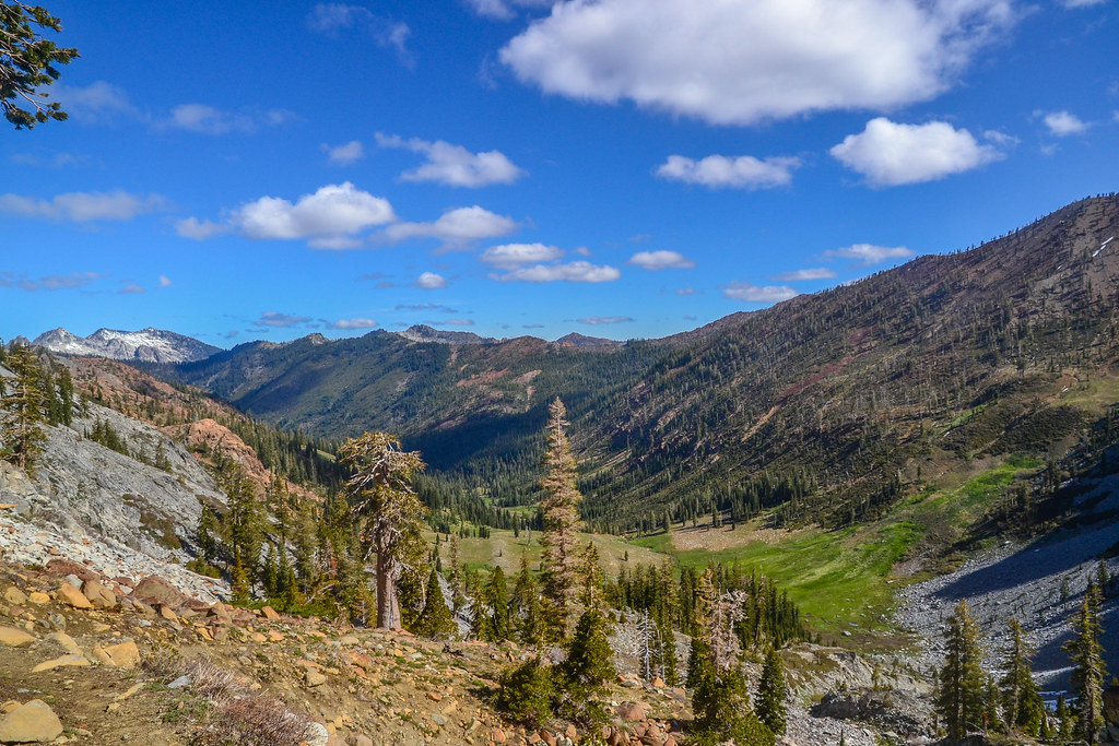 Photo: ilya_ktsn, CC BY 2.0 (via Flickr)
Summit Lake Trail (09W13A)
~13 min drive
0.72-mile out-and-back trail to Summit Lake in California with 254 ft of elevation gain.
HIKE
GRANITE PEAK
~6 min drive
5.36-mile out-and-back to Granite Peak in California with 4,918 ft gain.
HIKE
East Weaver Creek
~11 min drive
6.24-mile out-and-back trail in California with 2,394 ft gain.
HIKE
Granite Peak
~5 min drive
3.40-mile out-and-back trail in California with 1,765 ft elevation gain.
 Photo: ilya_ktsn, CC BY 2.0 (via Flickr)
Seven Up Peak
~14 min drive
2.40-mile out-and-back trail in California with 758 ft gain.
Also worth it near here
