Loading…

Free — you'll pick up right here.
Watch this trail
Sign up to watch it — saving subscribes you to gate, closure and report changes.
California
3.3 mi
Distance
1,553 ft
Gain
We won't guess. Here is exactly what we do and don't know.
What we do know
Inside Tahoe National Forest
2 managing-area boundaries mapped — agency alerts for them feed this page automatically.
Boundary data
What's missing
No access route mapped
We don't yet know which road reaches this trailhead, so we can't tell you if it's gated.
Nobody's filed a report here yet — be the first.
Why you'll love it
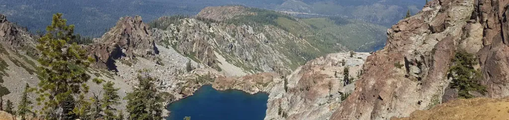
Sierra Buttes
AI-suggested draft · review before you go
No permit or access details on file for this trail — check with the local land manager before you go.
The Sierra Buttes trail is a scenic alpine ascent offering stunning 360-degree views from one of the region's most distinctive peaks. This moderately challenging hike climbs through mixed conifer forest before breaking into open terrain with expansive vistas of the surrounding Sierra Nevada landscape. The exposed summit provides excellent views of nearby peaks and valleys, making it a rewarding destination for hikers seeking alpine scenery without extreme technical difficulty.
Packer Lake Picnic
~1 min drive
Easy 0.64-mile stroll to a scenic picnic area at Packer Lake.
Gold Vly Marked Snomobile Tr
~1 min drive
Marked snowmobile trail with steady climbing through Sierra Nevada forest.
Fifty-Four Road
~6 min drive
Remote 25-mile backcountry route with 3,000+ ft gain for experienced hikers.
Sardine Lake Overlook
~2 min drive
Quick alpine lake overlook with rewarding views and minimal distance.
Upper Salmon Lake
~6 min drive
Steady alpine lake hike with 968 ft gain to pristine mountain lake.
Howard
~8 min drive
Moderate 11-mile trail with 865 ft gain through California backcountry.
Church Meadow Loop
~7 min drive
Easy 2-mile meadow loop with minimal elevation gain.
Mills Peak
~9 min drive
Accessible 4-mile peak hike with 717 ft gain and rewarding summit views.
Ridge Loop
~16 min drive
Moderate 10-mile ridge loop with 936 ft elevation gain and scenic vistas.
Spencer Lakes
~13 min drive
Easy alpine lake hike with minimal elevation gain near Spencer Lakes.