Rancho La Polka Trail
 Photo: Yūgen, CC BY 2.0 (via Flickr)
- 1.1 mi
- loop
- 402 ft
- climb
- 976 ft
- high point
- Loop
- route
- Sep–Jun
- best months
Clear today
Weather is good · OpenWeather · checked 9 h ago
Rancho La Polka Trail is a 1.06-mile loop in Coyote Lake-Harvey Bear Ranch County Park in California, on county land. It's an easy hike with a steady climb of 402 feet, and the route starts and ends at about 976 feet. The trail is a loop, so you return to your starting point without backtracking, and it makes a quick outing of about half an hour. Spring and fall are the most comfortable times to go. Typical averages from the Gilroy weather station, about 4.7 miles away, show May highs near 77°F and October highs near 79°F. Summer runs hotter, with July and August highs around 87°F, and the station sits well below the trail, so temperatures on the route run cooler. Several other trails sit close by. Roop Pond Trail is about 0.3 miles away, and Campground Trail is about a mile off. Mendoza Trail and Mummy Mountain Trail are both about 1.1 miles from the loop.
- Roop Pond TrailHiking0.3 mi
- Campground TrailHikingPhoto: Yūgen, CC BY 2.0 (via Flickr)1 mi
 Mendoza TrailHikingPhoto: j-dub1980(THANK YOU FOR 100k+ Views), CC BY-SA 2.0 (via Flickr)1.1 mi
- Mummy Mountain TrailHikingPhoto: Yūgen, CC BY 2.0 (via Flickr)1.1 mi
- Gaviota TrailHikingPhoto: Yūgen, CC BY 2.0 (via Flickr)1.2 mi
- Valley Oak TrailHikingPhoto: Yūgen, CC BY 2.0 (via Flickr)1.2 mi
 Uvas CreekCanoeingPhoto: Uvaseastman, CC BY-SA 4.0 (via Wikimedia Commons)7.9 mi
- Carnadero CreekCanoeing8.9 mi
Source: Roamze catalog (indexable pages within 10 miles, PostGIS distance)
- Campground TrailHiking · ~2 min drivePhoto: Yūgen, CC BY 2.0 (via Flickr)
- Mendoza TrailHiking · ~2 min drivePhoto: j-dub1980(THANK YOU FOR 100k+ Views), CC BY-SA 2.0 (via Flickr)
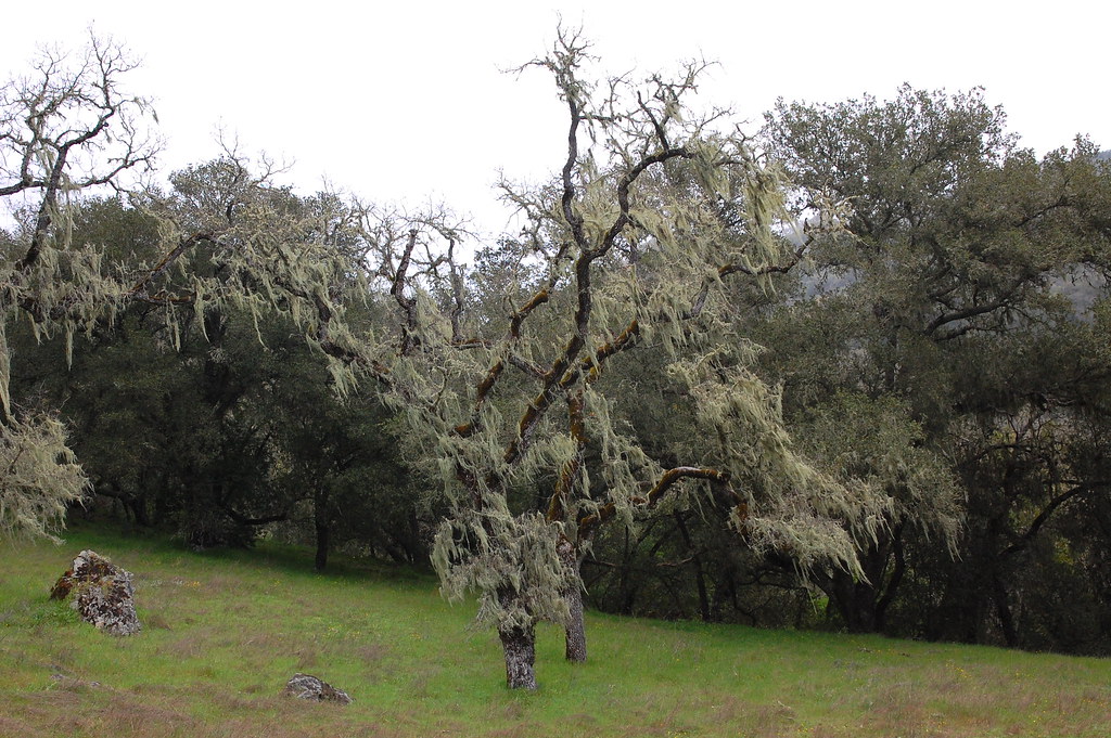 Grizzly Gulch TrailHiking · ~7 min drivePhoto: ilya_ktsn, CC BY 2.0 (via Flickr)
- Blue Oak TrailHiking · ~3 min drivePhoto: j-dub1980(THANK YOU FOR 100k+ Views), CC BY-SA 2.0 (via Flickr)
- Mummy Mountain TrailHiking · ~2 min drivePhoto: Yūgen, CC BY 2.0 (via Flickr)
 Townsprings TrailHiking · ~5 min drivePhoto: donjd2, CC BY 2.0 (via Flickr)
- Gaviota TrailHiking · ~2 min drivePhoto: Yūgen, CC BY 2.0 (via Flickr)
 Steer Jones TrailHiking · ~7 min drivePhoto: ilya_ktsn, CC BY 2.0 (via Flickr)
- Valley Oak TrailHiking · ~2 min drivePhoto: Yūgen, CC BY 2.0 (via Flickr)
- Roop Pond TrailHiking · Next door
Best time to visit Rancho La Polka Trail
Best months: September–June. Best months have typical highs of 55–85 °F, lows of 30 °F or warmer (32 °F where the station doesn't record snow), at most one snowy day and no more than 12 wet days.
Jan
61° / 38°
10 wet
Feb
64° / 40°
10 wet
Mar
68° / 43°
8 wet
Apr
72° / 44°
5 wet
May
77° / 49°
3 wet
Jun
83° / 52°
1 wet
Jul
87° / 54°
0 wet
Aug
87° / 54°
0 wet
Sep
85° / 53°
1 wet
Oct
79° / 48°
3 wet
Nov
68° / 42°
6 wet
Dec
60° / 37°
9 wet
Typical high / low (°F) and days with rain or snow, 1991–2020. Measured at Gilroy, CA, 4.7 mi away at 194 ft. The station sits about 800 ft lower than this place, so expect it a little cooler here. Source: NOAA NCEI U.S. Climate Normals 1991–2020.

Map and trail data © OpenStreetMap contributors
