Lower Packrat Trail
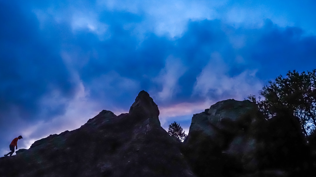
 Photo: bll123, CC BY 2.0 (via Flickr)
- 0.4 mi
- round trip
- 258 ft
- climb
- 630 ft
- high point
- Out and back
- route
- Jan–Dec
- best months
Lower Packrat Trail is a short, easy hike in Tilden Regional Park, a regional park in California managed by a regional agency. The trail is about 0.4 miles long and sits at roughly 550 feet, with a total climb of about 250 feet for the round trip. The most comfortable months for a visit are late spring through early fall. Typical averages from a nearby weather station in Berkeley show highs around 70°F in May and 76°F in September, with only a few wet days in summer. That station sits about 300 feet lower than the trail, so temperatures on the trail run a little cooler. The trail makes an easy pairing with other short hikes in the park. Memory Trail and Upper Packrat Trail both start within about a tenth of a mile, and Jewel Lake Trail is about 0.2 miles away. Climbers can find Great Stone Face about a mile off.
Local outfitters
- Point Reyes Outdoors32 mi away
Not on Roamze yet. Their page has how to reach them.
- Memory TrailHiking0.1 mi
- Upper Packrat TrailHikingPhoto: bll123, CC BY 2.0 (via Flickr)0.1 mi
 Jewel Lake TrailHikingPhoto: bll123, CC BY 2.0 (via Flickr)0.2 mi
- Pine Tree TrailHikingPhoto: bll123, CC BY 2.0 (via Flickr)0.3 mi
 Great Stone FaceRock climbingPhoto: User:Tfinc, CC BY-SA 3.0 (via Wikimedia Commons)1.1 mi
 Little Half DomeRock climbingPhoto: Burkhard Mücke, CC BY-SA 4.0 (via Wikimedia Commons)1.1 mi
 Mortar RockRock climbingPhoto: kevin dooley, CC BY 2.0 (via Flickr)1.2 mi
 Cragmont ParkRock climbingPhoto: albategnius, CC BY-SA 2.0 (via Flickr)1.2 mi
Source: Roamze catalog (indexable pages within 10 miles, PostGIS distance)
- Upper Packrat TrailHiking · Next doorPhoto: bll123, CC BY 2.0 (via Flickr)
 Selby TrailHiking · Next doorPhoto: roguelazer, CC BY 2.0 (via Flickr)
- Upper Jordan Fire TrailHiking · ~4 min drive
- Jewel Lake TrailHiking · Next doorPhoto: bll123, CC BY 2.0 (via Flickr)
- Wildcat Peak TrailHiking · Next doorPhoto: roguelazer, CC BY 2.0 (via Flickr)
- Pine Tree TrailHiking · Next doorPhoto: bll123, CC BY 2.0 (via Flickr)
 Quarry TrailHiking · ~2 min drivePhoto: reverendlukewarm, CC BY-SA 2.0 (via Flickr)
- Wildcat Gorge TrailHiking · Next doorPhoto: bll123, CC BY 2.0 (via Flickr)
- Meadows Canyon TrailHiking · ~2 min drivePhoto: reverendlukewarm, CC BY-SA 2.0 (via Flickr)
- Curran TrailHiking · ~2 min drivePhoto: reverendlukewarm, CC BY-SA 2.0 (via Flickr)
Best time to visit Lower Packrat Trail
Best months: Year-round. Best months have typical highs of 55–85 °F, lows of 30 °F or warmer (32 °F where the station doesn't record snow), at most one snowy day and no more than 12 wet days.
Jan
59° / 43°
11 wet
Feb
62° / 44°
10 wet
Mar
65° / 46°
10 wet
Apr
67° / 47°
7 wet
May
70° / 49°
3 wet
Jun
74° / 52°
1 wet
Jul
74° / 53°
0 wet
Aug
75° / 54°
1 wet
Sep
76° / 54°
1 wet
Oct
73° / 52°
3 wet
Nov
65° / 47°
7 wet
Dec
59° / 43°
11 wet
Typical high / low (°F) and days with rain or snow, 1991–2020. Measured at Berkeley, CA, 2.4 mi away at 310 ft. Source: NOAA NCEI U.S. Climate Normals 1991–2020.

Map and trail data © OpenStreetMap contributors
