Spanish Flat Camp Site Office
Campground
Campground · 7.5 mi from the trail
 Photo: Kurt Minard, CC BY-SA 3.0 (via Wikimedia Commons)
Chiles Creek is an easy out-and-back hike of about a mile on city-managed land within the Lake Hennessey area, roughly half a mile from the town of Saint Helena in California. The trail starts at about 354 feet and reaches a high point of 421 feet, with a total climb of about 260 feet for the round trip. The steepest stretch comes early, around 0.14 miles in, with a grade of about 8 percent. Spring and fall are the most comfortable times to go. Typical averages from the nearby Saint Helena weather station show May and October highs around 78°F with only a few wet days, while July and August average highs near 89°F with almost no rain. Whiskey Ridge and Conn Peak are both within a third of a mile, and the Old Man's Beard mountain biking trail is about 0.9 miles away. Paddlers can reach Conn Creek, about 2.8 miles off.
Spanish Flat Camp Site Office
Campground
Napa Valley Museum
Museum
Art and history museum in Yountville, California, U.S.A.
Places © OpenStreetMap contributors, Places © Overture Maps Foundation
More in TemelecNot on Roamze yet. Their page has how to reach them.
Whiskey RidgeHikingPhoto: Kurt Minard, CC BY-SA 3.0 (via Wikimedia Commons)0.2 miConn PeakHikingPhoto: Kurt Minard, CC BY-SA 3.0 (via Wikimedia Commons)0.3 mi Napa RiverCanoeingPhoto: Allen Lew (w:Flickr user enlewof), CC BY 2.0 (via Wikimedia Commons)4.8 mi
Source: Roamze catalog (indexable pages within 10 miles, PostGIS distance)
Whiskey RidgeHiking · Next doorPhoto: Kurt Minard, CC BY-SA 3.0 (via Wikimedia Commons)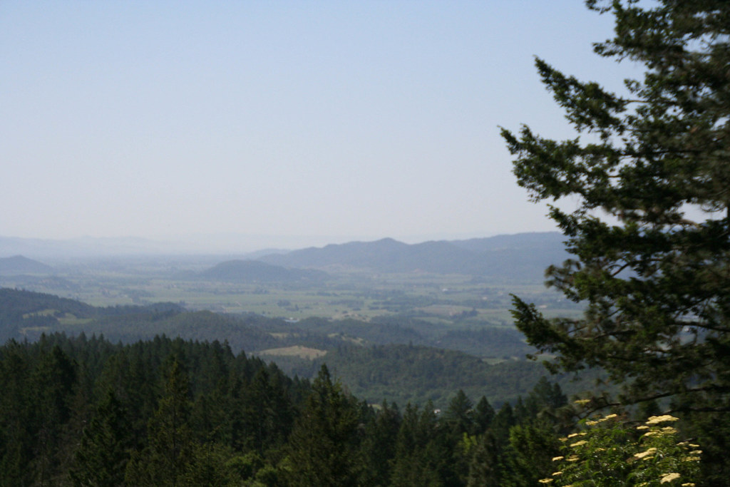 Old Sawmill TrailHiking · ~10 min drivePhoto: csitko, CC BY 2.0 (via Flickr)
 John Hoffnagle LoopHiking · ~15 min drivePhoto: Skyfirex, CC BY-SA 3.0 (via Wikimedia Commons)Conn PeakHiking · Next doorPhoto: Kurt Minard, CC BY-SA 3.0 (via Wikimedia Commons)Linda Falls TrailHiking · ~11 min drivePhoto: Skyfirex, CC BY-SA 3.0 (via Wikimedia Commons)
 Smittle Creek TrailHiking · ~13 min drivePhoto: Bureau of Reclamation, CC BY-SA 2.0 (via Wikimedia Commons)Devil's Punchbowl TrailHiking · ~13 min drivePhoto: Skyfirex, CC BY-SA 3.0 (via Wikimedia Commons)
 Vista TrailHiking · ~15 min drivePhoto: lamblukas, CC BY 2.0 (via Flickr)
 Headwaters TrailHiking · ~15 min drivePhoto: Philip Kendall, CC BY-SA 2.0 (via Wikimedia Commons)
Best months: February–June and October–December. Best months have typical highs of 55–85 °F, lows of 30 °F or warmer (32 °F where the station doesn't record snow), at most one snowy day and no more than 12 wet days.
Jan
59° / 40°
13 wet
Feb
63° / 42°
11 wet
Mar
67° / 44°
10 wet
Apr
72° / 46°
6 wet
May
78° / 50°
3 wet
Jun
85° / 54°
1 wet
Jul
89° / 56°
0 wet
Aug
89° / 56°
0 wet
Sep
87° / 54°
1 wet
Oct
78° / 49°
3 wet
Nov
66° / 44°
8 wet
Dec
58° / 40°
12 wet
Typical high / low (°F) and days with rain or snow, 1991–2020. Measured at Saint Helena, CA, 6.3 mi away at 225 ft. Source: NOAA NCEI U.S. Climate Normals 1991–2020.
Map and trail data © OpenStreetMap contributors
