Bluff Trail
- 0.4 mi
- round trip
- 45 ft
- climb
- 4,883 ft
- high point
- Out and back
- route
- May–Jun, Aug–Sep
- best months
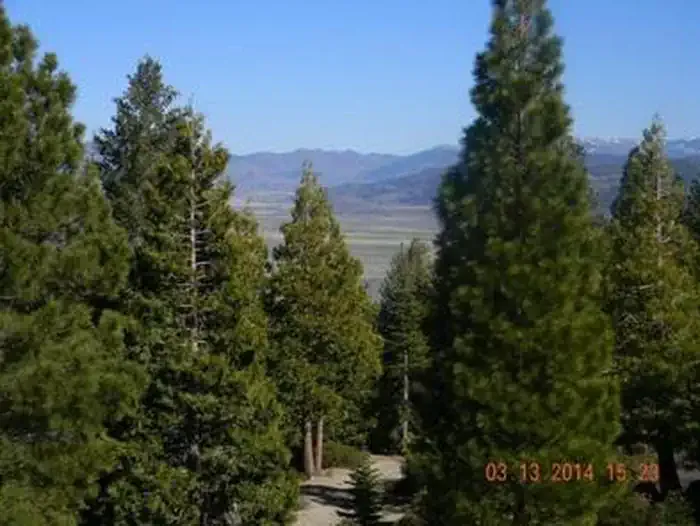
Bluff Trail is a short, easy hike in Sierra Valley Preserve in California, managed by a non-governmental organization. The trail is about 0.35 miles long and sits at roughly 4,880 feet, with a total climb of about 45 feet over the course of the out-and-back route. It's a flat, low-effort walk that makes an easy addition to a day spent exploring the preserve. Late spring and early fall are the most comfortable times to go. Typical averages from the nearby Portola weather station show May highs around 67°F and September highs near 79°F, with only a few wet days in each month. July and August run warmer, with highs in the mid-80s. The Botanical Trail lies just 0.3 miles away, and Ross Ridge is about 3.6 miles off. Paddlers can head to the North Channel Little Last Chance Creek, about 5.8 miles away, and Grizzly Family Campground is roughly 8.9 miles from the trail.
Local outfitters
- Alpenglow Expeditions41 mi away
Not on Roamze yet. Their page has how to reach them.
- Botanical TrailHiking0.3 mi
- ROSS RIDGEHiking3.6 mi
- North Channel Little Last Chance CreekCanoeing5.8 mi
 Middle Fork Feather RiverCanoeingPhoto: Frank Schulenburg, CC BY-SA 4.0 (via Wikimedia Commons)6.3 mi
- Grizzly Family Cg.Camping8.9 mi
 GrizzlyCampingPhoto: Recreation.gov (RIDB) / public domain8.9 mi
 Calpine LookoutCampingPhoto: Recreation.gov (RIDB) / public domain8.9 mi
- LAKE DAVIS TRAILHiking9.1 mi
Source: Roamze catalog (indexable pages within 10 miles, PostGIS distance)
 Phil's LoopHiking · ~22 min drivePhoto: Andre Charland, CC BY 2.0 (via Flickr)
 BEAR LAKES LOOP TRAILHiking · ~29 min drivePhoto: waterarchives, CC BY-SA 2.0 (via Flickr)
- LAKE DAVIS TRAILHiking · ~16 min drive
- HASKELL PEAKHiking · ~23 min drive
- Lower Mills Peak TrailHiking · ~23 min drivePhoto: Andre Charland, CC BY 2.0 (via Flickr)
- LUNCH CREEK NORDICHiking · ~21 min drive
- RIDGE LOOPHiking · ~28 min drive
- MILLS PEAK TRAILHiking · ~25 min drive
 Frazier Falls TrailHiking · ~27 min drivePhoto: Ken Lund, CC BY-SA 2.0 (via Flickr)
- Haskell Peak TrailHiking · ~22 min drive
Best time to visit Bluff Trail
Best months: May–June and August–September. Best months have typical highs of 55–85 °F, lows of 30 °F or warmer (32 °F where the station doesn't record snow), at most one snowy day and no more than 12 wet days.
Jan
43° / 19°
8 wet
Feb
46° / 21°
8 wet
Mar
52° / 25°
8 wet
Apr
58° / 29°
6 wet
May
67° / 35°
5 wet
Jun
77° / 40°
3 wet
Jul
86° / 45°
1 wet
Aug
85° / 43°
1 wet
Sep
79° / 37°
2 wet
Oct
66° / 30°
4 wet
Nov
53° / 24°
6 wet
Dec
42° / 19°
8 wet
Typical high / low (°F) and days with rain or snow, 1991–2020. Measured at Portola, CA, 5.6 mi away at 4,850 ft. This station doesn't record snowfall. Source: NOAA NCEI U.S. Climate Normals 1991–2020.
Map and trail data © OpenStreetMap contributors
