Half Moon Bay RV Park
Campground
Campground · 8.2 mi from the trail
Blue Oak Trail is a short, easy out-and-back hike in Pulgas Ridge Open Space Preserve in California, on land managed by a regional agency. The trail is about 0.4 miles long, and the round trip covers roughly 0.8 miles with a total elevation gain of about 342 feet. The high point is 465 feet, and the route starts and ends at that elevation, so the climb is a small one with a rolling profile. Spring and fall are the most comfortable times to go. Typical averages from a nearby weather station show April highs around 73°F and October highs around 80°F, while July and August average in the upper 80s. The trail is close to several other routes. Hassler Loop Trail is about 0.1 mile away, and Cordilleras Trail is about 0.2 mile away. Franciscan Trail and Dick Bishop Trail are each about 0.4 mile away.
Half Moon Bay RV Park
Campground
Canyon Inn
Pub
 If it rainsBrokenSphere, CC BY-SA 3.0 · Wikimedia Commons
Aerospace museum in San Carlos, California
Places © OpenStreetMap contributors · Photos: BrokenSphere, CC BY-SA 3.0 (commons)
More in Pescadero Cordilleras TrailHikingPhoto: btwashburn, CC BY 2.0 (via Flickr)0.2 mi
 Franciscan TrailHikingPhoto: Charles Nadeau from San Mateo, CA, CC BY 2.0 (via Wikimedia Commons)0.4 mi
 Polly Geraci TrailHikingPhoto: Charles Nadeau from San Mateo, CA, CC BY 2.0 (via Wikimedia Commons)0.4 miDick Bishop TrailHikingPhoto: Charles Nadeau from San Mateo, CA, CC BY 2.0 (via Wikimedia Commons)0.4 miBaywood Glen TrailHikingPhoto: Charles Nadeau from San Mateo, CA, CC BY 2.0 (via Wikimedia Commons)0.5 mi
Source: Roamze catalog (indexable pages within 10 miles, PostGIS distance)
Cordilleras TrailHiking · Next doorPhoto: btwashburn, CC BY 2.0 (via Flickr)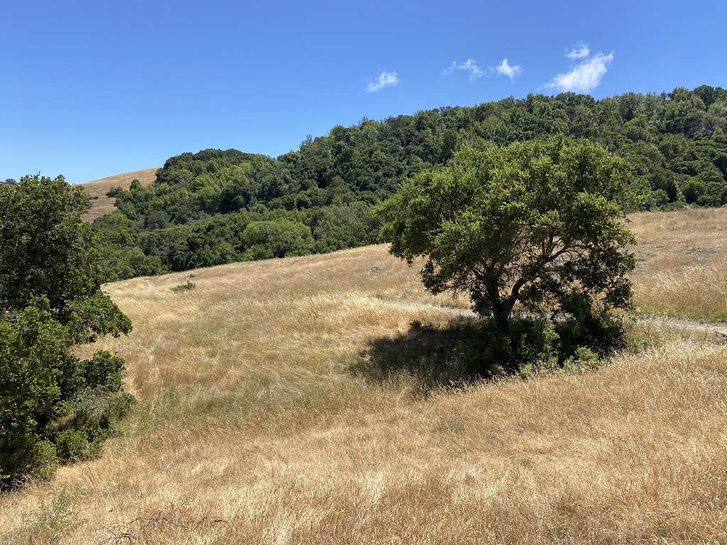 Edgewood TrailHiking · Next doorPhoto: btwashburn, CC BY 2.0 (via Flickr)Franciscan TrailHiking · Next doorPhoto: Charles Nadeau from San Mateo, CA, CC BY 2.0 (via Wikimedia Commons)Dusky-footed Woodrat TrailHiking · ~1 min drivePhoto: Charles Nadeau from San Mateo, CA, CC BY 2.0 (via Wikimedia Commons)Dick Bishop TrailHiking · Next doorPhoto: Charles Nadeau from San Mateo, CA, CC BY 2.0 (via Wikimedia Commons)
 Crystal Springs TrailHiking · ~2 min drivePhoto: btwashburn, CC BY 2.0 (via Flickr)Polly Geraci TrailHiking · Next doorPhoto: Charles Nadeau from San Mateo, CA, CC BY 2.0 (via Wikimedia Commons)
 Raymundo TrailHiking · ~3 min drivePhoto: Charles Nadeau from San Mateo, CA, CC BY 2.0 (via Wikimedia Commons)Baywood Glen TrailHiking · Next doorPhoto: Charles Nadeau from San Mateo, CA, CC BY 2.0 (via Wikimedia Commons)Mount Redondo TrailHiking · ~4 min drivePhoto: Charles Nadeau from San Mateo, CA, CC BY 2.0 (via Wikimedia Commons)
Best months: October–June. Best months have typical highs of 55–85 °F, lows of 30 °F or warmer (32 °F where the station doesn't record snow), at most one snowy day and no more than 12 wet days.
Jan
61° / 38°
Feb
64° / 40°
Mar
69° / 41°
Apr
73° / 43°
May
78° / 47°
Jun
84° / 50°
Jul
88° / 53°
Aug
89° / 52°
Sep
87° / 51°
Oct
80° / 46°
Nov
68° / 41°
Dec
61° / 37°
Typical high / low (°F) and days with rain or snow, 1991–2020. Measured at Woodside Fire Stn 1, CA, 3.7 mi away at 380 ft. This station doesn't record snowfall. Source: NOAA NCEI U.S. Climate Normals 1991–2020.
Map and trail data © OpenStreetMap contributors

