Walnut RV Park
Campground
Campground · 3.6 mi from the trail
Aliso Canyon Trail is an easy out-and-back hike in Aliso Canyon Park, a city-managed park in California. The trail is about 3.5 miles long, with a total elevation gain of 974 feet, and it starts and ends at roughly 1,160 feet, reaching a high point of about 1,543 feet. The steepest stretch comes at about 1.7 miles, where the grade reaches 18 percent. Spring and fall are the most comfortable times to go. Typical averages from a nearby weather station show April highs around 75°F and October highs around 82°F, while July and August average in the low 90s. That station sits about 640 feet lower than the trail's high point, so temperatures on the higher ground run cooler. The hike takes about 1.5 hours. The Palisades Trail to Aliso Canyon starts just 0.1 mile away, and the Porter Ranch Palisades Trail is about 0.6 mile off. The Dr. Mario A. De Campos Trail and the Grotto Trail are both within about 2 miles.
Walnut RV Park
Campground
Bearies Acai
Fast food
 If it rainsJunkyardsparkle, CC0 · Wikimedia Commons
Railway station in Simi Valley, the United States of America
Places © OpenStreetMap contributors · Photos: Junkyardsparkle, CC0 (commons)
More in Moorpark Back WallRock climbingPhoto: Oran Viriyincy, CC BY-SA 2.0 (via Flickr)4.4 mi
 Spiral BoulderRock climbingPhoto: jxson, CC BY 2.0 (via Flickr)4.4 mi
Source: Roamze catalog (indexable pages within 10 miles, PostGIS distance)
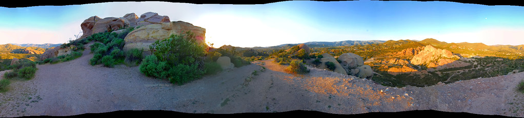 Romo TrailHiking · ~7 min drivePhoto: RuggyBearLA, CC BY 2.0 (via Flickr)
 Santa Susana Pass TrailHiking · ~8 min drivePhoto: Clotee Allochuku-Albritton, CC BY-SA 2.0 (via Flickr)
 Santa Susana Pass TrailHiking · ~8 min drivePhoto: Clotee Allochuku-Albritton, CC BY-SA 2.0 (via Flickr)Mattingly TrailHiking · ~9 min drivePhoto: Clotee Allochuku-Albritton, CC BY-SA 2.0 (via Flickr)
 Andora TrailHiking · ~10 min drivePhoto: ron.shafrir, CC BY 2.0 (via Flickr)Hill Palmer TrailHiking · ~10 min drivePhoto: ron.shafrir, CC BY 2.0 (via Flickr)Waterfall TrailHiking · ~10 min drivePhoto: ron.shafrir, CC BY 2.0 (via Flickr)
Best months: October–June. Best months have typical highs of 55–85 °F, lows of 30 °F or warmer (32 °F where the station doesn't record snow), at most one snowy day and no more than 12 wet days.
Jan
67° / 47°
6 wet
Feb
68° / 47°
7 wet
Mar
71° / 49°
5 wet
Apr
75° / 52°
3 wet
May
78° / 56°
1 wet
Jun
84° / 60°
1 wet
Jul
90° / 64°
0 wet
Aug
92° / 64°
0 wet
Sep
89° / 62°
1 wet
Oct
82° / 56°
2 wet
Nov
74° / 50°
4 wet
Dec
67° / 46°
6 wet
Typical high / low (°F) and days with rain or snow, 1991–2020. Measured at Northridge Cal State, CA, 2.7 mi away at 904 ft. The station sits about 600 ft lower than this place, so expect it a little cooler here. Source: NOAA NCEI U.S. Climate Normals 1991–2020.
Map and trail data © OpenStreetMap contributors

