Maumee South River Access Point
- Mar–Jun, Sep–Nov
- best months
Clear at last check
Weather is good · OpenWeather · checked 22 h ago
Is Maumee South River Access Point open right now?
Closure in the area
There's a closure order in Buffalo National River. It doesn't name Maumee South River Access Point, so check the source for the area it covers.
South Woolum Road Closed, Alternate Route Available
Park closure covering Buffalo National River · NPS · Buffalo National River
As of · Source: NPS · Buffalo National River. Agencies don't list every closure — check before you go.
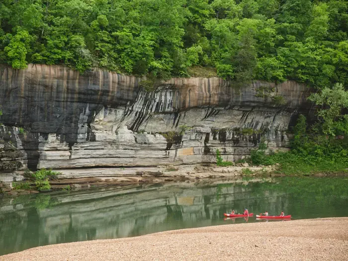
Maumee South River Access Point is a boat launch on the Buffalo National River in Arkansas, about 5.6 miles from the town of Gilbert. It serves as a put-in for paddlers and boaters heading onto the river within the national park. Spring and fall are the most comfortable times to visit. Typical averages from a nearby weather station in Gilbert show October highs around 73°F with lows near 45°F, and April highs around 70°F. Midsummer highs typically reach about 89°F. Several trails lie within a few miles, including the Overlook Trail and the Indian Rockhouse Trail, both under 5 miles away. Buffalo Point campground is about 5.1 miles off, and Tyler Bend Campground is about 8 miles away for an overnight stay.
 Overlook TrailHikingPhoto: Farther Along, CC BY 2.0 (via Flickr)4.7 mi
- Indian Rockhouse TrailHikingPhoto: Farther Along, CC BY 2.0 (via Flickr)4.8 mi
 Forest TrailHikingPhoto: Farther Along, CC BY 2.0 (via Flickr)4.8 mi
- Return TrailHikingPhoto: Farther Along, CC BY 2.0 (via Flickr)5 mi
- Campground TrailHiking5.1 mi
 Buffalo PointCampingPhoto: Recreation.gov (RIDB) / public domain5.1 mi
- Tyler Bend CampgroundCamping8 mi
- Big CreekCanoeing8.7 mi
Source: Roamze catalog (indexable pages within 10 miles, PostGIS distance)
- Maumee North River Access PointBoat launch · Next door
- Big CreekCanoeing · ~15 min drive
- Spring Creek Access PointBoat launch · ~5 min drive
- Bear CreekCanoeing · ~26 min drive
- Dillards Ferry River Access PointBoat launch · ~6 min drive
- Clear CreekCanoeing · ~28 min drive
- Buffalo Point River Access PointBoat launch · ~9 min drive
- Middle Fork Little Red RiverCanoeing · ~31 min drive
- Gilbert River Access PointBoat launch · ~10 min drive
- Roasting Ear CreekCanoeing · ~35 min drive
Best time to visit Maumee South River Access Point
Best months: March–June and September–November. Best months have typical highs of 55–85 °F, lows of 30 °F or warmer (32 °F where the station doesn't record snow), at most one snowy day and no more than 12 wet days.
Jan
48° / 24°
7 wet
Feb
53° / 28°
7 wet
Mar
61° / 36°
8 wet
Apr
70° / 45°
8 wet
May
77° / 55°
9 wet
Jun
85° / 64°
7 wet
Jul
89° / 67°
7 wet
Aug
89° / 65°
7 wet
Sep
83° / 57°
6 wet
Oct
73° / 45°
7 wet
Nov
60° / 35°
7 wet
Dec
51° / 27°
7 wet
Typical high / low (°F) and days with rain or snow, 1991–2020. Measured at Gilbert, AR, 5.7 mi away at 606 ft. This station doesn't record snowfall. Source: NOAA NCEI U.S. Climate Normals 1991–2020.
Map and trail data © OpenStreetMap contributors
