Cove Lake Recreation Area
Campground
Campground · 0.7 mi from the trail
Closure in the area
There's a closure order in Ozark-St. Francis National Forest. It doesn't name Cove Lake Perimeter, so check the source for the area it covers (9 listed).
Ozark Highlands Trail Access During ARDOT Hwy 123 Big Piney Creek Bridge Reconstruction
Agency closure covering Ozark-St. Francis National Forest · USFS · Ozark-St. Francis National Forest
Wildfire Risk Increases in Arkansas and Oklahoma
Agency closure covering Ozark-St. Francis National Forest · USFS · Ozark-St. Francis National Forest
Spring Lake Recreation Area Closed For Rest of 2026 Season
Agency closure covering Ozark-St. Francis National Forest · USFS · Ozark-St. Francis National Forest
Lake Wedington Recreation Area Water Line Project
Agency closure covering Ozark-St. Francis National Forest · USFS · Ozark-St. Francis National Forest
Morgan Mtn Rd Partially Closed for Road Repair
Agency closure covering Ozark-St. Francis National Forest · USFS · Ozark-St. Francis National Forest
As of · Source: USFS · Ozark-St. Francis National Forest. Agencies don't list every closure — check before you go.
Cove Lake Perimeter is an easy hike of about 6.7 miles in the Magazine Mountain Ranger District of the Ozark-St. Francis National Forest in Arkansas. The trail is managed by the Forest Service and runs on natural ground, with no horses or bikes allowed. It starts at about 1,059 feet and reaches a high point of 1,093 feet, with the steepest stretch at about 1.1 miles in, where the grade reaches 10%. Spring and fall are the most comfortable times to go. Typical averages from a nearby weather station in Subiaco show October highs around 74°F and April highs around 72°F, while July and August average about 92°F. That station sits roughly 600 feet lower than the trail, so temperatures on the hike run cooler. Cove Lake Recreation Area and Cove Lake Campground Complex are both within a mile, and the CCC Trail is about a mile away. Mount Magazine State Park, a climbing area, is about 4.4 miles off.
Cove Lake Recreation Area
Campground
Logan County "Old Jail" Museum
Museum
Places © OpenStreetMap contributors
More in Coal HillNot on Roamze yet. Their page has how to reach them.
Best months: March–May and September–November. Best months have typical highs of 55–85 °F, lows of 30 °F or warmer (32 °F where the station doesn't record snow), at most one snowy day and no more than 12 wet days.
Jan
49° / 29°
7 wet
Feb
54° / 32°
7 wet
Mar
63° / 40°
9 wet
Apr
72° / 48°
8 wet
May
80° / 58°
9 wet
Jun
88° / 67°
8 wet
Jul
92° / 70°
7 wet
Aug
92° / 69°
7 wet
Sep
85° / 62°
6 wet
Oct
74° / 50°
7 wet
Nov
61° / 39°
8 wet
Dec
51° / 32°
8 wet
Typical high / low (°F) and days with rain or snow, 1991–2020. Measured at Subiaco, AR, 5 mi away at 500 ft. The station sits about 600 ft lower than this place, so expect it a little cooler here. This station doesn't record snowfall. Source: NOAA NCEI U.S. Climate Normals 1991–2020.
 Photo: Tony Webster, CC BY 2.0 (via Flickr)
Ccc Trail
~2 min drive
1.71-mile out-and-back trail in Arkansas with 66 ft elevation gain.
 Photo: Tony Webster, CC BY-SA 2.0 (via Flickr)
Mt. Magazine Trail
~7 min drive
Strenuous out-and-back to Arkansas's highest peak with panoramic views.
 Photo: thigpen.robert, CC BY-SA 2.0 (via Flickr)
HUCKLEBERRY MTN HORSE TRAIL
~7 min drive
1.84-mile out-and-back trail in Arkansas with 346 ft elevation gain
HIKE
Danville Mountain Trail
~33 min drive
1.52-mile out-and-back hike on Danville Mountain in Arkansas with 111 ft of elevation gain.
HIKE
Ozark Highlands Trail
~1h 2m drive
132-mile point-to-point Ozark trail through mountains and valleys.
 Photo: thigpen.robert, CC BY-SA 2.0 (via Flickr)
HUCKLEBERRY MTN. LOOP-APPLE
~9 min drive
8.72-mile out-and-back trail in Arkansas with 1,385 ft elevation gain.
HIKE
Huckleberry Mtn-Orange
~13 min drive
19.96-mile out-and-back trail in Arkansas with 1,325 ft elevation gain.
 Photo: SlapTheWorld, Public Domain Dedication (CC0) (via Flickr)
Indian Creek Oht Spur
~54 min drive
0.49-mile out-and-back trail in Arkansas with 64 ft gain.
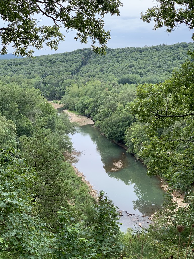 Photo: SlapTheWorld, Public Domain Dedication (CC0) (via Flickr)
Redding Loop East-Oht Spurs
~55 min drive
4.63-mile out-and-back trail in Arkansas with 1,693 ft gain.
HIKE
Hole in the Ground Mtn. Trail
~31 min drive
7.32-mile out-and-back hike in Arkansas with 1,061 ft gain

