Ralph Natural Bridge
- 820 ft
- elevation
- Mar–Jun, Sep–Nov
- best months
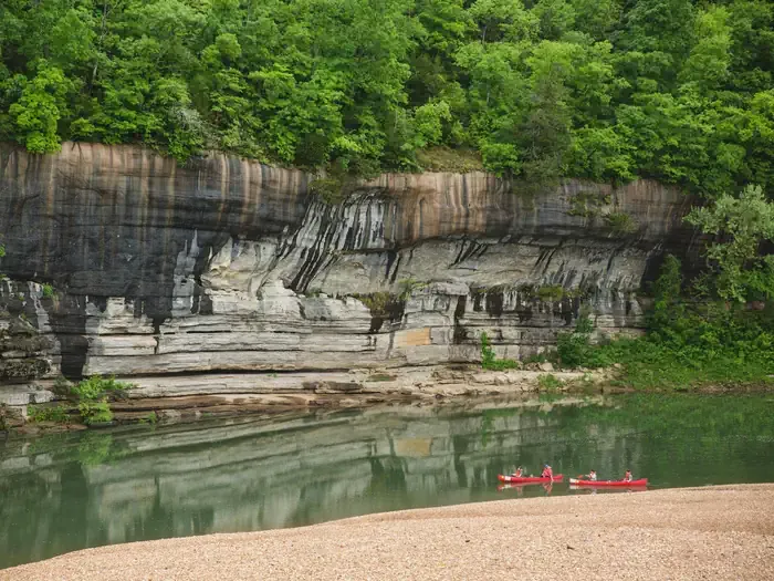
Ralph Natural Bridge is a natural arch in Arkansas, sitting at about 820 feet elevation roughly 3.3 miles from the town of Yellville. It is a single feature rather than a route, so there is no climb to plan around, no trail to measure, and no distance to cover. It is a destination in its own right, a natural stone bridge that makes an easy stop for anyone passing through the area. Spring and fall are the most comfortable times to visit. Typical averages from a nearby weather station in Gilbert, Arkansas, show October highs around 73°F with lows near 45°F, and April highs around 70°F. That station sits about 214 feet lower than the arch, so temperatures at the bridge run a little cooler. Several other spots lie within about 10 miles. Return Trail is a hike about 9 miles away, and Buffalo Point campground is just under 10 miles off. Indian Rockhouse Trail is a little farther, at about 9.8 miles.
- Elevation
- 820 ft
Elevation from USGS 3D Elevation Program terrain data (about 10 m resolution).
 Return TrailHikingPhoto: Farther Along, CC BY 2.0 (via Flickr)8.9 mi
 Buffalo PointCampingPhoto: Recreation.gov (RIDB) / public domain9.7 mi
- Indian Rockhouse TrailHikingPhoto: Farther Along, CC BY 2.0 (via Flickr)9.8 mi
Source: Roamze catalog (indexable pages within 10 miles, PostGIS distance)
- Indian RockhouseNatural arch · ~15 min drive
- Arlberg ArchNatural arch · ~58 min drive
- Arch RockNatural arch · ~1h 3m drive
- Pedestal RocksNatural arch · ~1h 4m drive
- Alum Cove Natural BridgeNatural arch · ~1h 4m drive
- Natural Bridge of ArkansasNatural arch · ~1h 6m drive
- Lost Valley Natural BridgeNatural arch · ~1h 9m drive
- Buzzard Roost Rocks Natural ArchNatural arch · ~1h 17m drive
- Sweden Fork Natural BridgeNatural arch · ~1h 23m drive
- Hurricane Creek Natural BridgeNatural arch · ~1h 15m drive
Best time to visit Ralph Natural Bridge
Best months: March–June and September–November. Best months have typical highs of 55–85 °F, lows of 30 °F or warmer (32 °F where the station doesn't record snow), at most one snowy day and no more than 12 wet days.
Jan
48° / 24°
7 wet
Feb
53° / 28°
7 wet
Mar
61° / 36°
8 wet
Apr
70° / 45°
8 wet
May
77° / 55°
9 wet
Jun
85° / 64°
7 wet
Jul
89° / 67°
7 wet
Aug
89° / 65°
7 wet
Sep
83° / 57°
6 wet
Oct
73° / 45°
7 wet
Nov
60° / 35°
7 wet
Dec
51° / 27°
7 wet
Typical high / low (°F) and days with rain or snow, 1991–2020. Measured at Gilbert, AR, 13.4 mi away at 606 ft. This station doesn't record snowfall. Source: NOAA NCEI U.S. Climate Normals 1991–2020.
