Cannon Point Walkway
An out-and-back trail, 0.8 miles each way (1.6 miles round trip) in Wellington, New Zealand.
- 0.8 mi
- round trip
- 754 ft
- climb
- 942 ft
- high point
- Out and back
- route
Cannon Point Walkway is an out-and-back trail, 0.8 miles each way (1.6 miles round trip) in Wellington, New Zealand. It runs between about 480 ft and 940 ft above sea level, with roughly 190 ft of climbing one way. The nearest town is Upper Hutt, about 2.0 miles north of the trailhead. Peaks within about 3 miles include Cannon Point and Emerald Hill. For camping, Wellington's Kiwi Holiday Park and Wellington Naturist Club are within about 6 miles. There are 22 other mapped trails within about 3 miles, so you can combine or extend the outing. Distances, elevations and the route shape here come from OpenStreetMap and the Copernicus 90 m elevation model. Trails, access rules and conditions change, so check locally before you go.
Keep exploring — more trails worth the drive
 Photo: Jonathan Harker, CC0 (via Wikimedia Commons)
Pauatahanui Harbour circuit - b) Pauatahanui to Paremata Bridge
~15 min drive
A 4.7-mile point-to-point route in Wellington, New Zealand.
Tane's Track
~6 min drive
A 1.4-mile loop in Wellington, New Zealand.
Cannon Point Walkway
~1 min drive
An out-and-back trail, 0.7 miles each way (1.5 miles round trip) in Wellington, New Zealand.
Ridge Track
~11 min drive
An out-and-back trail, 4.1 miles each way (8.3 miles round trip) in Wellington, New Zealand.
Clarke's Creek
~2 min drive
An out-and-back trail, 2.2 miles each way (4.3 miles round trip) in Wellington, New Zealand.
Woolshed Road
~2 min drive
An out-and-back trail, 1.7 miles each way (3.4 miles round trip) in Wellington, New Zealand.
New Track
~3 min drive
An out-and-back trail, 0.5 miles each way (1.0 miles round trip) in Wellington, New Zealand.
Lindsays No1 Road
~3 min drive
An out-and-back trail, 0.4 miles each way (0.8 miles round trip) in Wellington, New Zealand.
Lookout
~3 min drive
An out-and-back trail, 0.7 miles each way (1.4 miles round trip) in Wellington, New Zealand.
Cruiser Drive
~3 min drive
An out-and-back trail, 2.3 miles each way (4.6 miles round trip) in Wellington, New Zealand.
Also worth it near here
 Photo: Jeff Hitchcock, CC BY 3.0 (via Wikimedia Commons)
Wellington's Kiwi Holiday Park
~1 min drive
Mount Climie Track
~6 min drive
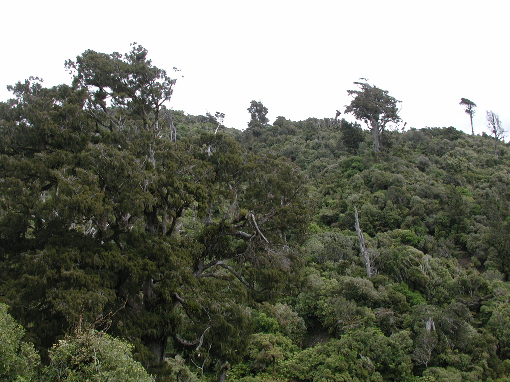 Photo: Pseudopanax at en.wikipedia, Public domain (via Wikimedia Commons)
Climie
~8 min drive
Orange Hut
~11 min drive
 Photo: StellaMcQ, CC BY-SA 4.0 (via Wikimedia Commons)
Paekakariki Beach
~18 min drive
Conditions and forecast
Daily highs and lows, wind and the chance of precipitation at Cannon Point Walkway for the next 7 days, from the Open-Meteo model.
Map and trail data © OpenStreetMap contributors
