Wurzelweg
- 0.4 mi
- one way
- 852 ft
- climb
- 7,511 ft
- high point
- Point to point
- route
Wurzelweg is a 0.4-mile point-to-point route in Trentino-South Tyrol, Italy, inside Parco Nazionale dello Stelvio - Nationalpark Stilfser Joch. It runs between about 6,660 ft and 7,510 ft above sea level, with roughly 850 ft of climbing one way. It is a mountain path with steeper and uneven sections, so wear proper hiking shoes. It is mapped as a named hiking route, with the sections joined into one trail here. It is on the edge of Sulden - Solda. Peaks within about 3 miles include Scheibenkopf - Monte del Bersaglio, Vorderes Schöneck - Dossobello di Fuori and Marltschneide - Dosso Marlet. For camping, Camping Trafoi is within about 6 miles. There are 20 other mapped trails within about 3 miles, so you can combine or extend the outing. Distances, elevations and the route shape here come from OpenStreetMap and the Copernicus 90 m elevation model. Trails, access rules and conditions change, so check locally before you go.
Keep exploring — more trails worth the drive
 Photo: silvio alaimo sj, CC BY 3.0 (via Wikimedia Commons)
Rif. V Alpini - Passo Solda
~6 min drive
An out-and-back trail, 0.8 miles each way (1.5 miles round trip) in Lombardy, Italy.
Morosiniweg - Sentiero Morosini
~1 min drive
A 1.8-mile point-to-point route in Trentino-South Tyrol, Italy.
Eselsteig
~2 min drive
An out-and-back trail, 1.8 miles each way (3.7 miles round trip) in Trentino-South Tyrol, Italy.
Legerwand
~3 min drive
A 0.6-mile point-to-point route in Trentino-South Tyrol, Italy.
Rifugio Campo – Rifugio Branca
~7 min drive
A 9.9-mile point-to-point route in Lombardy, Italy.
 Photo: Dispe, CC0 (via Wikimedia Commons)
Rif. V Alpini - Passo Camosci - Campo
~6 min drive
A 2.8-mile point-to-point route in Lombardy, Italy.
Zugstieg Marlt - Madona
~1 min drive
A 0.9-mile point-to-point route in Trentino-South Tyrol, Italy.
Herrensteig - Sentiero dei Signori
~7 min drive
A 2.5-mile point-to-point route in Trentino-South Tyrol, Italy.
 Photo: Denis Faustinelli, CC BY 3.0 (via Wikimedia Commons)
Casati - Cevedale
~7 min drive
An out-and-back trail, 1.8 miles each way (3.6 miles round trip) in Lombardy, Italy.
Zustieg Marltgrat - Accesso al Coston del Marlèt
~1 min drive
An out-and-back trail, 1.0 miles each way (1.9 miles round trip) in Trentino-South Tyrol, Italy.
Also worth it near here
 Photo: Gawain78, CC BY-SA 3.0 (via Wikimedia Commons)
Hintergrathütte - Rifugio del Coston
~2 min drive
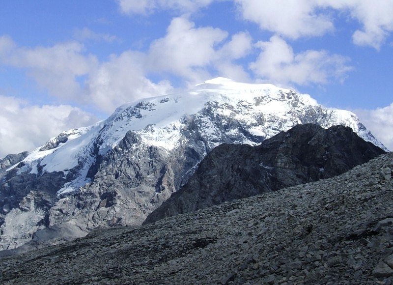 Photo: No machine-readable author provided. Idéfix~commonswiki assumed (based on copyright claims)., CC BY-SA 3.0 (via Wikimedia Commons)
Ortler: Minnigherode (from Mittelstation - Stazione intermedia cable car station)
~3 min drive
 Photo: Svíčková, CC BY-SA 3.0 (via Wikimedia Commons)
Tabarettaspitze - Punta Tabaretta
~3 min drive
Camping Trafoi
~7 min drive
 Photo: Sebastiano Zampieri, CC BY-SA 4.0 (via Wikimedia Commons)
Passo Zebrù - Rif. Pizzini
~8 min drive
Conditions and forecast
Daily highs and lows, wind and the chance of precipitation at Wurzelweg for the next 7 days, from the Open-Meteo model.
Map and trail data © OpenStreetMap contributors
