Frontsteig - Sentiero del fronte
- 1.7 mi
- round trip
- 2,346 ft
- climb
- 7,649 ft
- high point
- Out and back
- route
Frontsteig - Sentiero del fronte is an out-and-back trail, 1.7 miles each way (3.4 miles round trip) in Trentino-South Tyrol, Italy, inside Naturpark Fanes-Sennes-Prags - Parco Naturale Fanes-Sennes-Braies. It runs between about 7,170 ft and 7,650 ft above sea level, with roughly 990 ft of climbing one way. It is demanding mountain hiking, with rocky or exposed stretches where you need sure footing. Most of the way is dirt. The nearest town is Schmieden - Ferrara, about 4.8 miles southeast of the trailhead. Peaks within about 3 miles include Große Pyramide am Helltaler Schlechten - Grande Piramide di Valchiara, Zweite Pyramide am Helltaler Schlechten - Piramide Seconda di Valchiara and Gran Pala di Valchiara. Wasserfall Toblacher See - Cascata Lago di Dobbiaco is within about 3 miles. For camping, Camping Lago di Dobbiaco - Toblacher See and Camping Olympia are within about 6 miles. Distances, elevations and the route shape here come from OpenStreetMap and the Copernicus 90 m elevation model. Trails, access rules and conditions change, so check locally before you go.
Keep exploring — more trails worth the drive
 Photo: Maurizio Ceol, CC BY 3.0 (via Wikimedia Commons)
Gamsschartensteig - Sentiero delle Forcelle
~12 min drive
A 0.5-mile point-to-point route in Trentino-South Tyrol, Italy.
 Photo: kallerna, photocropper: User:LudwigSebastianMicheler, CC BY-SA 4.0 (via Wikimedia Commons)
Sentiero delle trincee
~22 min drive
A 0.7-mile point-to-point route in Veneto, Italy.
Römerweg - Via Romana
~9 min drive
A 9.7-mile point-to-point route in Trentino-South Tyrol, Italy.
Cresta Alessandro
~12 min drive
An out-and-back trail, 0.4 miles each way (0.9 miles round trip) in Veneto, Italy.
Kirchsteig - Sentiero della Chiesa
~13 min drive
A 0.5-mile point-to-point route in Trentino-South Tyrol, Italy.
Via Ferrata Ivano Dibona
~9 min drive
A 4.7-mile point-to-point route in Veneto, Italy.
Attention: dismissed path
~7 min drive
An out-and-back trail, 1.0 miles each way (2.0 miles round trip) in Veneto, Italy.
Tschachenweg
~10 min drive
A 0.5-mile point-to-point route in Trentino-South Tyrol, Italy.
Normale Punta Col de Varda
~13 min drive
An out-and-back trail, 0.4 miles each way (0.8 miles round trip) in Veneto, Italy.
Dolomites World Heritage Geotrail 17
~18 min drive
A 0.5-mile point-to-point route in Trentino-South Tyrol, Italy.
Also worth it near here
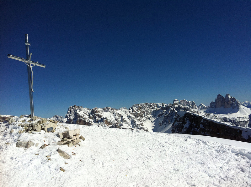 Photo: Robert Leiter, CC BY-SA 3.0 (via Wikimedia Commons)
Große Pyramide am Helltaler Schlechten - Grande Piramide di Valchiara
~1 min drive
 Photo: Alexander Hoernigk, CC BY-SA 4.0 (via Wikimedia Commons)
Skitour Dürrenstein - Skitour Picco di Vallandro
~1 min drive
 Photo: K.u.k. Kriegspressequartier, Lichtbildstelle - Wien, Public domain (via Wikimedia Commons)
Skiwanderweg Schluderbach - Plätzwiese
~2 min drive
34 Dolomitenhöhenweg Nr. 3 - 34 Alta Via delle Dolomiti 3
~2 min drive
 Photo: Falk2, CC BY-SA 4.0 (via Wikimedia Commons)
Dürrensteinhütte - Rifugio di Vallandro
~2 min drive
Conditions and forecast
Daily highs and lows, wind and the chance of precipitation at Frontsteig - Sentiero del fronte for the next 7 days, from the Open-Meteo model.
Map and trail data © OpenStreetMap contributors
