Punta Penna
- 4,364 ft
- summit
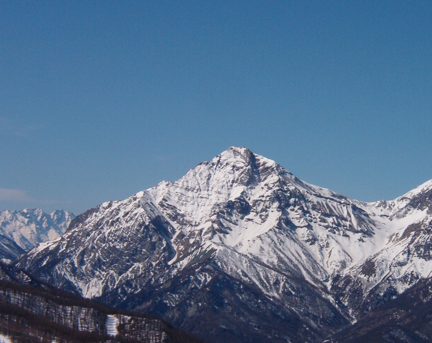
Punta Penna is a mountain in Piedmont, Italy, with its summit at about 4,360 ft (1,330 m) above sea level. No mapped trail reaches the top in OpenStreetMap, so plan the approach with local maps or a guide. The nearest town is Monastero di Lanzo, about 2.2 miles north of the summit. Peaks within about 3 miles include Ciucrin, Monte Ciucrin and Punta Cialma. Cascate del Tessuolo and Cascate del Tessuolo are within about 3 miles. For camping, Camping La Roccia and Camping Luigi Bergera are within about 6 miles. The location and elevation come from OpenStreetMap and the Copernicus 90 m elevation model. Check local access rules and conditions before you go.
Conditions and forecast
Daily highs and lows, wind and the chance of precipitation at the summit for the next 7 days, from the Open-Meteo model.
- Summit elevation
- 4,364 ft
We don't know of a mapped trail or route to the summit of Punta Penna. Plan the approach with local maps, a guidebook or a local guide, and check conditions before you go.
Questions about Punta Penna
How tall is Punta Penna?
4,364 ft (1,330 m).
Is there a trail to the top of Punta Penna?
We don't know of a mapped trail or route to the summit. Plan the approach with local maps, a guidebook or a local guide.
 Gran Paradiso13,323 ft · Aosta Valley, Italy1 route15 mi awayPhoto: Marie-Lan Taÿ Pamart, CC BY 4.0 (via Wikimedia Commons)
 Grande Casse12,648 ft · Auvergne-Rhône-Alpes, France1 route30 mi awayPhoto: Rémih, CC BY-SA 4.0 (via Wikimedia Commons)
 Mont Chaberton10,276 ft · Provence-Alpes-Côte d'Azur, France1 route42 mi awayPhoto: Francofranco56, Public domain (via Wikimedia Commons)
 Grand Combin14,137 ft · Valais, Switzerland1 route42 mi awayPhoto: Carsten Steger, CC BY-SA 4.0 (via Wikimedia Commons)
 Grandes Jorasses13,806 ft · Aosta Valley, Italy1 route43 mi awayPhoto: Ferrand, Henri (1853-1926). Photographe, Public domain (via Wikimedia Commons)
 Mont Blanc15,768 ft · Auvergne-Rhône-Alpes, France1 route44 mi awayPhoto: Christian David, CC BY-SA 4.0 (via Wikimedia Commons)
 Monte di Santa CristinaSummit · ~4 min drivePhoto: italo losero, CC BY-SA 3.0 (via Wikimedia Commons)
 Uja di BellavardaSummit · ~6 min drivePhoto: F Ceragioli, CC BY-SA 3.0 (via Wikimedia Commons)
 Monte RossoSummit · ~6 min drivePhoto: F Ceragioli, CC BY-SA 4.0 (via Wikimedia Commons)
 Uja di CorioSummit · ~7 min drivePhoto: Franco56, CC BY-SA 4.0 (via Wikimedia Commons)
 Rocca PerabiancaSummit · ~9 min drivePhoto: F Ceragioli, CC BY-SA 3.0 (via Wikimedia Commons)
 Monte VaccarezzaSummit · ~4 min drivePhoto: Franco56, CC BY-SA 4.0 (via Wikimedia Commons)
 Monte CrestaSummit · ~7 min drivePhoto: F Ceragioli, CC BY-SA 3.0 (via Wikimedia Commons)
 Monte PellerinSummit · ~8 min drivePhoto: F Ceragioli, CC BY-SA 4.0 (via Wikimedia Commons)
 Monte PluSummit · ~9 min drivePhoto: F Ceragioli, CC BY-SA 4.0 (via Wikimedia Commons)
 Punta Pian SpigoSummit · ~9 min drivePhoto: F Ceragioli, CC BY-SA 3.0 (via Wikimedia Commons)
Map and trail data © OpenStreetMap contributors
