Parco Naturale Regionale Terra delle Gravine
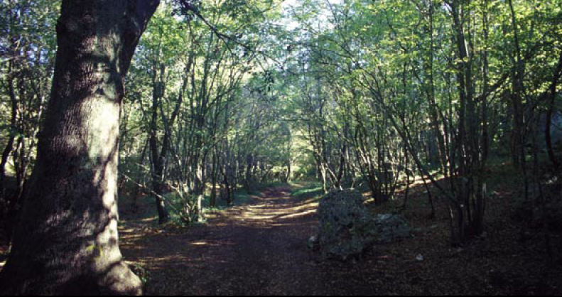
 Photo: Pietro D'Ambrosio, CC BY 2.5 (via Wikimedia Commons)
- Provincia di Taranto
- managed by
- Mar–Nov
- best months
Parco Naturale Regionale Terra delle Gravine is a national park in Apulia, Italy, covering about 62,200 acres (252 km²). There are 3 mapped trails inside it, including Laterza – Ginosa, Percorso 2 LIPU and avvicinamento falesia Capitan Harlock. Its peaks include Monte Sant'Elia, Monte Santa Trinità and Cozzo della Cannazza. Elevations inside the park range from about 180 ft to 1,480 ft. The nearest town is Laterza, about 1.8 miles east of the park's centre. It was established in 2005. It is classed as a regional park. It is managed as an IUCN category IV protected area. Administratively, it is in Province of Taranto. These details come from Wikidata. The boundary comes from OpenStreetMap. Check the park's own rules, fees and opening hours before you go.
Conditions and forecast
Daily highs and lows, wind and the chance of precipitation at Parco Naturale Regionale Terra delle Gravine for the next 7 days, from the Open-Meteo model.
Park size
62,201 acres
 Oasi WWF Bosco RomanazziState park · ~27 min drivePhoto: Savinogiusto, CC BY-SA 3.0 (via Wikimedia Commons)
 Riserva Naturale Regionale Orientata "Bosco delle Pianelle"State park · ~33 min drivePhoto: Unknown authorUnknown author, CC BY-SA 3.0 (via Wikimedia Commons)
 Pulicchio di GravinaState park · ~49 min drivePhoto: Canaxmaxa, CC BY-SA 3.0 (via Wikimedia Commons)
 Riserva naturale orientata Bosco Pantano di PolicoroState park · ~57 min drivePhoto: Ragioidmen, CC BY-SA 3.0 (via Wikimedia Commons)
 Parco Nazionale dell'Alta MurgiaState park · ~58 min drivePhoto: Fishmax77, CC BY-SA 4.0 (via Wikimedia Commons)
 Parco Naturale Regionale Lama BaliceState park · ~58 min drivePhoto: Fidia 82, Public domain (via Wikimedia Commons)
 Parco naturale regionale Dune costiere da Torre Canne a Torre San LeonardoState park · ~1h 5m drivePhoto: PanoramioFasano, CC BY-SA 4.0 (via Wikimedia Commons)
 Parco Regionale Gallipoli Cognato Piccole Dolomiti LucaneState park · ~1h 7m drivePhoto: Idéfix (talk · contribs), CC BY-SA 3.0 (via Wikimedia Commons)
- Parco Terra delle GravineState park · ~10 min drive
- Oasi WWF "Cesare Soria"State park · ~14 min drive
Also worth it near here
 Parco Murgia Timone 001Hiking · ~20 min drivePhoto: Laida (Tagzania user ID: 24661), CC BY-SA 4.0 (via Wikimedia Commons)
- Camping Green Village MarziottaCamping · ~22 min drive
- AQP - Acquedotto PuglieseMountain biking · ~23 min drive
 Monte Sant'EliaSummit · ~25 min drivePhoto: Gianfranco Spazioso, CC BY-SA 3.0 (via Wikimedia Commons)
- Spiaggia Verde MareBeach · ~30 min drive
Best time to visit Parco Naturale Regionale Terra delle Gravine
Best months: March–November. Best months have typical highs of 55–85 °F, lows of 30 °F or warmer (32 °F where there's no snowfall data), at most one snowy day and no more than 12 wet days.
Jan
50° / 38°
8 wet
Feb
51° / 37°
8 wet
Mar
55° / 41°
8 wet
Apr
61° / 45°
9 wet
May
70° / 53°
6 wet
Jun
79° / 60°
5 wet
Jul
84° / 65°
3 wet
Aug
84° / 66°
4 wet
Sep
76° / 60°
6 wet
Oct
68° / 54°
8 wet
Nov
58° / 46°
9 wet
Dec
52° / 41°
10 wet
Typical high / low (°F) and days with rain or snow, 1981–2010. Modelled for the 1 km square this place sits in (average height 1,240 ft), not measured at a weather station. We don't have this place's elevation, so higher spots nearby can run cooler. Snowfall days aren't in this data. Source: CHELSA 1 km climate model (1981–2010) and CRU TS 4.09 wet days. Data: CHELSA V2.1 climatologies (Karger et al. 2017), WSL (CC0 1.0); CRU TS 4.09 (Harris et al. 2020), University of East Anglia Climatic Research Unit. Contains public sector information licensed under the Open Government Licence v3.0. (Open Government Licence v3.0).
Map and trail data © OpenStreetMap contributors
