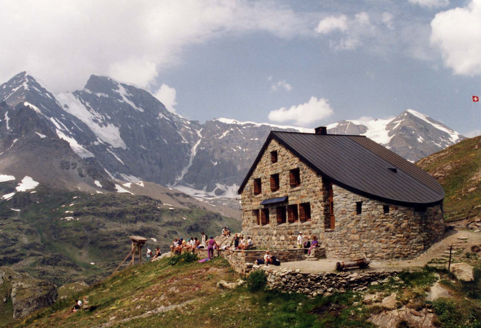
Rifugio Franco Chiarella all'Amianthe
 Photo: JesperDeGroot, CC BY-SA 3.0 (via Wikimedia Commons)
- At 9,774 ftHigh camp: expect cold nights, even in summer
Rifugio Franco Chiarella all'Amianthe is a mountain hut in Aosta Valley, Italy, at about 9,770 ft (2,979 m) above sea level. It is run by CAI Sezione di Torino. It has about 42 beds. Trails within about a mile include Sentiero Sergio Queirolo. The nearest town is Ollomont, about 4.2 miles north of the hut. Peaks within about 3 miles include Pointe Farinet, Grande Maison - Pointe Sud and Grande Maison - Pointe Nord. Cascata di Barliard is within about 3 miles. For camping, Camping Lac Lexert and Gran Combin are within about 6 miles. The location and elevation come from OpenStreetMap and the Copernicus 90 m elevation model. Check local access rules and conditions before you go.
Conditions and forecast
Daily highs and lows, wind and the chance of precipitation at Rifugio Franco Chiarella all'Amianthe for the next 7 days, from the Open-Meteo model.
 Bivacco Regondi-GavazziHut camping · ~5 min drivePhoto: Franco56, CC BY-SA 4.0 (via Wikimedia Commons)
 Camping Lac LexertCamping · ~9 min drivePhoto: ekstijn, CC BY-SA 3.0 (via Wikimedia Commons)
 Cabane de ChanrionHut camping · ~7 min drivePhoto: Jean-Louis Pitteloud, CC BY-SA 3.0 (via Wikimedia Commons)
- Gran CombinCamping · ~10 min drive
 Rifugio Letey-ChampillonHut camping · ~8 min drivePhoto: Franco56, CC0 (via Wikimedia Commons)
- Camping Forêt des Mélèzes et village SiouxCamping · ~13 min drive
 Cabane FXB PanossièreHut camping · ~10 min drivePhoto: Jean-Louis Pitteloud, CC BY-SA 3.0 (via Wikimedia Commons)
- Camping del MulinoCamping · ~13 min drive
 Hospice du Grand Saint-BernardHut camping · ~12 min drivePhoto: Ludovic Péron, CC BY-SA 3.0 (via Wikimedia Commons)
- Camping PinetaCamping · ~14 min drive
Also worth it near here
- Sentiero Sergio QueiroloHiking · Next door
 Grand CombinSummit · ~3 min drivePhoto: Carsten Steger, CC BY-SA 4.0 (via Wikimedia Commons)
- Mulattiera Pont ByMountain biking · ~4 min drive
- Cascata di BarliardWaterfall · ~5 min drive
- Grand Combin: Spalla Isler (from Cordonne)Mountaineering · ~8 min drivePhoto: Carsten Steger, CC BY-SA 4.0 (via Wikimedia Commons)
Best time to visit Rifugio Franco Chiarella all'Amianthe
No month here meets our mild-weather rule. Best months have typical highs of 55–85 °F, lows of 30 °F or warmer (32 °F where there's no snowfall data), at most one snowy day and no more than 12 wet days.
Jan
8° / -5°
14 wet
Feb
12° / -3°
13 wet
Mar
19° / 2°
15 wet
Apr
24° / 10°
19 wet
May
33° / 18°
20 wet
Jun
42° / 25°
18 wet
Jul
49° / 31°
16 wet
Aug
48° / 30°
16 wet
Sep
41° / 24°
16 wet
Oct
32° / 15°
15 wet
Nov
19° / 3°
16 wet
Dec
9° / -4°
15 wet
Typical high / low (°F) and days with rain or snow, 1981–2010. Modelled for the 1 km square this place sits in (average height 9,967 ft), not measured at a weather station. Snowfall days aren't in this data. Source: CHELSA 1 km climate model (1981–2010) and CRU TS 4.09 wet days. Data: CHELSA V2.1 climatologies (Karger et al. 2017), WSL (CC0 1.0); CRU TS 4.09 (Harris et al. 2020), University of East Anglia Climatic Research Unit. Contains public sector information licensed under the Open Government Licence v3.0. (Open Government Licence v3.0).
Map and trail data © OpenStreetMap contributors
