Brottos
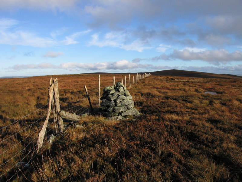
 Photo: David Medcalf, CC BY-SA 2.0 (via Wikimedia Commons)
- 2,054 ft
- summit
Brottos is a mountain in Wales, United Kingdom, with its summit at about 2,050 ft (626 m) above sea level. It stands inside SoDdGA Migneint-Arenig-Dduallt. No mapped trail reaches the top in OpenStreetMap, so plan the approach with local maps or a guide. The nearest town is Y Frongoch, about 3.4 miles northwest of the summit. Peaks within about 3 miles include Carnedd y Filiast, Foel-boeth and Llechwedd-llyfn. For camping, Tyn Cornel and Llwyn Onn Campsite are within about 6 miles. The location and elevation come from OpenStreetMap and the Copernicus 90 m elevation model. Check local access rules and conditions before you go.
Conditions and forecast
Daily highs and lows, wind and the chance of precipitation at the summit for the next 7 days, from the Open-Meteo model.
- Summit elevation
- 2,054 ft
We don't know of a mapped trail or route to the summit of Brottos. Plan the approach with local maps, a guidebook or a local guide, and check conditions before you go.
Questions about Brottos
How tall is Brottos?
2,054 ft (626 m).
Is there a trail to the top of Brottos?
We don't know of a mapped trail or route to the summit. Plan the approach with local maps, a guidebook or a local guide.
 Carnedd y FiliastSummit · Next doorPhoto: Chris Andrews, CC BY-SA 2.0 (via Wikimedia Commons)
 Foel-boethSummit · ~1 min drivePhoto: Rude Health, CC BY-SA 2.0 (via Wikimedia Commons)
 Llechwedd-llyfnSummit · ~1 min drivePhoto: John H Darch, CC BY-SA 2.0 (via Wikimedia Commons)
 Waun Garnedd-y-filiastSummit · ~2 min drivePhoto: Gabby77 (talk), Public domain (via Wikimedia Commons)
 Carnedd Llechwedd-llyfnSummit · ~2 min drivePhoto: Gabby77 (talk), Public domain (via Wikimedia Commons)
 Graig DduSummit · ~2 min drivePhoto: Joseph Jones, CC BY-SA 2.0 (via Wikimedia Commons)
 GarneddwenSummit · ~3 min drivePhoto: Rude Health, CC BY-SA 2.0 (via Wikimedia Commons)
 Yr OerfaSummit · ~3 min drivePhoto: Colin Park, CC BY-SA 2.0 (via Wikimedia Commons)
 Foel FrechSummit · ~3 min drivePhoto: David Medcalf, CC BY-SA 2.0 (via Wikimedia Commons)
 Craig Y GarnSummit · ~4 min drivePhoto: David Medcalf, CC BY-SA 2.0 (via Wikimedia Commons)


Map and trail data © OpenStreetMap contributors
