East Dart Waterfall
 Photo: Mark A Coleman, CC BY 3.0 (via Wikimedia Commons)
- 1,565 ft
- elevation
- Jun–Jul
- best months
East Dart Waterfall is a waterfall in South West England, United Kingdom, at about 1,570 ft above sea level. It is inside Dartmoor National Park. The nearest town is Postbridge, about 1.9 miles northwest of the falls. Peaks within about 3 miles include Braddon Tor, Winney's Down and Hartland Tor. For camping, Runnage Farm Campsite and Beardown Farm are within about 6 miles. The location and elevation come from OpenStreetMap and the Copernicus 90 m elevation model. Check local access rules and conditions before you go.
Conditions and forecast
Daily highs and lows, wind and the chance of precipitation at East Dart Waterfall for the next 7 days, from the Open-Meteo model.
- Elevation
- 1,565 ft
 Venford WaterfallWaterfall · ~12 min drivePhoto: Guy Wareham, CC BY-SA 2.0 (via Wikimedia Commons)
 Devil's CauldronWaterfall · ~13 min drivePhoto: Lewis Clarke, CC BY-SA 2.0 (via Wikimedia Commons)
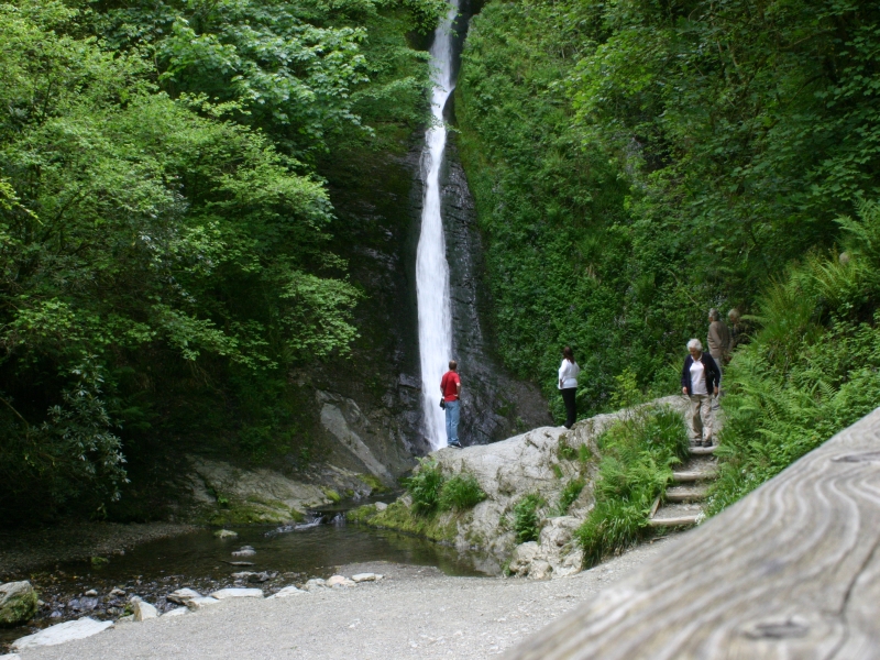 White Lady WaterfallWaterfall · ~14 min drivePhoto: A. R. Yeo MortimerCat, CC BY 2.5 (via Wikimedia Commons)
 Burrator WaterfallWaterfall · ~16 min drivePhoto: Guy Wareham, CC BY-SA 2.0 (via Wikimedia Commons)
 Golitha FallsWaterfall · ~45 min drivePhoto: Gareth James, CC BY-SA 2.0 (via Wikimedia Commons)
 Sherbrook ChineWaterfall · ~46 min drivePhoto: David Smith, CC BY-SA 2.0 (via Wikimedia Commons)
 PeppercombeWaterfall · ~53 min drivePhoto: John Lindsay, CC BY-SA 2.0 (via Wikimedia Commons)
 St. Nectan's KieveWaterfall · ~59 min drivePhoto: Raimond Spekking, CC BY-SA 4.0 (via Wikimedia Commons)
 Speke' MillWaterfall · ~1h 2m drivePhoto: Lewis Clarke, CC BY-SA 2.0 (via Wikimedia Commons)
- Kitt's StepsWaterfall · ~12 min drive
Best time to visit East Dart Waterfall
Best months: June–July. Best months have typical highs of 55–85 °F, lows of 30 °F or warmer (32 °F where there's no snowfall data), at most one snowy day and no more than 12 wet days.
Jan
43° / 34°
20 wet
Feb
43° / 33°
15 wet
Mar
46° / 35°
16 wet
Apr
50° / 36°
14 wet
May
55° / 42°
13 wet
Jun
61° / 47°
12 wet
Jul
64° / 51°
12 wet
Aug
64° / 51°
13 wet
Sep
60° / 48°
14 wet
Oct
54° / 44°
19 wet
Nov
47° / 39°
19 wet
Dec
44° / 35°
19 wet
Typical high / low (°F) and days with rain or snow, 1981–2010. Modelled for the 1 km square this place sits in (average height 1,562 ft), not measured at a weather station. Snowfall days aren't in this data. Source: CHELSA 1 km climate model (1981–2010) and CRU TS 4.09 wet days. Data: CHELSA V2.1 climatologies (Karger et al. 2017), WSL (CC0 1.0); CRU TS 4.09 (Harris et al. 2020), University of East Anglia Climatic Research Unit. Contains public sector information licensed under the Open Government Licence v3.0. (Open Government Licence v3.0).


Map and trail data © OpenStreetMap contributors
