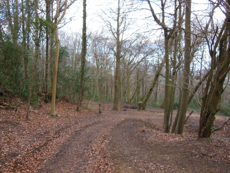
Cranham Common
 Photo: P L Chadwick, CC BY-SA 2.0 (via Wikimedia Commons)
- Jun–Sep
- best months
Cranham Common is a protected natural area in South West England, United Kingdom, covering about 100 acres (0 km²). It is on the edge of Cranham. The boundary comes from OpenStreetMap. Check the park's own rules, fees and opening hours before you go.
Conditions and forecast
Daily highs and lows, wind and the chance of precipitation at Cranham Common for the next 7 days, from the Open-Meteo model.
Park size
59 acres
 Alney Island Local Nature ReserveState park · ~11 min drivePhoto: Richard Webb, CC BY-SA 2.0 (via Wikimedia Commons)
 Tinkley GateState park · ~15 min drivePhoto: David Smith, CC BY-SA 2.0 (via Wikimedia Commons)
 Coopers Hill Local Nature ReserveState park · ~2 min drivePhoto: Ian S, CC BY-SA 2.0 (via Wikimedia Commons)
 Snows Farm Nature ReserveState park · ~5 min drivePhoto: Cwmhiraeth, CC BY-SA 3.0 (via Wikimedia Commons)
 Leckhampton HillState park · ~9 min drivePhoto: Philip Halling, CC BY-SA 2.0 (via Wikimedia Commons)
 The Cotswolds National LandscapeState park · ~11 min drivePhoto: Saffron Blaze, CC BY-SA 3.0 (via Wikimedia Commons)
 Minchinhampton CommonState park · ~13 min drivePhoto: Robin Webster, CC BY-SA 2.0 (via Wikimedia Commons)
 Woodchester ParkState park · ~14 min drivePhoto: chris morton, CC BY-SA 2.0 (via Wikimedia Commons)
 Coombe Hill Nature ReserveState park · ~16 min drivePhoto: Jonathan Billinger, CC BY-SA 2.0 (via Wikimedia Commons)
 Meerend Thicket and Ashleworth HamState park · ~16 min drivePhoto: Jonathan Billinger, CC BY-SA 2.0 (via Wikimedia Commons)
Also worth it near here
 Gustav Holst Way (Cranham Church to Crickley Hill)Hiking · ~1 min drivePhoto: Ian S, CC BY-SA 2.0 (via Wikimedia Commons)
 Saltridge HillSummit · ~2 min drivePhoto: Terry Jacombs, CC BY-SA 2.0 (via Wikimedia Commons)
 Buckshead Farm campsiteCamping · ~2 min drivePhoto: don cload, CC BY-SA 2.0 (via Wikimedia Commons)
Best time to visit Cranham Common
Best months: June–September. Best months have typical highs of 55–85 °F, lows of 30 °F or warmer (32 °F where there's no snowfall data), at most one snowy day and no more than 12 wet days.
Jan
43° / 34°
17 wet
Feb
44° / 34°
13 wet
Mar
48° / 36°
15 wet
Apr
53° / 38°
13 wet
May
59° / 44°
13 wet
Jun
64° / 49°
12 wet
Jul
68° / 53°
11 wet
Aug
67° / 53°
12 wet
Sep
63° / 50°
12 wet
Oct
56° / 45°
16 wet
Nov
48° / 39°
16 wet
Dec
44° / 35°
17 wet
Typical high / low (°F) and days with rain or snow, 1981–2010. Modelled for the 1 km square this place sits in (average height 630 ft), not measured at a weather station. We don't have this place's elevation, so higher spots nearby can run cooler. Snowfall days aren't in this data. Source: CHELSA 1 km climate model (1981–2010) and CRU TS 4.09 wet days. Data: CHELSA V2.1 climatologies (Karger et al. 2017), WSL (CC0 1.0); CRU TS 4.09 (Harris et al. 2020), University of East Anglia Climatic Research Unit. Contains public sector information licensed under the Open Government Licence v3.0. (Open Government Licence v3.0).
Map and trail data © OpenStreetMap contributors
