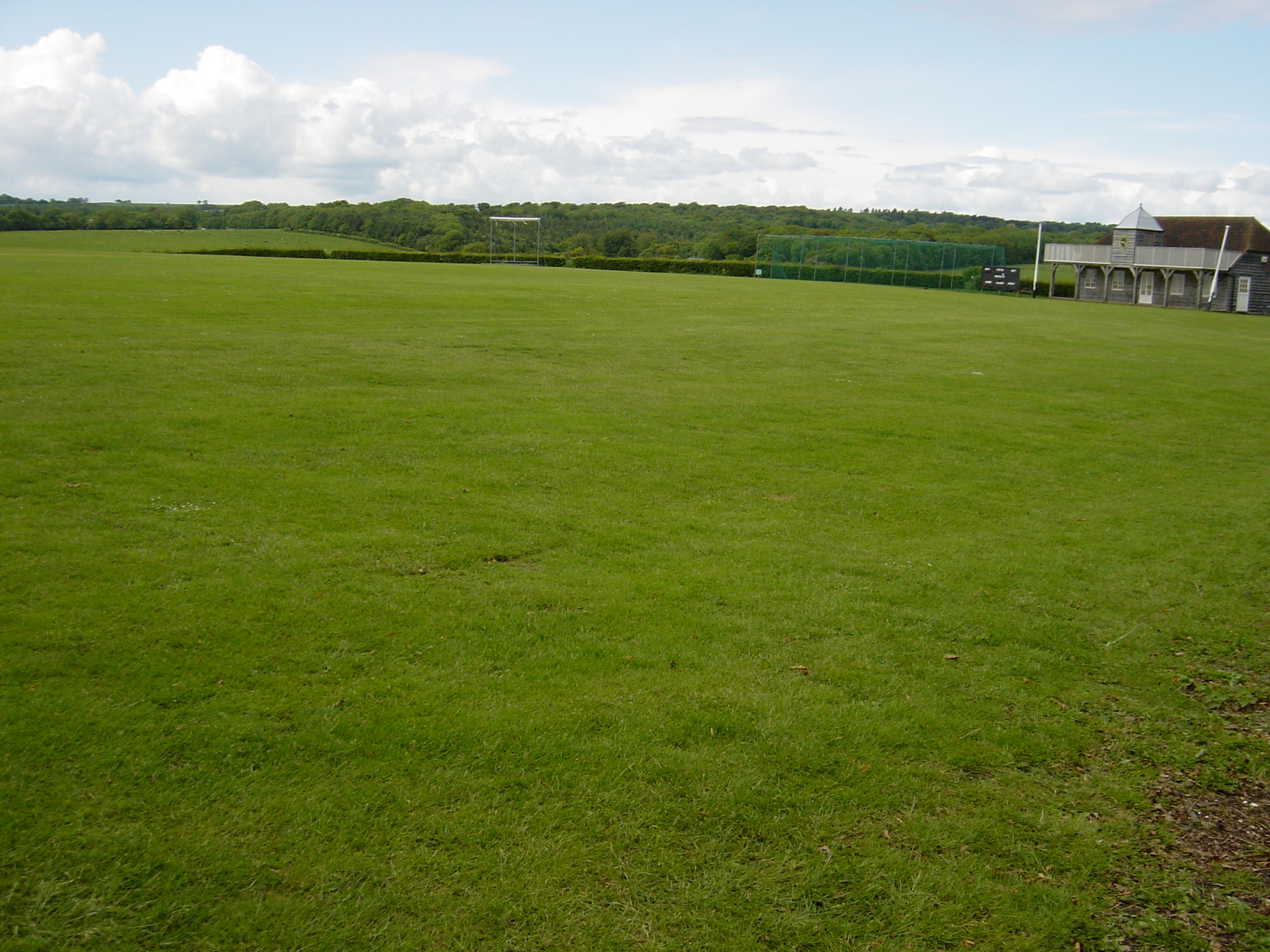
Pit Hill Farm Campsite.
 Photo: Chris Gunns, CC BY-SA 2.0 (via Wikimedia Commons)
- May–Sep
- best months
- At 206 ft
Pit Hill Farm Campsite. is a campground in South East England, United Kingdom, at about 210 ft above sea level. It is inside South Downs National Park. Camping here is paid. Trails within about a mile include Wayfarers Walk. The nearest town is Denmead, about 0.9 miles north of the campground. Peaks within about 3 miles include Windmill Down, Broadhalfpenny Down and Home Down. For camping, Grenville at Wallops Wood and The Sustainability Centre are within about 6 miles. The location and elevation come from OpenStreetMap and the Copernicus 90 m elevation model. Check local access rules and conditions before you go.
Conditions and forecast
Daily highs and lows, wind and the chance of precipitation at Pit Hill Farm Campsite. for the next 7 days, from the Open-Meteo model.
 Grenville at Wallops WoodCamping · ~5 min drivePhoto: David Martin, CC BY-SA 2.0 (via Wikimedia Commons)
 Lyons CopseCamping · ~11 min drivePhoto: David Martin, CC BY-SA 2.0 (via Wikimedia Commons)
 College Down FarmCamping · ~14 min drivePhoto: David Howard, CC BY-SA 2.0 (via Wikimedia Commons)
 Watercress Lodges and CampsiteCamping · ~20 min drivePhoto: Christine Matthews, CC BY-SA 2.0 (via Wikimedia Commons)
 Nunnington Farm Caravan and CampingCamping · ~21 min drivePhoto: Dave Spicer, CC BY-SA 2.0 (via Wikimedia Commons)
 Littleton Farm CampsiteCamping · ~31 min drivePhoto: Richard Law, CC BY-SA 2.0 (via Wikimedia Commons)
 Ferny Crofts Scout Activity CentreCamping · ~32 min drivePhoto: Mike Faherty, CC BY-SA 2.0 (via Wikimedia Commons)
 Gumber CampsiteCamping · ~33 min drivePhoto: Dave Spicer, CC BY-SA 2.0 (via Wikimedia Commons)
 Slindon Camping & Caravan Club.Camping · ~33 min drivePhoto: PAUL FARMER, CC BY-SA 2.0 (via Wikimedia Commons)
 The SpurCamping · ~34 min drivePhoto: Shazz, CC BY-SA 2.0 (via Wikimedia Commons)
Also worth it near here
 Broadhalfpenny DownSummit · ~3 min drivePhoto: BenShade at English Wikipedia, CC BY-SA 3.0 (via Wikimedia Commons)
 King Charles III England Coast Path: Portsmouth to East Head: Southmoor Alt RouteHiking · ~11 min drivePhoto: Peter Trimming, CC BY-SA 2.0 (via Wikimedia Commons)
 Avington ParkWaterfall · ~24 min drivePhoto: Bill Nicholls, CC BY-SA 2.0 (via Wikimedia Commons)
Best time to visit Pit Hill Farm Campsite.
Best months: May–September. Best months have typical highs of 55–85 °F, lows of 30 °F or warmer (32 °F where there's no snowfall data), at most one snowy day and no more than 12 wet days.
Jan
45° / 37°
16 wet
Feb
45° / 36°
12 wet
Mar
49° / 38°
13 wet
Apr
54° / 41°
11 wet
May
60° / 47°
11 wet
Jun
65° / 52°
9 wet
Jul
69° / 56°
9 wet
Aug
68° / 56°
10 wet
Sep
64° / 52°
11 wet
Oct
57° / 48°
14 wet
Nov
50° / 42°
15 wet
Dec
46° / 38°
15 wet
Typical high / low (°F) and days with rain or snow, 1981–2010. Modelled for the 1 km square this place sits in (average height 246 ft), not measured at a weather station. Snowfall days aren't in this data. Source: CHELSA 1 km climate model (1981–2010) and CRU TS 4.09 wet days. Data: CHELSA V2.1 climatologies (Karger et al. 2017), WSL (CC0 1.0); CRU TS 4.09 (Harris et al. 2020), University of East Anglia Climatic Research Unit. Contains public sector information licensed under the Open Government Licence v3.0. (Open Government Licence v3.0).
Map and trail data © OpenStreetMap contributors
