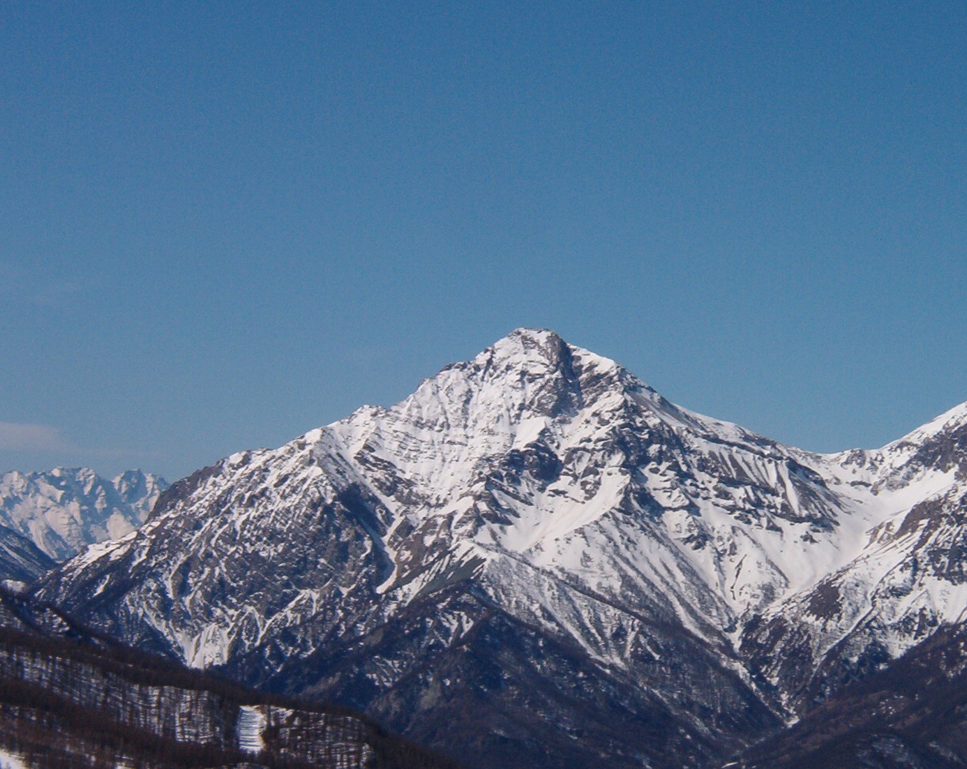
Dent de Crolles
 Photo: Matthieu Riegler
English : This photo has been taken by Matthieu Riegler (User:Kyro) and released under the licenses stated below. You are free to use it for any purpose as long as you credit me as author, Wikimedia Commons as site and follow the terms of the licenses. Could you be kind enough to leave me a message on this page to inform me about your use of this picture.
Example: © Matthieu Riegler, CC-BY
Français : Cette photo a été prise par Matthieu Riegler (User:Kyro) et placée sous les licences ci-dessous. Vous êtes libre de la réutiliser, pour n'importe quelle utilisation, tant que vous me citez en tant qu'auteur, Wikimedia Commons en tant que site et suivez les instructions des licences. Pourriez-vous avoir l'amabilité de me laisser un message sur cette page pour m'informer de votre utilisation de cette image.
Exemple : © Matthieu Riegler, CC-BY
This file is licensed under the Creative Commons Attribution 3.0 Unported license.Attribution: Matthieu Riegler, CC-by
You are free:
to share – to copy, distribute and transmit the work
to remix – to adapt the work
Under the following conditions:
attribution – You must give appropriate credit, provide a link to the license, and indicate if changes were made. You may do so in any reasonable manner, but not in any way that suggests the licensor endorses you or your use.
https://creativecommons.org/licenses/by/3.0CC BY 3.0 Creative Commons Attribution 3.0 truetrue
Vous souhaitez faire apparaitre cette photo sans crédit ? Contactez moi !
If you want to use the photo without credit, please contact me., CC BY 3.0 (via Wikimedia Commons)
- 6,765 ft
- summit
- parc naturel régional de Chartreuse
- managed by
- Jul–Aug
- best months
Dent de Crolles is a mountain in Auvergne-Rhône-Alpes, France, with its summit at about 6,770 ft (2,062 m) above sea level. It stands inside Réserve naturelle des Hauts de Chartreuse. Mapped trails that come within about half a mile of the top include Sangle de la Face Est and Bord de Falaise. The nearest town is Plateau-des-Petites-Roches, about 1.3 miles west of the summit. Peaks within about 3 miles include Pravouta, Roc d'Arguille and Bec Charvet. Cascade de Crolles and Cascade du Guiers are within about 3 miles. For camping, Camping des Petites Roches and Camping de Martinière are within about 6 miles. It is part of the Chartreuse Mountains. Its topographic prominence, the height it rises above the lowest col linking it to higher ground, is about 2,260 ft (690 m). Administratively, it is in Isère. These details come from Wikidata. The location and elevation come from OpenStreetMap and the Copernicus 90 m elevation model. Check local access rules and conditions before you go.
Conditions and forecast
Daily highs and lows, wind and the chance of precipitation at the summit for the next 7 days, from the Open-Meteo model.
- Summit elevation
- 6,765 ft
- Land manager
- parc naturel régional de Chartreuse
We don't know of a mapped trail or route to the summit of Dent de Crolles. Plan the approach with local maps, a guidebook or a local guide, and check conditions before you go.
Questions about Dent de Crolles
How tall is Dent de Crolles?
6,765 ft (2,062 m).
Is there a trail to the top of Dent de Crolles?
We don't know of a mapped trail or route to the summit. Plan the approach with local maps, a guidebook or a local guide.
 Meije13,068 ft · Auvergne-Rhône-Alpes, France1 route30 mi awayPhoto: user:RobinL, CC BY-SA 2.5 (via Wikimedia Commons)
 Barre des Écrins13,458 ft · Provence-Alpes-Côte d'Azur, France1 route36 mi awayPhoto: Günter Seggebäing, Coesfeld, Germany, CC BY-SA 3.0 (via Wikimedia Commons)
 Grande Casse12,648 ft · Auvergne-Rhône-Alpes, France1 route48 mi awayPhoto: Rémih, CC BY-SA 4.0 (via Wikimedia Commons)
 Mont Chaberton10,276 ft · Provence-Alpes-Côte d'Azur, France1 route50 mi awayPhoto: Francofranco56, Public domain (via Wikimedia Commons)
 Mont Blanc15,768 ft · Auvergne-Rhône-Alpes, France1 route61 mi awayPhoto: Christian David, CC BY-SA 4.0 (via Wikimedia Commons)
 Grandes Jorasses13,806 ft · Aosta Valley, Italy1 route67 mi awayPhoto: Ferrand, Henri (1853-1926). Photographe, Public domain (via Wikimedia Commons)
 Roc d'ArguilleSummit · ~2 min drivePhoto: Patrice78500, CC BY-SA 3.0 (via Wikimedia Commons)
 Bec CharvetSummit · ~3 min drivePhoto: Patrice78500, CC BY-SA 3.0 (via Wikimedia Commons)
 La SciaSummit · ~5 min drivePhoto: Patrice78500, CC BY-SA 3.0 (via Wikimedia Commons)
 ChamechaudeSummit · ~6 min drivePhoto: Remontees, CC BY-SA 4.0 (via Wikimedia Commons)
 Charmant SomSummit · ~8 min drivePhoto: No machine-readable author provided. Gemini1980 assumed (based on copyright claims)., Public domain (via Wikimedia Commons)
 Le Grand SomSummit · ~8 min drivePhoto: No machine-readable author provided. Gemini1980 assumed (based on copyright claims)., Public domain (via Wikimedia Commons)
 MontfromageSummit · ~9 min drivePhoto: Rémih, CC BY-SA 4.0 (via Wikimedia Commons)
 Le Grand MantiSummit · ~10 min drivePhoto: Alexis Chabert, CC BY-SA 4.0 (via Wikimedia Commons)
 La PinéaSummit · ~10 min drivePhoto: No machine-readable author provided. Gemini1980 assumed (based on copyright claims)., Public domain (via Wikimedia Commons)
 Petit SomSummit · ~10 min drivePhoto: Thierry Thomas, Public domain (via Wikimedia Commons)
Also worth it near here
- Sangle de la Face EstHiking · Next door
- Liaison St Hilaire - Col de MarcieuCross-country skiing · ~2 min drive
- Camping des Petites RochesCamping · ~2 min drive
 Cascade de CraponozWaterfall · ~3 min drivePhoto: Unknown authorUnknown author, CC BY-SA 3.0 (via Wikimedia Commons)
- Le Creux de la neigeSki touring · ~6 min drive
Best time to visit Dent de Crolles
Best months: July–August. Best months have typical highs of 55–85 °F, lows of 30 °F or warmer (32 °F where there's no snowfall data), at most one snowy day and no more than 12 wet days.
Jan
28° / 12°
12 wet
Feb
29° / 13°
11 wet
Mar
34° / 17°
12 wet
Apr
39° / 21°
15 wet
May
48° / 29°
16 wet
Jun
54° / 36°
13 wet
Jul
59° / 40°
11 wet
Aug
59° / 40°
11 wet
Sep
52° / 35°
12 wet
Oct
46° / 29°
13 wet
Nov
35° / 19°
13 wet
Dec
29° / 14°
13 wet
Typical high / low (°F) and days with rain or snow, 1981–2010. Modelled for the 1 km square this place sits in (average height 6,296 ft), not measured at a weather station. Snowfall days aren't in this data. Source: CHELSA 1 km climate model (1981–2010) and CRU TS 4.09 wet days. Data: CHELSA V2.1 climatologies (Karger et al. 2017), WSL (CC0 1.0); CRU TS 4.09 (Harris et al. 2020), University of East Anglia Climatic Research Unit. Contains public sector information licensed under the Open Government Licence v3.0. (Open Government Licence v3.0).
Map and trail data © OpenStreetMap contributors
