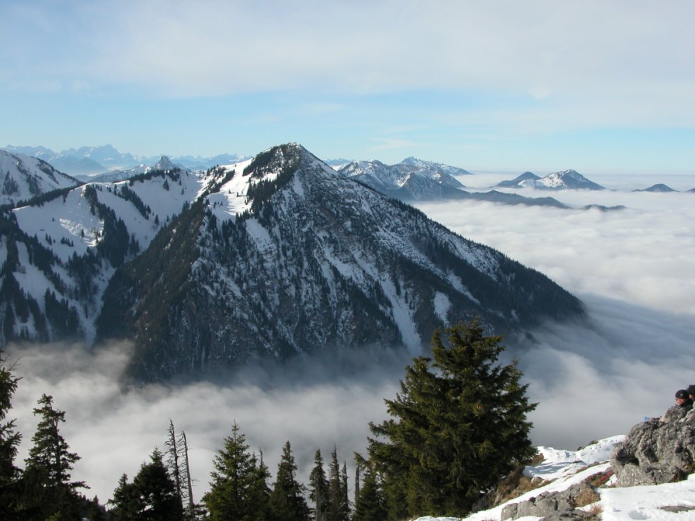
Rinnerspitz
 Photo: Rufus46, CC BY-SA 3.0 (via Wikimedia Commons)
- 5,285 ft
- summit
Rinnerspitz is a mountain in Bavaria, Germany, with its summit at about 5,290 ft (1,611 m) above sea level. Mapped trails that come within about half a mile of the top include Sommerweg. The nearest town is Spitzingsee, about 2.7 miles west of the summit. Peaks within about 3 miles include Bodenschneid, Wasserspitz and Eckspitz. Rottachfall and Sibli-Wasserfall are within about 3 miles. For camping, Campingplatz Schliersee and Campingplatz Wallberg are within about 6 miles. The location and elevation come from OpenStreetMap and the Copernicus 90 m elevation model. Check local access rules and conditions before you go.
Conditions and forecast
Daily highs and lows, wind and the chance of precipitation at the summit for the next 7 days, from the Open-Meteo model.
- Summit elevation
- 5,285 ft
We don't know of a mapped trail or route to the summit of Rinnerspitz. Plan the approach with local maps, a guidebook or a local guide, and check conditions before you go.
Questions about Rinnerspitz
How tall is Rinnerspitz?
5,285 ft (1,611 m).
Is there a trail to the top of Rinnerspitz?
We don't know of a mapped trail or route to the summit. Plan the approach with local maps, a guidebook or a local guide.
 Zugspitze9,718 ft · Tyrol, Austria1 route43 mi awayPhoto: Tuxyso, CC BY-SA 4.0 (via Wikimedia Commons)
 Großvenediger11,998 ft · Salzburg, Austria1 route46 mi awayPhoto: Jörg Braukmann, CC BY-SA 4.0 (via Wikimedia Commons)
 Grossglockner12,461 ft · Carinthia, Austria1 route58 mi awayPhoto: DennisPeeters, Public domain (via Wikimedia Commons)
 Hochkönig9,649 ft · Salzburg, Austria1 route60 mi awayPhoto: StVeit Maps, CC BY-SA 4.0 (via Wikimedia Commons)
 Wildspitze12,362 ft · Tyrol, Austria1 route71 mi awayPhoto: Pirmin Olde Weghuis, CC BY-SA 3.0 (via Wikimedia Commons)
 Piz Boè10,341 ft · Trentino-South Tyrol, Italy1 route81 mi awayPhoto: kallerna, CC BY-SA 4.0 (via Wikimedia Commons)
 BodenschneidSummit · Next doorPhoto: Wasquewhat, CC BY 4.0 (via Wikimedia Commons)
 StümpflingSummit · ~2 min drivePhoto: Strubbl, CC BY-SA 4.0 (via Wikimedia Commons)
 Brecherspitz VorgipfelSummit · ~2 min drivePhoto: Andrea Schieber from München, Deutschland, CC BY-SA 2.0 (via Wikimedia Commons)
 BrecherspitzSummit · ~3 min drivePhoto: Schwammerl-Bob, Public domain (via Wikimedia Commons)
 LahnenkopfSummit · ~3 min drivePhoto: Wasquewhat, CC BY-SA 4.0 (via Wikimedia Commons)
 WallbergSummit · ~3 min drivePhoto: Bernd Reuschenberg, CC BY-SA 3.0 (via Wikimedia Commons)
 RoßkopfSummit · ~3 min drivePhoto: No machine-readable author provided. Zerohund~commonswiki assumed (based on copyright claims)., CC BY 2.5 (via Wikimedia Commons)
 SchlierseespitzSummit · ~3 min drivePhoto: Wasquewhat, CC BY-SA 4.0 (via Wikimedia Commons)
 BaumgartenschneidSummit · ~4 min drivePhoto: Luidger, CC BY-SA 3.0 (via Wikimedia Commons)
 RotzigmoosbergSummit · ~4 min drivePhoto: Wasquewhat, CC BY-SA 4.0 (via Wikimedia Commons)
Also worth it near here
 Brecherspitz OstgratHiking · ~4 min drivePhoto: Лорд Бъмбъри, CC BY-SA 4.0 (via Wikimedia Commons)
 Campingplatz SchlierseeCamping · ~6 min drivePhoto: Strubbl, CC BY-SA 4.0 (via Wikimedia Commons)
 Valepp-WasserfallWaterfall · ~8 min drivePhoto: Ricardalovesmonuments, CC BY-SA 4.0 (via Wikimedia Commons)
Map and trail data © OpenStreetMap contributors
