Mountains in O'Higgins
200 mountains and 188 routes in O'Higgins, Chile, each with its own page: heights, seasons, and every way to the top we have mapped.
Mountains
- Cumbre Chilena16,847 ft · O'Higgins, Chile
- Cumbre Oeste16,775 ft · O'Higgins, Chile
- Alto de los Arrieros16,437 ft · O'Higgins, Chile
- Cumbre Norte16,306 ft · O'Higgins, Chile
- Cerro Portillo16,276 ft · O'Higgins, Chile
- Torre Central16,263 ft · O'Higgins, Chile
- Torres del Brujo16,142 ft · O'Higgins, Chile
- Torre de Flores16,043 ft · O'Higgins, Chile
- Nevado de Flores16,020 ft · O'Higgins, Chile
- Alto de la Mamá15,968 ft · O'Higgins, Chile
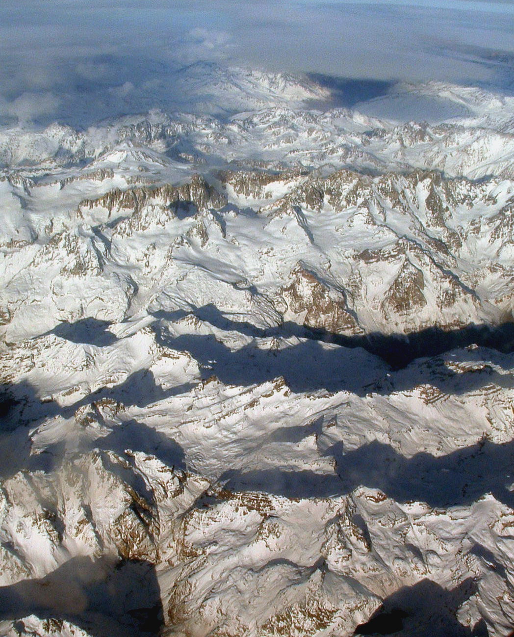 Volcán Palomo15,945 ft · O'Higgins, ChilePhoto: Robert Morrow, CC BY-SA 3.0 (via Wikimedia Commons)
- Torre Norte15,945 ft · O'Higgins, Chile
- Punta Ventisquero15,623 ft · O'Higgins, Chile
- Cerro El Brujo15,551 ft · O'Higgins, Chile
- Brujo S/W15,410 ft · O'Higgins, Chile
- Alto del Azufre15,390 ft · O'Higgins, Chile
- Cerro Seler15,312 ft · O'Higgins, Chile
- Punta Mistral15,226 ft · O'Higgins, Chile
- Cerro Aguja15,131 ft · O'Higgins, Chile
- Cerro Corona del Diablo15,056 ft · O'Higgins, Chile
- Punta Nuseva14,993 ft · O'Higgins, Chile
- Cerro Doctor Hernán Cruz14,977 ft · O'Higgins, Chile
- Puntilla IV del Azufre14,888 ft · O'Higgins, Chile
- Puntilla II del Azufre14,816 ft · O'Higgins, Chile
- Puntilla I del Azufre14,790 ft · O'Higgins, Chile
- Puntilla III del Azufre14,790 ft · O'Higgins, Chile
- Torre de Pangal14,790 ft · O'Higgins, Chile
- Nevado Granitos14,780 ft · O'Higgins, Chile
- Cerro Corona de Don Manuel14,741 ft · O'Higgins, Chile
- Nevado Mañke14,698 ft · O'Higgins, Chile
- Punta María Ángeles14,665 ft · O'Higgins, Chile
- Puntilla V del Azufre14,642 ft · O'Higgins, Chile
- Nevado del Granitos14,620 ft · O'Higgins, Chile
- Cerro Gendarme14,583 ft · O'Higgins, Chile
- Puntilla de Flores I14,531 ft · O'Higgins, Chile
- Punta de Don Manuel Este14,370 ft · O'Higgins, Chile
- Cumbre Sur del Brujo14,304 ft · O'Higgins, Chile
- Nevado Cisne14,272 ft · O'Higgins, Chile
- Nevado Penitente14,272 ft · O'Higgins, Chile
- Cerro ASAVA14,255 ft · O'Higgins, Chile
- Puntilla de Flores II14,203 ft · O'Higgins, Chile
- Cerro ASAE14,127 ft · O'Higgins, Chile
- Cerro Cotón14,081 ft · O'Higgins, Chile
- Punta Escultura14,062 ft · O'Higgins, Chile
- Volcán Tinguiririca14,042 ft · O'Higgins, Chile
- Volcán Tinguiririca14,042 ft · O'Higgins, Chile
- Volcán Monserrat13,878 ft · O'Higgins, Chile
- Volcán Monserrat13,878 ft · O'Higgins, Chile
- Punta de Don Manuel Sur13,862 ft · O'Higgins, Chile
- Volcán Azufreras13,855 ft · O'Higgins, Chile
- Volcán Azufreras13,855 ft · O'Higgins, Chile
- Puntilla de Flores III13,835 ft · O'Higgins, Chile
- Aguja de la Meza13,797 ft · O'Higgins, Chile
- Cerro Diablo13,786 ft · O'Higgins, Chile
- Cerro Sandra13,773 ft · O'Higgins, Chile
- Cerro Chile Japón13,734 ft · O'Higgins, Chile
- Cerro Monolitos13,648 ft · O'Higgins, Chile
- Cerro Las Vegas13,625 ft · O'Higgins, Chile
- Torreones Centrales del Granitos13,615 ft · O'Higgins, Chile
- Punta Hermandad13,579 ft · O'Higgins, Chile
- Punta Rosita13,570 ft · O'Higgins, Chile
- Aguja Rucaray13,461 ft · O'Higgins, Chile
- Cerro Ciprés del Granito13,451 ft · O'Higgins, Chile
- Puntilla de Flores IV13,386 ft · O'Higgins, Chile
- Alto de la Engorda13,360 ft · O'Higgins, Chile
- Punta Chimenea13,346 ft · O'Higgins, Chile
- Agujas del Palomo13,323 ft · O'Higgins, Chile
- Mirador de la Calería13,235 ft · O'Higgins, Chile
- Cerro Champagnat Noreste13,212 ft · O'Higgins, Chile
- Cerro Manuel Rodríguez13,209 ft · O'Higgins, Chile
- Punta Estructura13,199 ft · O'Higgins, Chile
- Cerro Pilar Occidental13,176 ft · O'Higgins, Chile
- Volcán Fray Carlos13,163 ft · O'Higgins, Chile
- Volcán Fray Carlos13,163 ft · O'Higgins, Chile
- Cerro Pilar Oriental13,117 ft · O'Higgins, Chile
- Cerro Placilla13,110 ft · O'Higgins, Chile
- Cordón Los Metalitos13,097 ft · O'Higgins, Chile
- Alto de los Pejerreyes13,074 ft · O'Higgins, Chile
- Cerro Champagnat Sur13,058 ft · O'Higgins, Chile
- Gran Torre del Cortaderal13,018 ft · O'Higgins, Chile
- Altos del Pelambre12,956 ft · O'Higgins, Chile
- Punta Mesoncito12,946 ft · O'Higgins, Chile
- Alto de los Llanos12,910 ft · O'Higgins, Chile
- Punta Budapest12,897 ft · O'Higgins, Chile
- Aguja Roja12,881 ft · O'Higgins, Chile
- San Hilario Suroeste12,694 ft · O'Higgins, Chile
- Punta Torrecilla12,657 ft · O'Higgins, Chile
- Cerro San Joaquín12,638 ft · O'Higgins, Chile
- Cerro Fragüita12,631 ft · O'Higgins, Chile
- San Hilario Noreste12,598 ft · O'Higgins, Chile
- Alto del Potrerillo12,533 ft · O'Higgins, Chile
- Punta Cortaderal12,500 ft · O'Higgins, Chile
- Alto de los Cristales12,500 ft · O'Higgins, Chile
- Altos del Pelambre12,441 ft · O'Higgins, Chile
- Volcán Andrés12,438 ft · O'Higgins, Chile
- Cerro Socavones12,428 ft · O'Higgins, Chile
- Cerro Diablo12,375 ft · O'Higgins, Chile
- Cerro Gato Negro12,359 ft · O'Higgins, Chile
- Punta Vetas Brujas12,356 ft · O'Higgins, Chile
- Cerro Los Cruceros12,297 ft · O'Higgins, Chile
- Cerro Yeso12,290 ft · O'Higgins, Chile
- Punta Manzanilla12,270 ft · O'Higgins, Chile
- Monte San Hilario12,238 ft · O'Higgins, Chile
- Cerro Matancilla12,231 ft · O'Higgins, Chile
- Cerro Los Guzmanes12,182 ft · O'Higgins, Chile
- Aguja de Roca12,139 ft · O'Higgins, Chile
- Cerro Mariana Huerta12,133 ft · O'Higgins, Chile
- Cerro Mesoncito12,113 ft · O'Higgins, Chile
- Cerro Torta12,100 ft · O'Higgins, Chile
- Alto de la Buena Vista12,057 ft · O'Higgins, Chile
- Cerro Potrerillo Alto12,034 ft · O'Higgins, Chile
- Aguja El Brujo12,032 ft · O'Higgins, Chile
- Cerro Morado12,021 ft · O'Higgins, Chile
- Cerro Negro11,975 ft · O'Higgins, Chile
- Volcán Natalia11,939 ft · O'Higgins, Chile
- Cerro Gualtatas de Flores11,936 ft · O'Higgins, Chile
- Punta Colmillo11,854 ft · O'Higgins, Chile
- Punta Mako11,841 ft · O'Higgins, Chile
- Cerro Negro Sur11,811 ft · O'Higgins, Chile
- Cerro San Augusto11,778 ft · O'Higgins, Chile
- Cerro Valdenegro11,703 ft · O'Higgins, Chile
- Cerro Duende11,677 ft · O'Higgins, Chile
- Volcán Don Cucho11,667 ft · O'Higgins, Chile
- Cerro Don Cucho11,667 ft · O'Higgins, Chile
- Cerro Cuerno11,667 ft · O'Higgins, Chile
- Cerro Tridente11,637 ft · O'Higgins, Chile
- Cerro Mirador del Manantiales11,611 ft · O'Higgins, Chile
- Alto de la Planchada11,565 ft · O'Higgins, Chile
- Punta Lajas11,552 ft · O'Higgins, Chile
- Cerro Corona de los Punzones11,545 ft · O'Higgins, Chile
- Morro de las Lajas11,532 ft · O'Higgins, Chile
- Cerro Manantiales11,516 ft · O'Higgins, Chile
- Cerro Potrerillo Vargas11,516 ft · O'Higgins, Chile
- Morro Bandera11,417 ft · O'Higgins, Chile
- Cerro Rosario11,404 ft · O'Higgins, Chile
- Puntilla Baja de Flores11,375 ft · O'Higgins, Chile
- Cerro Mesón de los Punzones11,342 ft · O'Higgins, Chile
- Cerro Los Helados11,293 ft · O'Higgins, Chile
- Sierra de los Pozones11,267 ft · O'Higgins, Chile
- Cerro Pterodáctilo11,220 ft · O'Higgins, Chile
- Cerro Sesquicentenario11,168 ft · O'Higgins, Chile
- Volcán Sordo Lucas11,152 ft · O'Higgins, Chile
- Cerro Las Pizarras11,122 ft · O'Higgins, Chile
- Alto del Retamal11,056 ft · O'Higgins, Chile
- Cerro Lomas Bayas11,033 ft · O'Higgins, Chile
- Alto del Padre10,988 ft · O'Higgins, Chile
- Cerro de los Escalones10,922 ft · O'Higgins, Chile
- Cerro La Guardia10,843 ft · O'Higgins, Chile
- Cerro Loma Falsa10,784 ft · O'Higgins, Chile
- Cerro de los Escalones10,758 ft · O'Higgins, Chile
- Cerro Cuchilla10,686 ft · O'Higgins, Chile
- Alto de las Placetas10,679 ft · O'Higgins, Chile
- Alto del León10,584 ft · O'Higgins, Chile
- Espolones del Brujo10,538 ft · O'Higgins, Chile
- Cerro Cruz del Muerto Huachuchero10,502 ft · O'Higgins, Chile
- Cerro Tinajón10,463 ft · O'Higgins, Chile
- Alto de las Yeguas10,407 ft · O'Higgins, Chile
- Morro La Piedra10,400 ft · O'Higgins, Chile
- Cerro Los Inocentes10,390 ft · O'Higgins, Chile
- Cerro Gualtatas de Río Blanco10,354 ft · O'Higgins, Chile
- Cerro Alto del Collay10,348 ft · O'Higgins, Chile
- Cerro Vegas del Flaco10,341 ft · O'Higgins, Chile
- Altos del Cepillo10,253 ft · O'Higgins, Chile
- Aguja La Bruja10,206 ft · O'Higgins, Chile
- Alto de los Bueyes10,052 ft · O'Higgins, Chile
 Alto de los Lirios10,016 ft · O'Higgins, ChilePhoto: Gerard Prins, CC BY-SA 3.0 (via Wikimedia Commons)
- Alto del Sapo10,013 ft · O'Higgins, Chile
- Alto de la Laguna9,948 ft · O'Higgins, Chile
- Caldera Olla Blanca9,941 ft · O'Higgins, Chile
- Cerro La Hovada Seca9,941 ft · O'Higgins, Chile
- Aguja El Brujito9,892 ft · O'Higgins, Chile
- Alto de Montserrat9,888 ft · O'Higgins, Chile
- Cerro El Peñón9,760 ft · O'Higgins, Chile
- Cerro Laguna de los Helados9,741 ft · O'Higgins, Chile
- Alto del Peñasco9,629 ft · O'Higgins, Chile
- Cerro Las Placetas9,521 ft · O'Higgins, Chile
- Alto de Cayetano9,442 ft · O'Higgins, Chile
- Alto del Guayacán9,383 ft · O'Higgins, Chile
- Pico del Cura9,259 ft · O'Higgins, Chile
- Cerro Durazno9,219 ft · O'Higgins, Chile
- Cerro Huemulino9,209 ft · O'Higgins, Chile
- Cerro Águilas del Chivato9,131 ft · O'Higgins, Chile
- Cerro Alto Rodeillo9,114 ft · O'Higgins, Chile
- Cerro Pellejo9,078 ft · O'Higgins, Chile
- Cerro Socavones9,055 ft · O'Higgins, Chile
- Cerro El Sillón9,042 ft · O'Higgins, Chile
- Alto de las Terneras Heladas8,973 ft · O'Higgins, Chile
- Cerro Sombrero8,927 ft · O'Higgins, Chile
- Cerro San Antonio8,901 ft · O'Higgins, Chile
- Cerro Lunes8,596 ft · O'Higgins, Chile
- Cerro Zapallo8,474 ft · O'Higgins, Chile
- Cerro Los Pocillos8,458 ft · O'Higgins, Chile
- Cerro Las Llaretas8,317 ft · O'Higgins, Chile
- Aguja Oriente8,304 ft · O'Higgins, Chile
- Alto de las Mesas8,281 ft · O'Higgins, Chile
- Cerro El Agujereado8,274 ft · O'Higgins, Chile
- Aguja Central8,205 ft · O'Higgins, Chile
- Cerro Colorado8,202 ft · O'Higgins, Chile
- Cerro Pabellones8,192 ft · O'Higgins, Chile
- Alto de la Plaza8,143 ft · O'Higgins, Chile
Routes that start here
- Agua Santa
- Balneario Santa Fe
- Bello Horizonte
- Bosque Hermoso
- Cal y Canto
- Camino a Cumbre Rucatalca7.8 mi round trip · 3,665 ft gain
- Camino Puertecillo - Hacienda Topocalma3.0 mi round trip · 682 ft gain
- Camping $4.000
- Camping de Carabineros
- Camping El Álamo
- Camping El Manzano
- Camping Emanuel
- Camping Entre Bosques
- Camping Fin De Ruta
- Camping Huinganes
- Camping La Patita
- Camping Laguna del perro
- Camping Las Nubes
- Camping Las Proteas
- Camping Las Vegas
- Camping Los Labradores
- Camping Los Peumos
- Camping Los Pinos
- Camping Millaco
- Camping Monteverde
- Camping Pequeño Bosque
- Camping Punta Pino
- Camping Ranchillo
- Camping Rapel
- Camping Remigio
- Camping Reserva Nacional Laguna Torca
- Camping Rondadero
- Camping San Luis
- Camping Tricahues
- Camping Tropical Lake
- Camping y Cabañas Puertecillo Norte
- Camping y Ecoturismo El Mirador
- Casa Rodante
- Casa Rodante
- Cascada Chorrillos
- Cascada del Agua
- Cascada El Chorro
- Cascada El Diamante
- Cascada El Manzano
- Cascada El Venado
- Cascada Los Socavones
- Cascada Piedra Lisa
- Cascada Rinconada de Parral
- Cascada Salto de la Virgen
- Cascada Tres Chorrillos
- Cerro La Cantera2.2 mi round trip · 1,826 ft gain
- Chorro de la Vieja
- Chorro de la Vieja
- Chorro de la Vieja
- Club de Campo y Marina Las Palmas de Rapel
- Cubillos
- Dunas de Matanzas
- Eco Camping La Caletilla
- El Bronce
- El Manzano
- El Refugio
- El Rincón - La Punta3.0 mi round trip · 382 ft gain
- Garganta Cipreses
- Hacienda Las Palmas de Cocalán
- Humedal Urbano Bucalemu
- Humedal Urbano Estero Purén Idahue
- Humedal Urbano La Vega de Pupuya
- Humedal Urbano Petrel
- Ingreso Cerro La Sepultura2.5 mi · 686 ft gain
- La Esperanza (Cumbres)
- La Garganta
- Laguna Del Venado3.2 mi round trip · 1,534 ft gain
- Las Brisas
- Las Palmas
- Las Vertientes de Coinco
- Olas de Chile Ecocamp
- Olas de Matanzas
- Parque Cuenca Andina
- Parque Nacional Las Palmas de Cocalán
- Parque Reserva El Maitén
- Playa Alto Colorado
- Playa Bucarruca
- Playa Caletilla
- Playa Carrizalillo
- Playa Carrizalillo
- Playa Chorrillos
- Playa Chorrillos
- Playa Cueva Negra
- Playa de Matanzas
- Playa El Chorrillo
- Playa El Guanaco
- Playa El Pangal
- Playa El Secreto
- Playa El Socavón
- Playa Grande de Bucalemu
- Playa Hueso de Ballena
- Playa Infiernillo
- Playa La Lancha Norte
- Playa La Lancha Sur
- Playa La Pancora
- Playa La Páncora
- Playa La Polcura
- Playa La Puntilla
- Playa La Sirena
- Playa Lagunillas
- Playa Las Agatas
- Playa Las Brisas
- Playa Las Cruces
- Playa Las Quiscas
- Playa Las Terrazas
- Playa Las Trancas
- Playa Los Arcos
- Playa Los Huachos
- Playa Los Lobos
- Playa Los Michayes
- Playa Los Piures
- Playa Los Robles
- Playa Mala Bajada
- Playa Mar Manzo
- Playa Matanzas
- Playa Matanzas Norte
- Playa Mónaco
- Playa Pancora Chica
- Playa Principal
- Playa Puertecillo
- Playa Punta de Lobos
- Playa Pupuya
- Playa Quebradilla
- Playa Quincheumo
- Playa Rucalonco
- Playa San Antonio
- Playa Santo Domingo
- Playa Tanumé
- Playa Topocalma
- Playa Vista Hermosa
- Portezuelo De Los Lazos3.8 mi round trip · 1,819 ft gain
- Poza Bruja
- Pozas Verdes
- Punta Centinela1.2 mi round trip · 508 ft gain
- Quebrada Honda8.8 mi round trip · 4,539 ft gain
- Reserva Nacional Laguna Torca
- Reserva Nacional Río Los Cipreses
- Reserva Natural Privada Bosques del Tinguiririca
- Reserva Natural Tipaume
- Ruta De El Baule9.5 mi round trip · 4,110 ft gain
- Salto de Almahue
- Santa Andrea
- Santuario de la Naturaleza Alto Huemul
- Santuario de la Naturaleza Bosque Marino de Calabacillo
- Santuario de la Naturaleza Cerro Poqui
- Santuario de la Naturaleza Marino Costero Piedra del Viento y Topocalma
- Santuario de la Naturaleza Predio Alto Huemul
- Sendero 3 Chorrillos2.2 mi round trip · 983 ft gain
- Sendero a Cerro El Tigre7.3 mi round trip · 3,380 ft gain
- Sendero a Cerro La Sepultura5.3 mi round trip · 2,005 ft gain
- Sendero a Laguna Los Patos1.7 mi · 1,345 ft gain
- Sendero a Mirador Victorino1.3 mi round trip · 592 ft gain
- Sendero a Playa Polcura0.8 mi · 817 ft gain
- Sendero a Salto De Almahue1.3 mi round trip · 726 ft gain
- Sendero Achupallas3.9 mi · 895 ft gain
- Sendero Al Alerón Rocoso (1,3 Km.)Moderate · 1.2 mi round trip · 1,271 ft gain
- Sendero Al Cerro Rucatalca10.0 mi round trip · 4,445 ft gain
- Sendero Al RefugioModerate · 6.2 mi round trip · 4,496 ft gain
- Sendero Arbol Gigante0.6 mi · 99 ft gain
- Sendero Cajón De Santos1.9 mi · 2,514 ft gain
- Sendero Cerro Gulutren1.7 mi round trip · 989 ft gain
- Sendero Cerro Valdovino4.8 mi round trip · 3,040 ft gain
- Sendero Costero Bucalemu Sur1.0 mi round trip · 242 ft gain
- Sendero De Chile: Tramo Hacienda Sauzal5.4 mi · 1,078 ft gain
- Sendero El ChivatoModerate · 2.2 mi round trip · 1,477 ft gain
- Sendero Jardín Etnobotánico0.7 mi round trip · 95 ft gain
- Sendero La HaciendaEasy · 5.7 mi round trip · 1,717 ft gain
- Sendero La Leona1.9 mi round trip · 1,066 ft gain
- Sendero Las PataguillasHard · 18.0 mi round trip · 6,344 ft gain
- Sendero Las Tinajas3.2 mi round trip · 1,854 ft gain
- Sendero Loma Tuerta6.9 mi round trip · 2,510 ft gain
- Sendero Los BroncesModerate · 17.9 mi round trip · 9,672 ft gain
- Sendero Los Peumos1.4 mi round trip · 912 ft gain
- Sendero Mirador (624 M)Moderate · 0.4 mi · 944 ft gain
- Sendero Peatonal a Playa La Pancora1.6 mi round trip · 393 ft gain
- Sendero Playa Panilonco0.7 mi round trip · 229 ft gain
- Sendero Zig-Zag1.3 mi round trip · 633 ft gain
- Surfarm
- Tebo
- Topocalma-Tumán1.6 mi round trip · 590 ft gain
- Trail Las 3 ComadresModerate · 3.3 mi round trip · 2,510 ft gain
- Valle Escondido
- Zona de Fiesta de Empresas Centro de Eventos Picarquín
